Immovable Cultural Heritage in the Bor District
This list includes Immovable Cultural Heritage sites in the Bor District of Serbia.[1]
Liste
| Number in the Central Register | Photo | Name | Municipality | Address | Designated since | Classification |
|---|---|---|---|---|---|---|
| SK 215 | 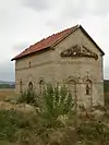 | Koroglaš Monastery | Negotin | Miloševo 44.259938°N 22.52787°E | 20 March 1948 | Great Importance |
| SK 223 | 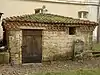 | Hajduk Veljko's Powder Magazine | Negotin Hajduk Veljkova St. 44.226862°N 22.531339°E | 13 March 1950 | Exceptional Importance | |
| SK 243 | 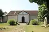 | Old church of the Holy Mother of God | Negotin 44.225812°N 22.540407°E | 18 June 1980 | Great Importance | |
| SK 284 | 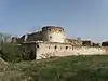 | Fetislam Fortress | Kladovo | Kladovo 44.615492°N 22.602286°E | 27 October 1964 | Great Importance |
| SK 286 | 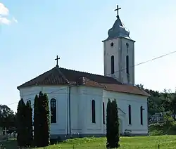 | Church of the Holy Trinity | Brza Palanka 44.483471°N 22.452749°E | 28 June 1967 | ||
| SK 299 | 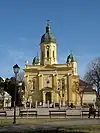 | Cathedral Church of the Holy Trinity | Negotin | Negotin 44.22675°N 22.531294°E | 2 June 1967 | |
| SK 300 | 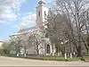 | Church of the Ascension of the Lord | Jabukovac 44.3484°N 22.385324°E | 28 June 1967 | ||
| SK 310 | 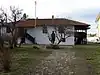 | Stevan Mokranjac's House | Negotin Dositejeva 7 44.225768°N 22.530427°E | 15 October 1975 | Great Importance | |
| SK 314 | Wooden church | Brestovac 44.183835°N 22.404936°E | 28 December 1976 | |||
| SK 315 | Wooden Church | Popovica 4.222537°N 22.282155°E | 28 December 1976 | |||
| SK 316 | Wooden Church | Trnjane 44.220031°N 22.357389°E | 28 December 1976 | |||
| SK 319 | 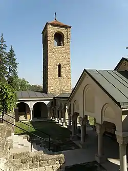 | Bukovo monastery | Bukovo 44.215694°N 22.492487°E | 18 June 1980 | ||
| SK 327 | .jpg.webp) | Residence of Prince Miloš | Bor | Brestovačka Banja 44.060154°N 22.044064°E | 22 July 1949 | |
| SK 328 | _035.jpg.webp) | Prince's castle | Brestovačka Banja 44.060204°N 22.043587°E | 22 July 1949 | ||
| SK 334 | 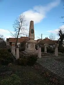 | Monument to Hajduk Veljko Petrović | Negotin | Negotin Trg Stevana Mokranjca 44.22652°N 22.53051°E | 7 September 1976 | |
| SK 335 | 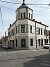 | Museum of Krajina Building | Negotin Vere Radosavljević 1 44.224782°N 22.531381°E | 18 June 1980 | ||
| SK 336 |  | Pedagogical Academy Building | Negotin Trg Đorđa Stanojevića 44.22961°N 22.529809°E | 18 June 1980 | ||
| SK 337 | Youth Center "Stanko Paunović" Building | Negotin Badnjevska 5 44.232981°N 22.526446°E | 18 June 1980 | |||
| SK 338 | Old Fountains Complex | Vidrovac 44.267376°N 22.491271°E | 18 June 1980 | |||
| SK 339 | 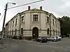 | JNA (Yougoslav People's Army) Club Building | Negotin Corner of Ljube Nešića St and Dobrile Radosavljević St 44.224726°N 22.53199°E | 3 July 1980 | ||
| SK 340 | Village house with "jazluk" | Brestovac 44.185405°N 22.403695°E | 3 July 1980 | |||
| SK 341 | Đokinska Watermill | Brestovac 44.185358°N 22.403952°E | 3 July 1980 | |||
| SK 342 | 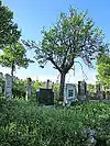 | Old Village Cemetery | Rajac 44.095612°N 22.547912°E | 3 July 1980 | Exceptional Importance | |
| SK 343 | _261.jpg.webp) | Old Village Cemetery | Rogljevo 44.119604°N 22.566365°E | 3 July 1980 | ||
| SK 459 | Partisan Momčilo Ranković's House | Rajac 44.093981°N 22.558061°E | 7 October 1981 | |||
| SK 460 | Old Civic House | Negotin Dobrile Radosavljević 2 44.225059°N 22.534095°E | 3 July 1980 | |||
| SK 465 | House of the People's Hero Stanko Paunović | Brestovac 44.185343°N 22.403716°E | 10 October 1975 | |||
| SK 475 | Old Post Office Building - Mezulana | Kladovo | Brza Palanka 44.466805°N 22.450119°E | 9 July 1979 | ||
| SK 609 | 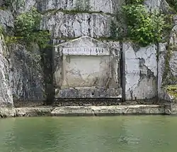 | Tabula Traiana | Tekija 44.650879°N 22.303972°E | 22 November 1949 | Exceptional Importance | |
| SK 873 | 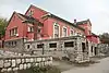 | Faculty of Engineering Building | Bor | Bor 44.081699°N 22.096228°E | 31 December 1988 | |
| SK 913 | _177.jpg.webp) | Monument to the Serbian and French Soldiers during 1912-1918. | Moše Pijade St. 44.075984°N 22.099484°E | 29 December 1988 | ||
| SK 914 | 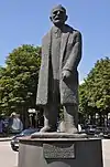 | Monument to Petar Radovanović | Bor 44.079395°N 22.098725°E | 29 December 1988 | ||
| SK 915 | 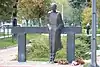 | Monument of Miklós Radnóti near Bor Lake | Bor 44.055696°N 22.102418°E | 29 December 1988 | ||
| SK 916 | 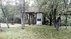 | Memorial Huts "Partisan Camp" | Brusovo 44.076947°N 22.098189°E | 29 December 1988 | ||
| SK 945 |  | Church of the Dormition of Holy Mother of God | Slatina 44.040412°N 22.162137°E | 28 December 1989 | ||
| SK 1468 | 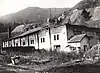 | Old Smelter in Majdanpek | Majdanpek | Majdanpek 44.367919°N 21.907314°E | 31 March 1983 | Great Importance |
| SK 2054 | 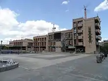 | Cultural Center Building in Bor | Bor | Moše Pijade 19 44.074893°N 22.098929°E | 29 December 1988 | |
| SK 2070 | 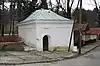 | Prince Miloš's Hammam (bath) in Brestovačka Banja | Brestovačka Banja 44.060345°N 22.044062°E | 22 July 1949 | ||
| SK 2088 | Office Building at Oslobođenja Square no. 5 in Bor | Trg oslobođenja 5 44.077897°N 22.099191°E | 29 December 1988 | |||
| SK 2089 | 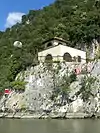 | "Pena" Signal Station on Đerdap | Kladovo | Tekija 44.618715°N 22.27421°E | 28 April 1994 |
Archaeological Sites
| Number in the Central Register | Photo | Name | Municipality | Address | Designated since | Classification |
|---|---|---|---|---|---|---|
| AN 23 | 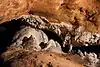 |
Lazareva Cave | Bor | Zlot 44.029445°N 21.962424°E |
4 September 1948 | |
| AN 38 | Mokranjske Stene | Negotin | Mokranje 44.163245°N 22.526499°E |
3 July 1980 | ||
| AN 39 |  |
Rudna Glava Archaeological Site | Majdanpek | Rudna Glava 44.339494°N 22.087591°E |
24 June 1981 | Exceptional Importance |
| AN 44 | 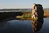 |
Pontes with Trajan's Bridge | Kladovo | Kladovo 44.613206°N 22.669130°E |
28 March 1981 | Exceptional Importance |
| AN 45 | .JPG.webp) |
Lepenski Vir | Majdanpek | Boljetin 44.556867°N 22.026450°E |
26 May 1966 | Exceptional Importance |
| AN 53 | Ravna Archaeological Site | Boljetin | 26 May 1966 | |||
| AN 54 | Hajdučka vodenica | Kladovo | Kladovo 44.638517°N 22.303292°E |
25 May 1966 | ||
| AN 55 | Veliki Gradac and Banja Archaeological Site | Majdanpek | Donji Milanovac | 25 May 1966 | ||
| AN 56 | Golo Brdo Archaeological Site | Kladovo | Kladovo | 27 May 1966 | ||
| AN 57 | Mala Livadica Archaeological Site | Majdanpek | Boljetin | 27 May 1966 | ||
| AN 58 | Velika Livadica Archaeological Site | Boljetin | 27 May 1966 | |||
| AN 60 | Transdierna | Kladovo | Tekija | 25 May 1966 | ||
| AN 61 | Kastrum Archaeological Site | Novi Sip | 25 May 1966 | |||
| AN 62 | Ribnica Archaeological Site | Majdanpek | Donji Milanovac | 25 May 1966 | ||
| AN 63 | Pecka Bara Archaeological Site | Kladovo | Kladovo | 25 May 1966 | ||
| AN 64 | Ciganija Archaeological Site | Majdanpek | Donji Milanovac | 25 May 1966 | ||
| AN 65 | Malo Golubinje Archaeological Site | Kladovo | Malo Golubinje | 25 May 1966 | ||
| AN 66 | Veliko Golubinje Archaeological Site | Veliko Golubinje | 25 May 1966 | |||
| AN 67 | Boljetinska Reka Archaeological Site | Majdanpek | Boljetin | 26 May 1966 | ||
| AN 92 | Trnjana Archaeological Site | Bor | Brestovačka Banja 44.070100°N 22.048257°E |
29 December 1988 | ||
| AN 93 |  |
Kučajna Archaeological Site | Bor 44.059398°N 22.090029°E |
29 December 1988 | ||
| AN 94 | Kastel Archaeological Site | Majdanpek | Miroč 44.475511°N 22.251006°E |
8 October 1986 | ||
| AN 103 | 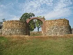 | Diana Karataš Roman and Byzantine Fortress | Kladovo | Novi Sip 44.653590°N 22.544301°E | 9 July 1979 | Exceptional Importance |
| AN 150 | Vrelo Archaeological Site | Negotin | Šarkamen 44.261868°N 22.296264°E |
8 August 1997 | ||
| AN 161 | Kmpije - Velike Livade | Bor | Bor 44.064393°N 22.106895°E |
10 May 2012 | ||
| AN 162 | Vajuga Archaeological Site | Kladovo | Vajuga 44.548736°N 22.647551°E |
10 May 2012 | ||
| AN 166 | Milutinovac Archaeological Site | Milutinovac 44.549829°N 22.573466°E |
18 May 2012 |
Historic Landmarks
| Number in the Central Register | Photo | Name | Municipality | Address | Designated since | Classification |
|---|---|---|---|---|---|---|
| ZM 11 | 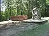 |
Memorial Hall and Memorial Museum at Stevanske livade | Negotin | Sikole | 7 September 1976 |
Spatial Cultural-Historical Units
| Number in the Central Register | Photo | Name | Municipality | Address | Designated since | Classification |
|---|---|---|---|---|---|---|
| PKIC 10 |  |
Štubik Wine Cellars Complex | Negotin | Štubik 44.226084°N 22.474123°E |
8 June 1980 | Exceptional Importance |
| PKIC 12 | 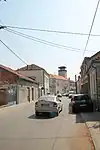 |
Old downtown | Negotin | Negotin 44.227639°N 22.530828°E |
3 July 1980 | Great Importance |
| PKIC 13 |  |
Mokranjac House Complex | Negotin | Negotin 44.225425°N 22.530565°E |
18 June 1980 | |
| PKIC 14 |  |
Rajac and Rogljevo Wine Cellars Complex | Negotin | Rajac 44.097268°N 22.550116°E |
23 February 1983 | Exceptional Importance |
| PKIC 32 | _019.jpg.webp) |
Narrow Area of Brestovačka Banja | Bor | Brestovačka Banja 44.060154°N 22.044064°E |
10 October 1991 | |
| PKIC 34 | 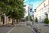 |
M. Tita Street | Kladovo | Kladovo M. Tita St. (Kralja Aleksandra St.) 44.611332°N 22.609484°E |
31 January 1986 |
See also
References
- "Cultural monuments in Serbia, list of all monuments". www.spomenicikulture.mi.sanu.ac.rs (in Serbian). Retrieved 2023-02-18.
| Per district |
|  |
|---|---|---|
| Per the level of protection | ||
This article is issued from Wikipedia. The text is licensed under Creative Commons - Attribution - Sharealike. Additional terms may apply for the media files.