Indian Springs, Georgia
Indian Springs is a census-designated place (CDP) in Catoosa County, Georgia, United States. The population was 2,336 at the 2020 census. It is part of the Chattanooga, TN–GA Metropolitan Statistical Area.
Indian Springs, Georgia | |
|---|---|
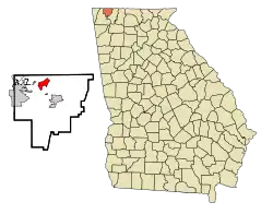 Location in Catoosa County and the state of Georgia | |
| Coordinates: 34°57′33″N 85°9′50″W | |
| Country | United States |
| State | Georgia |
| County | Catoosa |
| Area | |
| • Total | 2.56 sq mi (6.63 km2) |
| • Land | 2.56 sq mi (6.63 km2) |
| • Water | 0.00 sq mi (0.00 km2) |
| Elevation | 719 ft (219 m) |
| Population (2020) | |
| • Total | 2,336 |
| • Density | 912.14/sq mi (352.16/km2) |
| Time zone | UTC-5 (Eastern (EST)) |
| • Summer (DST) | UTC-4 (EDT) |
| ZIP code | 30736[2] |
| Area code(s) | 706/762 |
| FIPS code | 13-41036[3] |
| GNIS feature ID | 0332059[4] |
Geography
Indian Springs is located at 34°57′33″N 85°9′50″W (34.959131, -85.163983).[5]
According to the United States Census Bureau, the CDP has a total area of 2.6 square miles (6.7 km2), all land.
Demographics
| Census | Pop. | Note | %± |
|---|---|---|---|
| 2020 | 2,336 | — | |
| U.S. Decennial Census[6] | |||
2020 census
| Race | Num. | Perc. |
|---|---|---|
| White (non-Hispanic) | 2,092 | 89.55% |
| Black or African American (non-Hispanic) | 49 | 2.1% |
| Native American | 9 | 0.39% |
| Asian | 16 | 0.68% |
| Pacific Islander | 1 | 0.04% |
| Other/Mixed | 101 | 4.32% |
| Hispanic or Latino | 68 | 2.91% |
As of the 2020 United States census, there were 2,336 people, 868 households, and 660 families residing in the CDP.
2000 census
As of the census[3] of 2000, there were 1,982 people, 765 households, and 583 families residing in the CDP. The population density was 771.9 inhabitants per square mile (298.0/km2). There were 801 housing units at an average density of 311.9 per square mile (120.4/km2). The racial makeup of the CDP was 97.68% White, 0.45% African American, 0.96% Asian, 0.25% from other races, and 0.66% from two or more races. Hispanic or Latino of any race were 0.50% of the population.
There were 765 households, out of which 35.9% had children under the age of 18 living with them, 65.9% were married couples living together, 7.6% had a female householder with no husband present, and 23.7% were non-families. 20.4% of all households were made up of individuals, and 7.5% had someone living alone who was 65 years of age or older. The average household size was 2.59 and the average family size was 2.99.
In the CDP, the population was spread out, with 25.8% under the age of 18, 6.6% from 18 to 24, 33.9% from 25 to 44, 22.9% from 45 to 64, and 10.8% who were 65 years of age or older. The median age was 36 years. For every 100 females, there were 96.6 males. For every 100 females age 18 and over, there were 92.5 males.
The median income for a household in the CDP was $45,399, and the median income for a family was $51,350. Males had a median income of $35,313 versus $22,031 for females. The per capita income for the CDP was $18,499. About 7.9% of families and 11.1% of the population were below the poverty line, including 14.0% of those under age 18 and 18.6% of those age 65 or over.
References
- "2020 U.S. Gazetteer Files". United States Census Bureau. Retrieved December 18, 2021.
- "Indian Springs ZIP Code". zipdatamaps.com. 2023. Retrieved January 12, 2023.
- "U.S. Census website". United States Census Bureau. Retrieved January 31, 2008.
- "US Board on Geographic Names". United States Geological Survey. October 25, 2007. Retrieved January 31, 2008.
- "US Gazetteer files: 2010, 2000, and 1990". United States Census Bureau. February 12, 2011. Retrieved April 23, 2011.
- "Census of Population and Housing". Census.gov. Retrieved June 4, 2016.
- "Explore Census Data". data.census.gov. Retrieved December 17, 2021.
Municipalities and communities of Catoosa County, Georgia, United States | ||
|---|---|---|
| Cities | 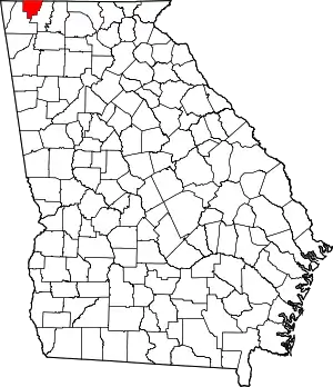 Map of Georgia highlighting Catoosa County | |
| Town | ||
| CDPs | ||
| Unincorporated communities | ||
| Footnotes | ‡This populated place also has portions in an adjacent county or counties | |