Ita Fort
The Ita Fort is an historical site in Itanagar, Arunachal Pradesh, India. Its name is "Fort of Bricks" in Assamese. It also lends its name to the city Itanagar, the capital of Arunachal Pradesh. The Ita Fort is generally assumed to have been built by the Sutiya kings in the 14th or 15th century.[1] The fort has an irregular shape, built mainly with bricks. The total brickwork is 16,200 cubic metres. The fort has three entrances on three sides, the western, eastern and southern,[2] similar to the walls of the Tamreswari Temple.
| Ita Fort | |
|---|---|
| Part of Arunachal Pradesh | |
| Itanagar, Arunachal Pradesh, India | |
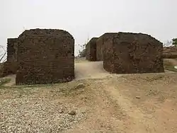 Ita Fort, southern gate | |
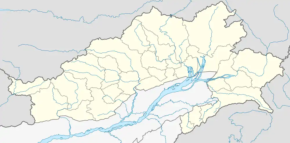 Ita Fort Location of Ita fort in Arunachal Pradesh, India  Ita Fort Ita Fort (India) | |
| Coordinates | 27.092°N 93.632°E |
| Type | Fort |
| Site information | |
| Controlled by | Government of Arunachal Pradesh |
| Condition | Ruins |
| Site history | |
| Built | 11th-14th century |
| Built by | Chutia Kingdom |
| Materials | Bricks, granite, and lime mortar |
History
The bricks used in the fort hint to later repairs in the 14th-15th century. The ruins of a hill fort on the banks of the Buroi river bear the same builder's marks as the ones found in the ruins of the Tamreswari Temple near Sadiya, which might indicate that the Sutiya fortifications were spread till Biswanath.[3] The location of Ita fort well to the east of Buroi shows that the Ita fort was also one of the Sutiya hill forts.
In the year 1941, the political officer of former Balipara frontier tract, Mr. D.N. Das, in an article published in the Journal of Assam Research Society, claimed the fort to be the capital of Ramachandra/Mayamatta Mayapur.[4] But, from the assamese chronicle Adi Charita[5] (which is itself dubious[6]), it is known that Ramachandra had his capital in Pratappura, due to which, he was known as Pratappuriya. Pratappura has been identified to be located near Biswanath.[7] The Pratapgarh ruins may have formed the eastern borders of the kingdom as evident from the Uma-tumani island (near Biswanath) stone inscription which mentions the ruler as Pratapuradhikari.[8] Further, it is also known that Ramachandra/Pratapuriya's son Arimatta or Sansanka had his kingdom in present-day Kamrup, Darrang and Sonitpur districts with capital at Baidargarh (Betna) and annexed the Kamata kingdom by killing the Kamateswar Phengua.[9] These might point that the Ita fort had nothing to do with Arimatta line of kings.
Gallery
 A brick wall at the southern gate.
 A granite stone carvings found in Ita fort depicting a lion, the symbol of the Chutia kingdom.
 Lion artwork from Ita fort. Lion was the emblem of the Chutia kingdom as found in Rukmini Nagar and Bhismaknagar.
Notes
- "Tourism in Arunachal Pradesh". Arunachalpradesh.nic.in. Archived from the original on 20 March 2012. Retrieved 27 March 2012.
- "The eastern gate the highest point of the fort is heavily damaged one. Built on stone masonry, this gate overlooks Doimukh in the Dikrong valley"(Tada 2011:119)
- (Baruah 1933:271)
- (Neog 2008:57)
- "It is supposed to have been written in 1586 saka (1664 AD)"(Neog 1980:29)
- Maheswar Neog states that the Adi-cwita, ascribed to Madhavadeva, has created much ill feeling among the Vaisnavas of Assam, and has been denounced by the more considerate section of sattra pontiffs and literary men alike.
- Journal of Asiatic Society of Bengal, p.190-191, Pratappura, capital city of Ramachandra was located near Biswanath, in the vicinity of Agnigarh.
- The Uma-tumani Rock inscription has the word Pratapapuradhikari indicating Pratappura to be located nearby.
- Gait, Edward, A History of Assam, p.18
References
- Baruah, K.L (1933). Early History Of Kamarupa.
- Neog, Maheswar (2008). Pavitra Assam Ed. 4th.
- Momin, Mignonette; Mawlong, Cecile A.; Qādrī, Fuz̤ail Aḥmad (2006). Society and Economy in North-East India. Regency Publications. ISBN 9788189233402.
- Tada, Tage (2011). Archaeological remains of Arunachal Pradesh up to 16th century (Ph.D.). Rajiv Gandhi University. hdl:10603/288770.
- Neog, Maheswar (1980). Early History of the Vaiṣṇava Faith and Movement in Assam: Śaṅkaradeva and His Times. Delhi: Motilal Banarsidass.