Ixiamas
Ixiamas is a town and municipality in the La Paz Department, Bolivia. It is on the level pampa 10 kilometres (6.2 mi) northeast of the Cordillera Central foothills.[1][2]
Ixiamas | |
|---|---|
Town | |
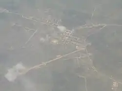 Ixiamas as seen from the air | |
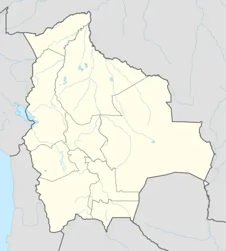 Ixiamas Location within Bolivia | |
| Coordinates: 13°46′S 68°8′W | |
| Country | |
| Department | La Paz Department |
| Province | Abel Iturralde Province |
| Municipality | Ixiamas Municipality |
| Time zone | UTC-4 (BOT) |
| Climate | Af |
It is served by Ixiamas Airport.
Climate
Ixiamas has a tropical rainforest climate, sitting on the southern edge of the Amazon forest in western Bolivia. Ixiamas receives ample rainfall throughout the year and is generally hot year round, with slightly milder winter temperatures.
| Climate data for Ixiamas, Bolivia | |||||||||||||
|---|---|---|---|---|---|---|---|---|---|---|---|---|---|
| Month | Jan | Feb | Mar | Apr | May | Jun | Jul | Aug | Sep | Oct | Nov | Dec | Year |
| Record high °C (°F) | 35.0 (95.0) |
35.0 (95.0) |
36.0 (96.8) |
34.6 (94.3) |
35.8 (96.4) |
33.3 (91.9) |
34.2 (93.6) |
36.4 (97.5) |
38.3 (100.9) |
36.5 (97.7) |
36.0 (96.8) |
36.8 (98.2) |
38.3 (100.9) |
| Average high °C (°F) | 30.2 (86.4) |
30.8 (87.4) |
31.5 (88.7) |
30.7 (87.3) |
29.4 (84.9) |
30.1 (86.2) |
30.5 (86.9) |
32.1 (89.8) |
33.3 (91.9) |
32.2 (90.0) |
31.3 (88.3) |
31.3 (88.3) |
31.1 (88.0) |
| Daily mean °C (°F) | 27.1 (80.8) |
27.0 (80.6) |
27.1 (80.8) |
26.8 (80.2) |
26.4 (79.5) |
25.6 (78.1) |
25.7 (78.3) |
27.3 (81.1) |
28.2 (82.8) |
28.1 (82.6) |
27.7 (81.9) |
27.3 (81.1) |
27.0 (80.6) |
| Average low °C (°F) | 22.3 (72.1) |
22.4 (72.3) |
21.7 (71.1) |
21.4 (70.5) |
18.7 (65.7) |
16.8 (62.2) |
17.5 (63.5) |
18.4 (65.1) |
20.3 (68.5) |
21.5 (70.7) |
21.6 (70.9) |
21.8 (71.2) |
20.4 (68.7) |
| Record low °C (°F) | 20.6 (69.1) |
20.0 (68.0) |
17.2 (63.0) |
15.0 (59.0) |
10.0 (50.0) |
9.9 (49.8) |
8.9 (48.0) |
10.0 (50.0) |
13.8 (56.8) |
16.1 (61.0) |
16.0 (60.8) |
19.0 (66.2) |
8.9 (48.0) |
| Average precipitation mm (inches) | 292.3 (11.51) |
382.2 (15.05) |
174.2 (6.86) |
127.9 (5.04) |
128.3 (5.05) |
63.3 (2.49) |
60.0 (2.36) |
94.1 (3.70) |
155.3 (6.11) |
164.4 (6.47) |
217.2 (8.55) |
279.1 (10.99) |
2,138.3 (84.19) |
| Average precipitation days (≥ 0.1 mm) | 17 | 17 | 18 | 13 | 7 | 3 | 2 | 2 | 5 | 10 | 12 | 16 | 122 |
| Average relative humidity (%) | 79 | 80 | 80 | 81 | 78 | 76 | 70 | 68 | 68 | 72 | 76 | 80 | 76 |
| Source: SENAMHI[3] | |||||||||||||
References
- OpenStreetMap - Ixiamas
- Google Maps - Ixiamas
-
. SENAMHI http://www.senamhi.gob.bo/sismet. Retrieved 18 October 2021.
{{cite web}}: Missing or empty|title=(help)

This article is issued from Wikipedia. The text is licensed under Creative Commons - Attribution - Sharealike. Additional terms may apply for the media files.