Jingjiang
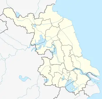
Jingjiang (Chinese: 靖江; pinyin: Jìngjiāng) is a county-level city under the administration of Taizhou, Jiangsu province, China. It is located on the northern (left) bank of the Yangtze River, and is the southernmost part of Taizhou City, bordering Nantong to the northeast, Suzhou to the southeast, Wuxi to the south, Changzhou to the southwest, and Zhenjiang to the west. The area of Jingjiang is 655.6 square kilometres and the population was 684,360 at the 2010 census.
Jingjiang
靖江市 Tsingkiang | |
|---|---|
 Stone pillar sculptures in Jingjiang | |
 Jingjiang Location in Jiangsu  Jingjiang Jingjiang (Eastern China)  Jingjiang Jingjiang (China) | |
| Coordinates: 32°00′32″N 120°15′47″E[1] | |
| Country | People's Republic of China |
| Province | Jiangsu |
| Prefecture-level city | Taizhou |
| Area | |
| • Total | 665 km2 (257 sq mi) |
| Population (2019)[3] | |
| • Total | 684,600 |
| • Density | 1,000/km2 (2,700/sq mi) |
| Time zone | UTC+8 (China Standard) |
| Postal code | 214500 |
History
The terrain of Jingjiang nowadays was originated as a shoal in the Yangtze River, which was known Matuosha in the ancient China. As the shoal had been extended, it was separated from then Jiangyin county to found a new county in 1471. As being looted by the Wokou for several time, it is designated Jiangjiang (means "pacifying the Yangzte River").[4]
The county under the administration of the prefecture-level city of Yangzhou originally, was converted to a county-level city in 1993, then was transferred to the Taizhou in 1996.[5]
Geography
The Yangzte had split into the north and the south distributaries at Jingjiang, but the city merged into the north bank later than the 1610s inasmuch as the north distributary was filled in by continued deposition.[4]
Climate
| Climate data for Jingjiang (1991–2020 normals, extremes 1981–2010) | |||||||||||||
|---|---|---|---|---|---|---|---|---|---|---|---|---|---|
| Month | Jan | Feb | Mar | Apr | May | Jun | Jul | Aug | Sep | Oct | Nov | Dec | Year |
| Record high °C (°F) | 19.6 (67.3) |
25.8 (78.4) |
28.7 (83.7) |
34.3 (93.7) |
35.1 (95.2) |
38.0 (100.4) |
39.1 (102.4) |
39.6 (103.3) |
37.1 (98.8) |
33.2 (91.8) |
28.1 (82.6) |
22.2 (72.0) |
39.6 (103.3) |
| Average high °C (°F) | 7.5 (45.5) |
9.9 (49.8) |
14.6 (58.3) |
20.8 (69.4) |
26.1 (79.0) |
28.9 (84.0) |
32.6 (90.7) |
32.1 (89.8) |
28.0 (82.4) |
22.9 (73.2) |
16.9 (62.4) |
10.2 (50.4) |
20.9 (69.6) |
| Daily mean °C (°F) | 3.7 (38.7) |
5.7 (42.3) |
10.0 (50.0) |
15.9 (60.6) |
21.3 (70.3) |
24.8 (76.6) |
28.7 (83.7) |
28.2 (82.8) |
24.0 (75.2) |
18.6 (65.5) |
12.6 (54.7) |
6.1 (43.0) |
16.6 (62.0) |
| Average low °C (°F) | 0.9 (33.6) |
2.6 (36.7) |
6.4 (43.5) |
11.8 (53.2) |
17.2 (63.0) |
21.6 (70.9) |
25.5 (77.9) |
25.2 (77.4) |
20.8 (69.4) |
15.0 (59.0) |
9.1 (48.4) |
3.0 (37.4) |
13.3 (55.9) |
| Record low °C (°F) | −9.2 (15.4) |
−8.8 (16.2) |
−5.5 (22.1) |
0.3 (32.5) |
6.0 (42.8) |
11.9 (53.4) |
17.9 (64.2) |
17.8 (64.0) |
9.4 (48.9) |
0.8 (33.4) |
−4.8 (23.4) |
−11.2 (11.8) |
−11.2 (11.8) |
| Average precipitation mm (inches) | 57.2 (2.25) |
54.6 (2.15) |
76.2 (3.00) |
74.4 (2.93) |
94.7 (3.73) |
196.9 (7.75) |
200.0 (7.87) |
178.9 (7.04) |
88.6 (3.49) |
59.8 (2.35) |
54.5 (2.15) |
37.4 (1.47) |
1,173.2 (46.18) |
| Average precipitation days (≥ 0.1 mm) | 9.6 | 9.2 | 10.7 | 9.9 | 10.7 | 11.9 | 12.8 | 12.7 | 8.5 | 7.3 | 8.6 | 7.7 | 119.6 |
| Average snowy days | 3.2 | 2.5 | 0.8 | 0.1 | 0 | 0 | 0 | 0 | 0 | 0 | 0.2 | 1.0 | 7.8 |
| Average relative humidity (%) | 73 | 72 | 70 | 68 | 70 | 76 | 78 | 79 | 77 | 73 | 73 | 71 | 73 |
| Mean monthly sunshine hours | 134.1 | 134.3 | 161.6 | 186.1 | 199.8 | 161.1 | 207.5 | 214.6 | 186.0 | 181.8 | 154.3 | 151.5 | 2,072.7 |
| Percent possible sunshine | 42 | 43 | 43 | 48 | 47 | 38 | 48 | 53 | 51 | 52 | 49 | 49 | 47 |
| Source: China Meteorological Administration[6][7] | |||||||||||||
Transportation
The city is part of the Yangtze River Delta region and has one river crossing. The Jiangyin Suspension Bridge, which carries the G2 Beijing–Shanghai Expressway to Jiangyin, is one of the longest suspension bridges in the world. The G40 Shanghai–Xi'an Expressway to Nanjing and Shanghai also passes through the city.
Economy
Traditionally, the city has been noted for its core manufacturing industries in electronics, auto parts, biochemicals, textiles and machinery. Emerging industries include shipbuilding and logistics (transport).
Seven major local shipyards, including one of China's largest private shipyards New Century Shipyard and its subsidiary New Time Shipyard; New Yangtze Shipyard, which went public in Singapore in 2007 and it was the first ever China's private shipyard listed on overseas stock exchange.
Administrative divisions
Jingjiang city consists of 1 subdistrict and 8 towns:[8]
- 1 subdistrict
- Jingcheng (靖城街道) - is upgraded from town.
- 8 towns
|
|
-Former town is merged to other.
- Binjiang (滨江新城)
In addition the city has a provincial level economic development zone (Jingjiang Economic Development Zone).
School and Education
Middle School:
- Jiangsu Jingjiang Senior Middle School
- Jiangsu Jingjiang Xieqiao Middle School
- Jiangjiang No.1 Middle School
- Jingjiang Bingjiang School
- Jingjiang Foreign Language School
Food
The city is noted for its pork jerky and slices, along with steamed soup dumplings filled with crab juices.
Notable people
References
- Google (2014-07-02). "Jingjiang" (Map). Google Maps. Google. Retrieved 2014-07-02.
- Taizhou Statistical Yearbook 2012/《泰州统计年鉴2012》.(in Chinese) Accessed 9 July 2014.
- China 2010 Census County-by-county Statistics/《中国2010年人口普查分县资料》.(in Chinese) Accessed 9 July 2014.
- 中国历史大辞典·历史地理卷 [The Great Encyclopaedia of Chinese history, Volume on Historical Geography] (in Chinese). Shanghai Cishu Press. 1996. p. 955. ISBN 7-5326-0299-0.
- 江苏市县概况 [A Survey of Cities and Counties in Jiangsu] (in Chinese). pp. 398–401. ISBN 978-7-55-373496-5.
- 中国气象数据网 – WeatherBk Data (in Simplified Chinese). China Meteorological Administration. Retrieved 25 June 2023.
- 中国气象数据网 (in Simplified Chinese). China Meteorological Administration. Retrieved 25 June 2023.
- "泰州市-行政区划网 www.xzqh.org" (in Chinese). XZQH. Retrieved 2012-05-24.
External links
- 中国靖江网 Archived 2010-01-06 at the Wayback Machine