Jourian
Jourian is a town and a notified area committee in Jammu district in the Indian administered union territory of Jammu and Kashmir.
Jourian | |
|---|---|
Town | |
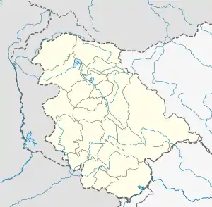 Jourian Location in Jammu and Kashmir, India  Jourian Jourian (India) | |
| Coordinates: 32.834°N 74.577°E | |
| Country | |
| Union Territory | Jammu and Kashmir |
| District | Jammu |
| Elevation | 274 m (899 ft) |
| Population (2001) | |
| • Total | 3,628 |
| Languages | |
| • Official | Dogri, Hindi, English, Kashmiri, Urdu[1][2] |
| Time zone | UTC+5:30 (IST) |
| PIN | 181202 |
Geography
Jourian is located at 32.83°N 74.58°E.[3] It has an average elevation of 274 metres (899 feet).
Demographics
Religion in Jourian Town (2011)[4]
Not Stated (0.53%)
As of 2001 India census,[5] Jourian had a population of 3628. Males constitute 51% of the population and females 49%. Jourian has an average literacy rate of 75%, higher than the national average of 59.5%: male literacy is 81%, and female literacy is 68%. In Jourian, 12% of the population is under 6 years of age.
In the 2011 census 97.20% of residents were Hindu, 0.69% were Sikh and 0.81% were Muslim.
References
- "The Jammu and Kashmir Official Languages Act, 2020" (PDF). The Gazette of India. 27 September 2020. Retrieved 27 September 2020.
- "Parliament passes JK Official Languages Bill, 2020". Rising Kashmir. 23 September 2020. Archived from the original on 24 September 2020. Retrieved 23 September 2020.
- "Maps, Weather, and Airports for Jaurian, India". www.fallingrain.com.
- "Jourian Town Population". Census India. Retrieved 11 July 2021.
- "Census of India 2001: Data from the 2001 Census, including cities, villages and towns (Provisional)". Census Commission of India. Archived from the original on 16 June 2004. Retrieved 1 November 2008.
This article is issued from Wikipedia. The text is licensed under Creative Commons - Attribution - Sharealike. Additional terms may apply for the media files.