Jwalamukhi Rural Municipality
Jwalamukhi (Nepali: ज्वालामुखी; gangajamuna) is a Gaupalika(Nepali: गाउपालिका ; gaupalika)[2] (formerly: village development committee) in Dhading District in the Bagmati Zone of central Nepal. The local body was formed by merging four VDCs namely Khari, Dhola, Nepal, Maidi and Chainpur, Bagmati. Currently, it has a total of 7 wards. The population of the rural municipality is 23,966 according to the data collected on 2017 Nepalese local elections.Chairman of this rural municipality is Binod Timalsina and he belongs to Nepali Congress Party.
Jwalamukhi
ज्वालामुखी | |
|---|---|
| Rural Municipality in Nepal | |
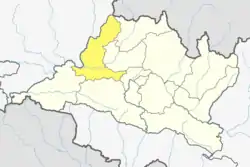
 Jwalamukhi Location in Nepal | |
| Coordinates: 27°38′43.3″N 84°34′3.68″E | |
| Country | Nepal |
| Development Region | Central |
| District | Dhading |
| Province | Bagmati Province |
| Rural Municipality | Jwalamukhi |
| Area | |
| • Total | 114.04 km2 (44.03 sq mi) |
| Population (2017)[1] | |
| • Total | 23,966 |
| • Density | 210/km2 (540/sq mi) |
| Time zone | UTC+5:45 (NST) |
| Area code | 010 |
| Website | jwalamukhimun |
Demographics
At the time of the 2011 Nepal census, Jwalamukhi Rural Municipality had a population of 23,966. Of these, 83.6% spoke Nepali, 6.1% Magar, 5.5% Tamang, 2.2% Newar, 2.1% Kumhali, 0.2% Gurung, 0.1% Maithili and 0.1% other languages as their first language.[3]
In terms of ethnicity/caste, 19.6% were Hill Brahmin, 17.3% Newar, 14.8% Magar, 13.9% Chhetri, 8.8% Sarki, 5.7% Tamang, 4.7% Gurung, 4.4% Kumal, 3.9% Kami, 2.7% Damai/Dholi, 1.1% Sanyasi/Dasnami, 1.0% Gharti/Bhujel, 0.8% Thakuri, 0.3% Majhi, 0.3% Thakali, 0.2% Hajam/Thakur, 0.1% Musalman, 0.1% Teli and 0.2% others.[4]
In terms of religion, 89.6% were Hindu, 6.2% Christian, 4.0% Buddhist, 0.1% Muslim and 0.1% others.[5]
In terms of literacy, 60.5% could both read and write, 2.2% could read but not write and 37.2% could neither read nor write.[6]
Geography
East: Niklantha Municipality
West: Gorkha District
North: Triuprasundari Gaupalika and Gorkha District
South: Siddhalek Gaupalika and Gorkha District
Population
As per 2017, Jwalamukhi hosts a population of 23,966 across a total area of 114.04 km2.
See also
References
- "MOFALD List of Gaupalika" (PDF). Retrieved 2017-06-02.
- "यसरी २ नगर र ११ गाउँपालिकामा बाँडिनेभयो धादिङलाई (स्पष्ट नक्सासहित)". Sajhapost. Nov 11, 2016.
- NepalMap Language
- NepalMap Caste
- NepalMap Religion
- NepalMap Literacy