Khaniyabas Rural Municipality
Khaniyabas (Nepali: खनियाबास; khaniyabas) is a Gaupalika(Nepali: गाउपालिका ; gaupalika)[2] Formerly: village development committee) in Dhading District in the Bagmati Zone of central Nepal. It has a literacy rate of 59.22% . The local body was formed by merging three VDCs namely Jharlang, Darkha and Satyadevi. The population of the rural municipality is 12,749 according to the data collected on 2017 Nepalese local elections.
Khaniyabas
खनियाबास | |
|---|---|
| Rural Municipality in Nepal | |
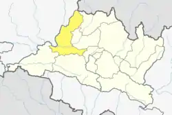
 Khaniyabas Location in Nepal | |
| Coordinates: 28°4′12.31″N 85°0′31.98″E | |
| Country | Nepal |
| Development Region | Central |
| Zone | Bagmati Province |
| District | Dhading |
| Rural Municipality | Khaniyabas |
| Established | 10 March 2017 |
| Government | |
| • Chairperson | Mr. Rana Bahadur Tamang (NC) |
| • Vice-chairperson | Sekkerong Tamang (CpN) |
| Area | |
| • Total | 120.80 km2 (46.64 sq mi) |
| Population (2017)[1] | |
| • Total | 12,749 |
| Time zone | UTC+5:45 (NST) |
| Area code | 010 |
| Literacy Rate | |
| Website | khaniyabasmun |
Demographics
At the time of the 2011 Nepal census, Khaniyabas Rural Municipality had a population of 12,749. Of these, 86.8% spoke Tamang, 12.2% Nepali, 0.5% Gurung, 0.1% Newar and 0.2% other languages as their first language.[3]
In terms of ethnicity/caste, 88.2% were Tamang, 4.2% Kami, 2.8% Magar, 1.1% Hill Brahmin, 0.9% Damai/Dholi, 0.9% Gurung, 0.8% Chhetri, 0.4% Gharti/Bhujel, 0.4% Newar, 0.1% Sarki and 0.3% others.[4]
In terms of religion, 51.6% were Buddhist, 37.4% Christian, 10.8% Hindu and 0.2% others.[5]
In terms of literacy, 59.8% could both read and write, 1.9% could read but not write and 38.2% could neither read nor write.[6]
Geography
East: Nuwakot District and Rasuwa District
West: Gangajamuna Gaupalika and Rubi Valley Gaupalika
North: Ruby Valley Gaupalika
South: Netrawati Gaupalika and Nuwakot District
Population
As per 2017, Khaniyabas hosts a population of 12,749 across a total area of 120.80 km2.
References
- "Local Elections 2074 - Election Results Overview - Dhading - Gajuri". Retrieved 2017-06-02.
- "यसरी २ नगर र ११ गाउँपालिकामा बाँडिनेभयो धादिङलाई (स्पष्ट नक्सासहित)". Sajhapost. Nov 11, 2016. Archived from the original on July 3, 2019. Retrieved June 5, 2017.
- NepalMap Language
- NepalMap Caste
- NepalMap Religion
- NepalMap Literacy