Kępa, West Pomeranian Voivodeship
Kępa [ˈkɛmpa] (German: Johannesthal) is a village in the administrative district of Gmina Drawno, within Choszczno County, West Pomeranian Voivodeship, in north-western Poland.[1] It lies approximately 3 kilometres (2 mi) north-west of Drawno, 24 km (15 mi) east of Choszczno, and 80 km (50 mi) east of the regional capital Szczecin.
Kępa | |
|---|---|
Village | |
 Kępa 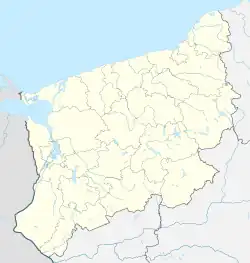 Kępa | |
| Coordinates: 53°14′N 15°44′E | |
| Country | |
| Voivodeship | West Pomeranian |
| County | Choszczno |
| Gmina | Drawno |
| Time zone | UTC+1 (CET) |
| • Summer (DST) | UTC+2 (CEST) |
| Area code | +48 95 |
| Car plates | ZCH |
Before 1945, the village was German-settled and part of Prussia and Germany.
References

This article is issued from Wikipedia. The text is licensed under Creative Commons - Attribution - Sharealike. Additional terms may apply for the media files.