Kırıkhan
Kırıkhan is a municipality and district of Hatay Province, Turkey.[2] Its area is 715 km2,[3] and its population is 121,028 (2022).[1] The name Kırıkhan means "broken inn" in the Turkish language, perhaps a reference to one of the many lodgings that once lined the road. The town stands at the intersection of the route between İskenderun and Aleppo, and the major north-south road between Antakya and Kahramanmaraş.
Kırıkhan | |
|---|---|
District and municipality | |
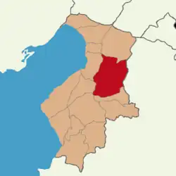 Map showing Kırıkhan District in Hatay Province | |
 Kırıkhan Location in Turkey | |
| Coordinates: 36°29′51″N 36°21′39″E | |
| Country | Turkey |
| Province | Hatay |
| Government | |
| • Mayor | Ayhan Yavuz (AKP) |
| Area | 715 km2 (276 sq mi) |
| Elevation | 151 m (495 ft) |
| Population (2022)[1] | 121,028 |
| • Density | 170/km2 (440/sq mi) |
| Time zone | TRT (UTC+3) |
| Postal code | 31440 |
| Area code | 0326 |
| Website | www |
The town was once part of the district of Belen, but became a district in its own right in 1923 at the time of the French Mandate. Kırıkhan was annexed to Turkey in 1939 with the rest of Hatay.
Its average summer temperature is 32.3 °C, and its average winter temperature is 7.3 °C.
The district’s major religious and touristic site is the Beyazid-i Bestami Külliyesi (Complex) on Darb-ı Sak Castle at Alabeyli village, which contains the tomb or maqam of Bayazid Bastami.[4] The ruined medieval Crusader castle Trapessac is situated near Kırıkhan.
Kırıkhan was heavily damaged by powerful earthquakes in February 2023 and subsequent aftershocks.[5]
Composition
There are 73 neighbourhoods in Kırıkhan District:[6]
- 408 Evler
- Abalaklı
- Adalar
- Aktutan
- Alaybeyli
- Alibeyçağıllı
- Alparslan
- Alsancak
- Arkıtça
- Aydınlı
- Aygırgölü
- Bahçelievler
- Balarmudu
- Baldıran
- Barbaros
- Başpınar
- Bektaşlı
- Çamsarı
- Çamseki
- Camuzkışlası
- Çankaya
- Çataltepe
- Ceylanlı
- Çiloğlanhüyüğü
- Cumhuriyet
- Danaahmetli
- Dedeçınar
- Delibekirli
- Demirkonak
- Fatih
- Gazi
- Gölbaşı
- Gültepe
- Gündüz
- Güventaşı
- Güzelce
- İçada
- Ilıkpınar
- İncirli
- Kaletepe
- Kamberlikaya
- Kamışlar
- Kangallar
- Karaçağıl
- Karadurmuşlu
- Karaelmaslı
- Karamağara
- Karamankaşı
- Karataş
- Kazkeli
- Kızılkaya
- Kodallı
- Kurtlusarımazı
- Kurtlusoğuksu
- Kurtuluş
- Mahmutlu
- Menderes
- Mimarsinan
- Muratpaşa
- Narlıhopur
- Özkızılkaya
- Özsoğuksu
- Özyörük
- Reşatlı
- Saylak
- Söğütlüöz
- Sucuköy
- Taşoluk
- Topboğazı
- Torun
- Yalangoz
- Yeni
- Yılanlı
Notable people
- Nerses Pozapalian, senior bishop of the Armenian Apostolic Church
References
- "Address-based population registration system (ADNKS) results dated 31 December 2022, Favorite Reports" (XLS). TÜİK. Retrieved 19 September 2023.
- Büyükşehir İlçe Belediyesi, Turkey Civil Administration Departments Inventory. Retrieved 19 September 2023.
- "İl ve İlçe Yüz ölçümleri". General Directorate of Mapping. Retrieved 19 September 2023.
- "Kırıkhan'da Darb-ı Sak Kalesi üzerine inşa edilmiş Beyazid-i Bestami Külliyesi". www.dunyabizim.com/ (in Turkish). Retrieved 2021-09-12.
- "Hatay'da ağır yıkımın bilançosu..." [The result of the heavy destruction in Hatay...] (in Turkish). Iskenderun.org. 2023-04-08.
- Mahalle, Turkey Civil Administration Departments Inventory. Retrieved 19 September 2023.
Kırıkhan in Hatay Province of Turkey | |||||||||||||||||||||||||||
|---|---|---|---|---|---|---|---|---|---|---|---|---|---|---|---|---|---|---|---|---|---|---|---|---|---|---|---|
| Districts |  Districts of Hatay | ||||||||||||||||||||||||||
| |||||||||||||||||||||||||||
Metropolitan municipalities are bolded. | |||||||||||||||||||||||||||