Sheema
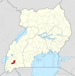
Sheema, also Sheema Municipality, is an urban centre in the Western Region of Uganda. It is the largest municipality in Sheema District.[2]
Sheema
Sheema Municipality | |
|---|---|
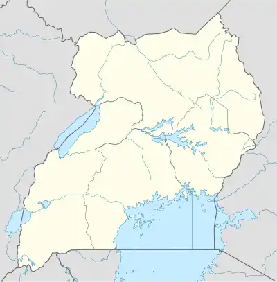
 Sheema Location in Uganda | |
| Coordinates: 00°34′52″S 30°22′46″E | |
| Country | |
| Region | Western Uganda |
| Sub-region | Ankole sub-region |
| District | Sheema District |
| Parliamentary Constituency | Sheema Municipality |
| Government | |
| • Member of Parliament | Elioda Tumwesigye[1] |
| Elevation | 4,630 ft (1,410 m) |
| Population (2014 Census) | |
| • Total | 80,375 |
Location
Sheema lies on the Mbarara–Ishaka Road, approximately 33 kilometres (21 mi), by road, west of Mbarara, the largest city in the sub-region.[3] This is about 29 kilometres (18 mi) east of Ishaka.[4] The coordinates of the town are:0°34'52.0"S, 30°22'46.0"E (Latitude:-0.581111; Longitude).[5] The elevation of the Kibingo neighborhood in Sheema Municipality is 1,410 metres (4,630 ft), above sea level.[6]
Overview
Sheema Municipality, is an urban centre in Sheema District. It includes the neighborhoods of Kabwohe, Itendero and Kibingo, where the district headquarters are located.[7] Sheema Town was created on 1 July 2018, by carving it out of Sheema North Constituency.[8][9]
Population
In 2014 the national census put the population of Sheema Municipality (Kibingo-Kabwohe-Itendero), at 80,735 people.[10]
Points of interest
The following points of interest lie within the town limits or close to the edges of town: (a) The offices of Sheema Town Council (b) Kabwohe Central Market, the largest source of fresh produce in Kabwohe (c) A branch of Stanbic Bank Uganda Limited (d) A branch of Pride Microfinance Limited (e) Emmanuel Church, Kabwohe, a place of worship affiliated with the Church of Uganda (e) The headquarters of Sheema District (f) Ankole Western University, a private university affiliated with Western Ankole Diocese of the Church of Uganda.[11] (g) Nganwa High School, a secondary school administered by the Uganda Ministry of Education (h) Integrated Community Based Initiatives (ICOBI), an NGO in Kabwohe and (i) Kabwohe Clinical Research Center (KCRC), a research, development, and medical testing center.
See also
References
- Ainebyoona, Felix (5 June 2018). "Minister Elioda Wins NRM Primaries In Sheema Municipality". Daily Monitor. Kampala. Retrieved 31 July 2018.
- Administrator (20 July 2018). "Museveni campaigns for Elioda in Sheema". New Vision. Kampala. Retrieved 31 July 2018.
- Globefeed.com (31 July 2018). "Distance between Golf Course Road, Mbarara, Western Region, Uganda and Kabwohe Town Council, Sheema, Western Region, Uganda". Globefeed.com. Retrieved 31 July 2018.
- Globefeed.com (31 July 2018). "Distance between Caltex Petrol Station, Ntungamo - Katunguru Road, Ishaka, Western Region, Uganda and Kabwohe Town Council, Sheema, Western Region, Uganda". Globefeed.com. Retrieved 31 July 2018.
- Google (31 July 2018). "Location of Sheema Municipality, Sheema District, Western Region, Uganda" (Map). Google Maps. Google. Retrieved 31 July 2018.
- Floodmap.net (31 July 2018). "The Elevation of the Kibingo, Uganda Neighborhood, Sheema Municipality, Western Region, Uganda". Floodmap.net. Retrieved 31 July 2018.
- Google (31 July 2018). "Map Showing Location of the Headquarters of Sheema District" (Map). Google Maps. Google. Retrieved 31 July 2018.
- Chimp Corps (20 July 2018). "Museveni Campaigns For Dr. Elioda Tumwesigye In Sheema Municipality". Kampala: Chimp Reports Uganda. Retrieved 31 July 2018.
- Ainebyoona, Felix (23 July 2018). "I contested for Sheema municipality seat because opposition targeted it - Tumwesigye". Daily Monitor. Kampala. Retrieved 31 July 2018.
- Uganda Bureau of Statistics (27 August 2014). "The population of all Ugandan cities and towns with more than 15,000 inhabitants according to census results: Sheema Municipality". Kampala: Citypopulation.de Quoting Uganda Bureau of Statistics. Retrieved 13 September 2018.
- Ahimbisibwe, Chris (19 April 2009). "Private Universities Cautioned On Fees". New Vision. Kampala. Retrieved 31 July 2018.
