Kabwoya
Kabwoya is a village in the Kikuube District of the Western Region of Uganda.
Kabwoya | |
|---|---|
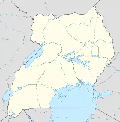 Kabwoya Location in Uganda | |
| Coordinates: 01°14′43″N 31°04′59″E | |
| Country | Uganda |
| Region | Western Region of Uganda |
| District | Kikuube District |
| Elevation | 3,900 ft (1,200 m) |
| Climate | Aw |
Location
Kabwoya is approximately 45.5 kilometres (28.3 mi), by road, south-west of Hoima, the nearest large city.[1] Kabwoya is also approximately 47 kilometres (29 mi), by road, north-east of Kagadi in neighboring Kagadi District, on the Kyenjojo–Kabwoya Road.[2] The coordinates of Kabwoya are 1°14'43.0"N, 31°04'59.0"E (Latitude:1.245278; Longitude:31.083056).[3]
Overview
The 135 kilometres (84 mi) Kigumba–Masindi–Hoima–Kabwoya Road[4] joins the 103 kilometres (64 mi) Kyenjojo–Kabwoya Road in the middle of Kabwoya.[5][6]
References
- Google (24 June 2021). "Road Distance Between Hoima, Uganda And Kabwoya, Uganda" (Map). Google Maps. Google. Retrieved 24 June 2021.
- Google (24 June 2021). "Road Distance Between Kagadi, Uganda And Kabwoya, Uganda With Map" (Map). Google Maps. Google. Retrieved 24 June 2021.
- Google (24 June 2021). "Location of Kabwoya, Western Region, Uganda" (Map). Google Maps. Google. Retrieved 24 June 2021.
- Rwothungeyo, Billy (10 June 2013). "Kigumba-Masindi-Hoima Road To Be Upgraded To Tarmac". New Vision. Kampala. Retrieved 26 July 2015.
- Kivabulaya, Fredrick (11 April 2015). "Kyenjojo-Kabwoya Road Compensation Process Starts". Uganda Radio Network. Retrieved 26 July 2015.
- Mugerwa, Francis (14 December 2012). "Government Secures Funds for Masindi-Kyenjojo Road". Daily Monitor. Kampala. Retrieved 26 July 2015.
External links
Capital: Hoima | ||
| Towns and villages | 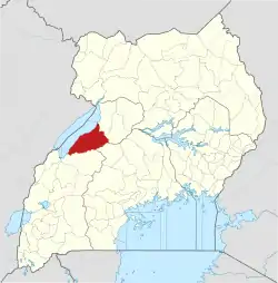 | |
| Geography | ||
| Economy | ||
| Banking | ||
| Energy |
| |
| Transport | ||
| Health | ||
| Notable landmarks | ||
| Notable people |
| |
This article is issued from Wikipedia. The text is licensed under Creative Commons - Attribution - Sharealike. Additional terms may apply for the media files.