Kajo Keji
Kajo Keji, also spelled Kajokaji, Kajukeji, Kajo-keji and Kago Kaju, is a town in South Sudan.
Kajo Keji | |
|---|---|
Town | |
.jpg.webp) | |
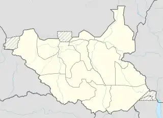
 Kajo Keji Location in South Sudan | |
| Coordinates: 03°50′57″N 31°39′28″E | |
| Country | |
| Region | Equatoria |
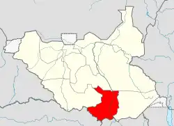
| State | Central Equatoria |
| County | Kajo Keji County |
| Population (2010) | |
| • Total | 196,000 |
| Time zone | UTC+2 (CAT) |
| Climate | Aw |
Location
Kajo Keji is part of the six counties of Central Equatoria (one of the ten states of South Sudan). It is approximately 150 kilometres (93 mi), by road, south of Juba, the capital of and largest city in South Sudan. It lies near the state border with Eastern Equatoria State and close to the international border with Uganda, to the south.[1][2] The town of Nimule lies approximately 50 kilometres (31 mi) by road southeast of Kajo Keji, at the point where the Victoria Nile leaves Uganda to enter South Sudan. The coordinates of Kajo Keji
are:3°50'57.0"N, 31°39'28.0"E (Latitude:3.849167; Longitude:31.657778).[3]
Payams
1.liwolo
2.kangapo 1
3.kangapo 2
Bomas
√bori
√logu
√wudu
√jokat
4.ngepo
5.lire
Overview
Kajo Keji and the surrounding community are home to the Kuku people.[4] The town is home to the headquarters of the Anglican Diocese of Kajo Keji, with Bishop Lule James Kenyi being the prelate.[5] Equity Bank South Sudan Limited maintains a branch in the town, being the only commercial bank in the county.[6]
Population
As of June 2010, the population of Kajo Keji was estimated at 196,000.[7]
Climate Kajo Kaji: Weather By Month
Located at an elevation of 957.32 meters (3140.81 feet) above sea level, Kajo Kaji has a Tropical wet and dry or savanna climate (Classification: Aw). The district's yearly temperature is 31.5°C (88.7°F) and it is 2.0% higher than South Sudan's averages. Kajo Kaji typically receives about 138.97 millimeters (5.47 inches) of precipitation and has 210.66 rainy days (57.72% of the time) annually.[1]
| Month | Jan | Feb | Mar | Apr | May | Jun | Jul | Aug | Sep | Nov | Oct | Dec | Year |
|---|---|---|---|---|---|---|---|---|---|---|---|---|---|
| Record high °C (°F) | 44.81(112.66) | 45.88(114.58) | 45.88(114.58) | 44.81(112.66) | 42.68(108.82) | 40.54(104.97) | 42.68(108.82) | 41.61(106.9) | 42.68(108.82) | 43.74(110.73) | 41.61(106.9) | 42.68(108.82) | 45.88(114.58) |
| Average high °C (°F) | 39.54(103.17) | 40.85(105.53) | 39.85(103.73) | 37.99(100.38) | 35.37(95.67) | 33.91(93.04) | 33.05(91.49) | 33.5(92.3) | 34.28(93.7) | 34.9(94.82) | 36.02(96.84) | 38.11(100.6) | 36.45(97.61) |
| Daily mean °C (°F) | 33.79(92.82) | 35.25(95.45) | 34.86(94.75) | 32.8(91.04) | 30.74(87.33) | 29.31(84.76) | 28.45(83.21) | 28.8(83.84) | 29.44(84.99) | 30.17(86.31) | 31.31(88.36) | 33.07(91.53) | 31.49(88.68) |
| Average low °C (°F) | 25.05(77.09) | 26.94(80.49) | 27.87(82.17) | 26.3(79.34) | 24.24(75.63) | 22.91(73.24) | 22.02(71.64) | 22.0(71.6) | 22.35(72.23) | 23.33(73.99) | 24.42(75.96) | 25.32(77.58) | 24.4(75.92) |
| Record low °C (°F) | 17.07(62.73) | 19.2(66.56) | 22.4(72.32) | 22.4(72.32) | 20.27(68.49) | 19.2(66.56) | 16.0(60.8) | 19.2(66.56) | 19.2(66.56) | 19.2(66.56) | 21.34(70.41) | 20.27(68.49) | 16.0(60.8) |
| Average precipitation mm (inches) | 5.63(0.22) | 28.35(1.12) | 58.21(2.29) | 99.1(3.9) | 220.83(8.69) | 236.87(9.33) | 227.12(8.94) | 248.02(9.76) | 215.02(8.47) | 215.54(8.49) | 96.52(3.8) | 16.31(0.64) | 138.96(5.47) |
| Average precipitation days (≥ 1.0 mm) | 1.55 | 5.43 | 10.77 | 17.26 | 24.83 | 26.67 | 28.42 | 29.09 | 25.13 | 23.86 | 13.68 | 3.98 | 17.55 |
| Average relative humidity (%) | 28.39 | 29.97 | 41.4 | 56.93 | 71.94 | 77.07 | 80.28 | 80.71 | 77.5 | 72.82 | 59.68 | 38.45 | 59.6 |
| Mean monthly sunshine hours | 11.19 | 12.27 | 12.58 | 13.18 | 13.26 | 13.07 | 13.04 | 13.05 | 11.77 | 11.71 | 12.05 | 11.89 | 12.42 |
See also
References
- Waakhe Simon Wudu (3 May 2013). "Work Starts On Juba-Kajo Keji Road". Gurtong.net. Retrieved 11 December 2014.
- "Yei River State residents fleeing to villages". Gurtong. 12 July 2016. Archived from the original on 18 August 2016. Retrieved 12 August 2016.
- "Location of Kajo Keji At Google Maps". Google Maps. Retrieved 11 December 2014.
- Geri, Alfred (27 October 2014). "Implications of Moyo – Kajo-Keji Conflict". Gurtong.net. Retrieved 11 December 2014.
- "Diocese: Kajo Keji". Retrieved 4 February 2020.
- Waakhe Simon Wudu (31 July 2012). "Equity Bank Opens In Kajo-Keji". Gurtong.net. Retrieved 11 December 2014.
- "Kajo Keji, South Sudan: General Information". United Nations Mission In Sudan. 8 June 2010. Archived from the original on 27 October 2014. Retrieved 11 December 2014.
