Khan Kamboul
Kamboul (Khmer: ខណ្ឌកំបូល) is a district (khan) located in western Phnom Penh, Cambodia. It was formerly a part of Kandal Province before being integrated into Phnom Penh. This khan was created on January 8, 2019, according to sub-decree 04 អនក្រ.បក by taken 6 sangkats from Khan Pou Senchey,[2] and 1 sangkat (Sangkat Prateah Lang) from Khan Dangkao.[3] It has a population of 75,529.
Kamboul
ខណ្ឌកំបូល | |
|---|---|
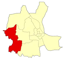 Location of Kamboul within Phnom Penh | |
 Kamboul | |
| Coordinates: 11°31′43″N 104°46′47″E | |
| Country | |
| Provinces | Phnom Penh |
| Area | |
| • Total | 96.2 km2 (37.1 sq mi) |
| Population (2019)[1] | |
| • Total | 75,529 |
| Time zone | UTC+7 (ICT) |
| Geocode | 1206 |
Administration
As of 2019, Khan Kamboul has 7 sangkats and 93 phums (villages).[2]
| No. | Code | Sangkat | Khmer | Number of villages |
|---|---|---|---|---|
| 1 | 121401 | Kamboul | កំបូល | 18 |
| 2 | 121402 | Kantouk | កន្ទោក | 13 |
| 3 | 121403 | Ovlaok | ឪឡោក | 14 |
| 4 | 121404 | Snaor | ស្នោរ | 18 |
| 5 | 121405 | Phleung Chheh Roteh | ភ្លើងឆេះរទេះ | 8 |
| 6 | 121406 | Boeng Thum | បឹងធំ | 16 |
| 7 | 121407 | Prateah Lang | ប្រទះឡាង | 6 |
| Total | 93 | |||
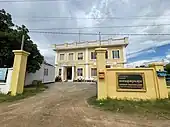 PRATEAH LANG Commune Hall
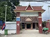 Kamboul Commune Hall
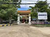 Kantouk Commune Hall
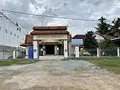 Phleung Chheh Roteh Commune Hall
Landmarks
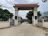 Kamboul High School
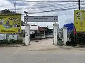 Kamboul Health Center
References
- "General Population Census of the Kingdom of Cambodia 2019 – Final Results" (PDF). National Institute of Statistics. Ministry of Planning. 26 January 2021. Retrieved 5 February 2021.
- "Cambodia Gazetteer Database Online". Cambodia NCDD Databases. National Committee for Sub-National Democratic Development (NCDD). 2019. Retrieved 2020-01-16.
- Sub-decree no. 04 អនក្រ.បក (2019-01-08). 2019.
This article is issued from Wikipedia. The text is licensed under Creative Commons - Attribution - Sharealike. Additional terms may apply for the media files.