Kartas-Kazmalyar
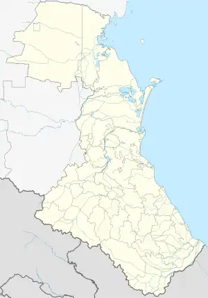
Kartas-Kazmalyar (Russian: Картас-Казмаляр; Lezgian: КIартас-Къазма) is a rural locality (a selo) in Magaramkentsky District, Republic of Dagestan, Russia. The population was 1,820 as of 2010.[2] There are 21 streets.[3]
Kartas-Kazmalyar
Картас-Казмаляр КIартас Къазма | |
|---|---|
Selo | |
 Kartas-Kazmalyar  Kartas-Kazmalyar | |
| Coordinates: 41°49′N 48°23′E[1] | |
| Country | Russia |
| Region | Republic of Dagestan |
| District | Magaramkentsky District |
| Time zone | UTC+3:00 |
Geography
Kartas-Kazmalyar is located 29 km northeast of Magaramkent (the district's administrative centre) by road, on the left bank of the Gyulgerichay River. Darkush-Kazmalyar and Kullar are the nearest rural localities.[4]
Nationalities
Lezgins live there.
References
- Село Картас-Казмаляр на карте
- Всероссийская перепись населения 2010 года. Таблица № 11. Численность населения городских округов, муниципальных районов, городских и сельских поселений, городских и сельских населённых пунктов Республики Дагестан
- Село Картас-Казмаляр на карте
- Расстояние от Картас-Казмаляра до Магарамкента 29 км
This article is issued from Wikipedia. The text is licensed under Creative Commons - Attribution - Sharealike. Additional terms may apply for the media files.