Kasibugga
Kasibugga is a twin-town in Srikakulam district of the Indian state of Andhra Pradesh. It is a municipality and the part in mandal of Palasa .[2]
Kasibugga | |
|---|---|
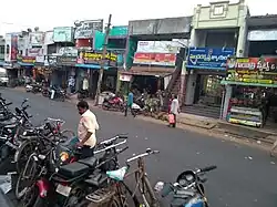 KT Road | |
.svg.png.webp) Kasibugga Location in Andhra Pradesh, India | |
| Coordinates: 18.764006°N 84.424130°E | |
| Country | India |
| State | Andhra Pradesh |
| District | Srikakulam |
| Government | |
| • Type | Municipality |
| • Body | Palasa-Kasibugga Municipality, SUDA |
| Languages | |
| • Official | Telugu |
| Time zone | UTC+5:30 (IST) |
| PIN | 532222 |
| Telephone code | 08945 |
| Vehicle registration | AP-30 (former) AP–39 (from 30 January 2019)[1] |
| Website | Palasa–Kasibugga Municipality |
Geography
Kasibugga is located at 18° 45' 33N 84° 24' 58E. It has an average elevation of 38 meters (127 feet).[3]
Administration
Kasibugga comes under Palasa (Assembly constituency) and the urban local body is ruled by Palasa-Kasibugga Municipality.[4]
Transport
Kasibugga is well connected with major cities in the state of Andhra Pradesh like Visakhapatnam and other cities and towns in Telangana and Odisha. National Highway 16(formerly NH5) bypasses through the town.
The nearest railway station is Palasa railway station which is connected to the town.[5]
References
- "New 'AP 39' code to register vehicles in Andhra Pradesh launched". The New Indian Express. Vijayawada. 31 January 2019. Retrieved 9 June 2019.
- "Srikakulam district mandals" (PDF). Census of India. The Registrar General & Census Commissioner, India. pp. 175, 209. Retrieved 24 October 2017.
- "Maps, Weather, and Airports for Kasibugga, India".
- "politics of kasibugga" (PDF). india code. The Gazette of India. pp. 71, 209. Archived from the original (PDF) on 24 September 2015. Retrieved 18 May 2017.
- "Railway station". indianrailways. Retrieved 25 October 2017.
External links
This article is issued from Wikipedia. The text is licensed under Creative Commons - Attribution - Sharealike. Additional terms may apply for the media files.