Kekerdom
Kekerdom is a village in the municipality of Berg en Dal in the province of Gelderland, the Netherlands. Kekerdom has 550 inhabitants (2008).
Kekerdom | |
|---|---|
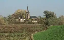
 Church of Kekerdom | |
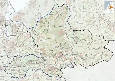
 Kekerdom Location in the province of Gelderland  Kekerdom Kekerdom (Netherlands) | |
| Coordinates: 51°52′N 6°00′E | |
| Country | Netherlands |
| Province | Gelderland |
| Municipality | Berg en Dal |
| Area | |
| • Total | 5.35 km2 (2.07 sq mi) |
| Elevation | 12 m (39 ft) |
| Population (2021)[1] | |
| • Total | 485 |
| • Density | 91/km2 (230/sq mi) |
| Time zone | UTC+1 (CET) |
| • Summer (DST) | UTC+2 (CEST) |
| Postal code | 6579[1] |
| Dialing code | 024 |
It was first mentioned between 814 and 815 as Cacradesheim, and means "settlement of Cacrad (person)".[3] In 1840, it was home to 351 people. World War II was reasonably quiet in Kekerdom until Operation Market Garden in September 1944. The village was in the line of fire. The Germans tried to flood the polder to delay the allied advance, and ordered the villagers to leave on 20 October. They arrived in Marum, Groningen where they were given shelter.[4] The gristmill De Duffelt was constructed in 1870 and rebuilt in 1938.[5]
Gallery
 Mill De Duffelt
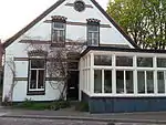
 House in Kekerdom
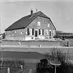
 Farm in Kekerdom
References
- "Kerncijfers wijken en buurten 2021". Central Bureau of Statistics. Retrieved 19 March 2022.
- "Postcodetool for 6579AA". Actueel Hoogtebestand Nederland (in Dutch). Het Waterschapshuis. Retrieved 19 March 2022.
- "Kekerdom - (geografische naam)". Etymologiebank (in Dutch). Retrieved 19 March 2022.
- "Kekerdom". Plaatsengids (in Dutch). Retrieved 19 March 2022.
- "De Duffelt". Molen database (in Dutch). Retrieved 19 March 2022.
Wikimedia Commons has media related to Kekerdom.
This article is issued from Wikipedia. The text is licensed under Creative Commons - Attribution - Sharealike. Additional terms may apply for the media files.