Khandkhel
Khandkhel (Pashto: خڼ خېل) or Khand Khil is a town in the Said Karam District of Paktia Province, Afghanistan. It is located 25 km to the northeast of Gardez, the capital of Paktia, and is 40 km to the southwest of Aryob.
Khandkhel | |
|---|---|
Town | |
 Khandkhel Location | |
| Coordinates: 33.7166357°N 69.3660712°E | |
| Country | |
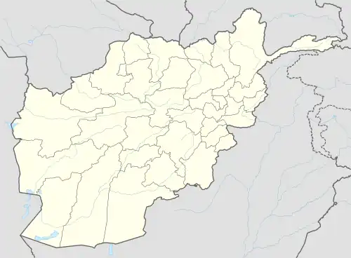
| Province | Paktia |
| District | Said Karam |
| Elevation | 2,513 m (8,245 ft) |
| Time zone | +4:30 |
Climate
Khandkhel features a humid continental climate (Dfb) under the Köppen climate classification. It has warm summers and cold, snowy winters. The average temperature in Khandkhel is 8.0 °C (46.4 °F), while the annual precipitation averages 730 millimetres (28.7 in). October is the driest month with 27 millimetres (1.1 in) of rainfall, while April, the wettest month, has an average precipitation of 93 millimetres (3.7 in).
July is the warmest month of the year with an average temperature of 19.0 °C (66.2 °F). The coldest month January has an average temperature of −5.6 °C (21.9 °F).
| Climate data for Khandkhel | |||||||||||||
|---|---|---|---|---|---|---|---|---|---|---|---|---|---|
| Month | Jan | Feb | Mar | Apr | May | Jun | Jul | Aug | Sep | Oct | Nov | Dec | Year |
| Record high °C (°F) | 13.2 (55.8) |
18.4 (65.1) |
23.9 (75.0) |
26.3 (79.3) |
32.4 (90.3) |
34.8 (94.6) |
35.6 (96.1) |
33.1 (91.6) |
30.2 (86.4) |
26.2 (79.2) |
21.7 (71.1) |
18.0 (64.4) |
35.6 (96.1) |
| Average high °C (°F) | −1.8 (28.8) |
−1.9 (28.6) |
5.1 (41.2) |
13.8 (56.8) |
19.5 (67.1) |
23.2 (73.8) |
24.9 (76.8) |
23.8 (74.8) |
20.8 (69.4) |
15.7 (60.3) |
8.6 (47.5) |
2.9 (37.2) |
12.9 (55.2) |
| Daily mean °C (°F) | −5.6 (21.9) |
−5.1 (22.8) |
1.3 (34.3) |
8.5 (47.3) |
13.5 (56.3) |
17.1 (62.8) |
19.0 (66.2) |
18.2 (64.8) |
15.3 (59.5) |
10.5 (50.9) |
4.0 (39.2) |
−1.3 (29.7) |
8.0 (46.3) |
| Average low °C (°F) | −9.3 (15.3) |
−8.3 (17.1) |
−2.6 (27.3) |
3.1 (37.6) |
7.5 (45.5) |
10.9 (51.6) |
13.1 (55.6) |
12.5 (54.5) |
9.7 (49.5) |
5.2 (41.4) |
−0.6 (30.9) |
−5.5 (22.1) |
3.0 (37.4) |
| Record low °C (°F) | −26.7 (−16.1) |
−29.5 (−21.1) |
−20.4 (−4.7) |
−10.8 (12.6) |
−4.5 (23.9) |
1.2 (34.2) |
4.8 (40.6) |
3.5 (38.3) |
−3.8 (25.2) |
−6.2 (20.8) |
−13.3 (8.1) |
−24.2 (−11.6) |
−29.5 (−21.1) |
| Average precipitation mm (inches) | 48 (1.9) |
72 (2.8) |
79 (3.1) |
93 (3.7) |
81 (3.2) |
66 (2.6) |
83 (3.3) |
79 (3.1) |
45 (1.8) |
27 (1.1) |
27 (1.1) |
30 (1.2) |
730 (28.9) |
| Source 1: Climate-Data.org[1] | |||||||||||||
| Source 2: NASA Power[2] (Extremes 1990-2021) | |||||||||||||
See also
References
- "Khandkhel. Climate-Data.org". Retrieved 4 September 2022.
- "Data Access Viewer". Retrieved 11 October 2022.
| Districts | 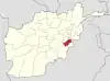 | |
|---|---|---|
| Populated places | ||
| Landforms | ||
| Other | ||