Kingston, Milton Keynes
Kingston is a district in the east side of Milton Keynes, in the civil parish of Kents Hill, Monkston and Brinklow.
| Kingston | |
|---|---|
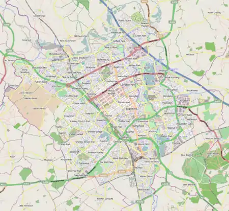 Kingston Mapping © OpenStreetMap 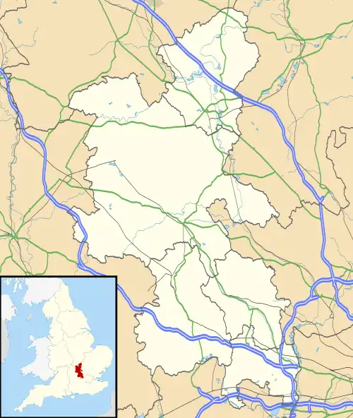 Kingston Location within Buckinghamshire | |
| OS grid reference | SP905385 |
| Civil parish |
|
| Unitary authority | |
| Ceremonial county | |
| Region | |
| Country | England |
| Sovereign state | United Kingdom |
| Post town | MILTON KEYNES |
| Postcode district | MK10 |
| Dialling code | 01908 |
| Police | Thames Valley |
| Fire | Buckinghamshire |
| Ambulance | South Central |
| UK Parliament | |
Kingston District Centre is a large retail development that serves this side of the Milton Keynes urban area (its home parish, Broughton, Middleton and the parish of Walton, Woburn Sands and Wavendon). The District Centre houses a Tesco hypermarket and other UK high street names, such as Aldi, Boots, Wilko, and other retail outlets. The centre also has a small local library, a meeting place and a separate restaurant building on the Southern ring road. Its Marks and Spencer closed in February 2020[1]
According to Milton Keynes City Council, Kingston, Wolverton, Bletchley and Westcroft form the second tier in the retail hierarchy of the city, below Central Milton Keynes.[2]
Bounded by Chaffron Way (H7) to the north, Tongwell St (A4146/V11) to the east, Standing Way (A421/H8) to the south and Newport Rd (formerly the A5130) to the east, the rest of the district consists of motor dealers, light industry factories and warehouses, including a Costco wholesale.
Transport
Rail
The closest inter-city service is provided at Milton Keynes Central on the West Coast Main Line, roughly 4 miles (6.4 km) to the west, and services on the Marston Vale Line are provided at Woburn Sands, roughly 2.5 miles (4.0 km) to the south-east.
Road
The Milton Keynes grid road system connects the district to other local destinations, whilst for accessing national routes, the M1 motorway is easily accessible via junctions 13 and 14, located 3 miles (4.8 km) to the south-east and 2 miles (3.2 km) to the north-west, respectively.
References
- "M&S and Next closing in Milton Keynes Kingston Park shopping centre". 17 January 2020. Retrieved 18 May 2020.
- Town Centres and the Retail Hierarchy.
- "Bus and Taxi, Bus Timetables, Maps and Travel Updates". Milton Keynes City Council.