Kirillov (town)
Kirillov (Russian: Кири́ллов) is a town and the administrative center of Kirillovsky District in Vologda Oblast, Russia, located on the shores of Lakes Siverskoye and Dolgoye, 129 kilometers (80 mi) northwest of Vologda, the administrative center of the oblast. Population: 7,728 (2010 Census);[4] 8,229 (2002 Census);[9] 8,817 (1989 Census).[10]
Kirillov
Кириллов | |
|---|---|
.jpg.webp) Bread-making factory in Kirillov | |
.png.webp) Flag  Coat of arms | |
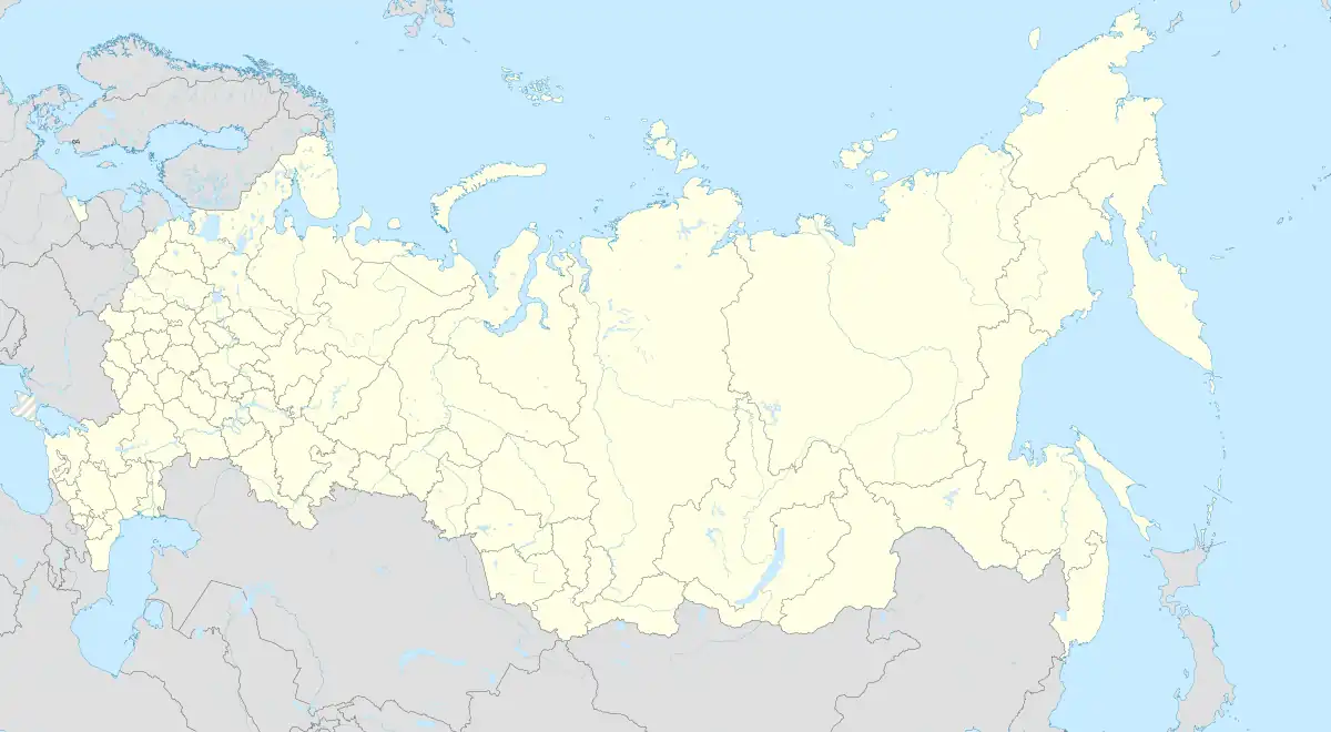
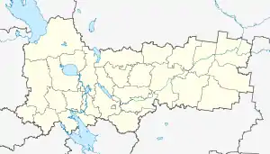
Location of Kirillov | |
 Kirillov Location of Kirillov  Kirillov Kirillov (Vologda Oblast) | |
| Coordinates: 59°51′N 38°23′E | |
| Country | Russia |
| Federal subject | Vologda Oblast[1] |
| Administrative district | Kirillovsky District[1] |
| Town of district significance | Kirillov[2] |
| Founded | 1397[3] |
| Town status since | 1776[3] |
| Elevation | 120 m (390 ft) |
| Population | |
| • Total | 7,728 |
| • Estimate (2018)[5] | 7,468 (−3.4%) |
| • Capital of | Kirillovsky District,[1] town of district significance of Kirillov[2] |
| • Municipal district | Kirillovsky Municipal District[6] |
| • Urban settlement | Kirillov Urban Settlement[6] |
| • Capital of | Kirillovsky Municipal District,[6] Kirillov Urban Settlement[6] |
| Time zone | UTC+3 (MSK |
| Postal code(s)[8] | 161100, 161101 |
| Dialing code(s) | +7 81757 |
| OKTMO ID | 19628101001 |
History
In the 13th century, the territory on which Kirillov now stands was a part of the Principality of Beloozero, which was taken over by the Grand Duchy of Moscow in the 14th century. In 1397, St. Cyril of White Lake, a monk and a disciple of St. Sergius of Radonezh, founded the Kirillo-Belozersky Monastery on the shore of Lake Siverskoye.[3] A monastic sloboda, from which the town later grew, developed around the monastery.[3] The monastery was subordinate to Archbishops of Rostov. In the 15th–17th centuries, the monastery developed into one of the most influential monasteries in Russia.[3] It also helped that the Sheksna River was one of the most heavily used waterways connecting central and northern Russia. At some point, the monastery was the second biggest landowner after the Trinity Lavra of St. Sergius. Vasili III of Russia, the Grand Prince of Moscow, and Ivan the Terrible, the Tsar, visited the monastery on several occasions.
In the course of the administrative reform carried out in 1708 by Peter the Great, the territory was included into Ingermanland Governorate (known since 1710 as Saint Petersburg Governorate). In 1727, separate Novgorod Governorate was split off.[11] The territory became a part of Charondsky Uyezd of Belozersk Province of Novgorod Governorate. In 1776, the territory was transferred to Novgorod Viceroyalty. At the same time, Kirillov was chartered and became the seat of Kirillovsky Uyezd. In 1796, the viceroyalty was abolished and the territory was transferred to Novgorod Governorate. Kirillovsky Uyezd was abolished as well; however, it was reestablished in 1802.
In June 1918, five uyezds of Novgorod Governorate, including Kirillovsky Uyezd, were split off to form Cherepovets Governorate, with the administrative center in Cherepovets.[12] On August 1, 1927 Cherepovets Governorate was abolished and its territory became Cherepovets Okrug of Leningrad Oblast.[12] At the same time, uyezds were abolished and Kirillovsky District was established.[12] On September 23, 1937, Kirillovsky District was transferred to newly established Vologda Oblast.[12]
Administrative and municipal status
Within the framework of administrative divisions, Kirillov serves as the administrative center of Kirillovsky District.[1] As an administrative division, it is incorporated within Kirillovsky District as the town of district significance of Kirillov.[2]
As a municipal division, the town of district significance of Kirillov, together with two rural localities in Sukhoverkhovsky Selsoviet of Kirillovsky District, is incorporated within Kirillovsky Municipal District as Kirillov Urban Settlement.[6]
Economy
Industry
There are enterprises of timber industry and food industry.[3]
Transportation
Kirillov is connected by all-seasonal roads with Vologda, Cherepovets, Belozersk, and Vytegra. There are also local roads.
The Volga–Baltic Waterway (formerly known as the Mariinsk Canal System), connecting the Rybinsk Reservoir in the basin of the Volga with Lake Onega in the basin of the Neva, runs several kilometers from Kirillov, following the course of the Sheksna River.
In the southern part of the town, one of the locks of the Northern Dvina Canal is located. The canal connects Lake Kubenskoye in the basin of the Northern Dvina with the Sheksna River, thus connecting the basins of the White Sea and the Volga. In the 19th century, the canal was the main waterway connecting the Volga with the White Sea. However, in the 1930s the White Sea – Baltic Canal was built and the Northern Dvina Canal lost its significance. The canal is still in operation, serving cargo traffic and occasional cruise ships moving from the Sheksna to Lake Kubenskoye.
Tourism
The economy of Kirillov is mainly tourist-oriented. Kirillov has been a tourist attraction since the Soviet times.
Culture and recreation


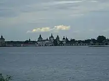
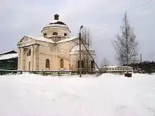
The Kirillo-Belozersky Monastery, located in the town, is a fortified ensemble built in the 15th and the 16th centuries. It also hosts the Kirillo-Belozersky Museum of History, Art, and Architecture[13]—an umbrella institution governing all museums in Kirillovsky District. The monastery has been designated as a cultural heritage monument of federal significance.[14] Kirillov also preserved the historical center and the town hosts seventy-seven cultural heritage monuments, including buildings both in and outside of the monastery.
Notable people
Russian mathematician Dmitry Grave was born in Kirillov in 1863, although he spent his career elsewhere.
References
Notes
- Resolution #178
- Law #371-OZ
- Энциклопедия Города России. Moscow: Большая Российская Энциклопедия. 2003. p. 191. ISBN 5-7107-7399-9.
- Russian Federal State Statistics Service (2011). Всероссийская перепись населения 2010 года. Том 1 [2010 All-Russian Population Census, vol. 1]. Всероссийская перепись населения 2010 года [2010 All-Russia Population Census] (in Russian). Federal State Statistics Service.
- "26. Численность постоянного населения Российской Федерации по муниципальным образованиям на 1 января 2018 года". Federal State Statistics Service. Retrieved January 23, 2019.
- Law #1116-OD
- "Об исчислении времени". Официальный интернет-портал правовой информации (in Russian). June 3, 2011. Retrieved January 19, 2019.
- Почта России. Информационно-вычислительный центр ОАСУ РПО. (Russian Post). Поиск объектов почтовой связи (Postal Objects Search) (in Russian)
- Russian Federal State Statistics Service (May 21, 2004). Численность населения России, субъектов Российской Федерации в составе федеральных округов, районов, городских поселений, сельских населённых пунктов – районных центров и сельских населённых пунктов с населением 3 тысячи и более человек [Population of Russia, Its Federal Districts, Federal Subjects, Districts, Urban Localities, Rural Localities—Administrative Centers, and Rural Localities with Population of Over 3,000] (XLS). Всероссийская перепись населения 2002 года [All-Russia Population Census of 2002] (in Russian).
- Всесоюзная перепись населения 1989 г. Численность наличного населения союзных и автономных республик, автономных областей и округов, краёв, областей, районов, городских поселений и сёл-райцентров [All Union Population Census of 1989: Present Population of Union and Autonomous Republics, Autonomous Oblasts and Okrugs, Krais, Oblasts, Districts, Urban Settlements, and Villages Serving as District Administrative Centers]. Всесоюзная перепись населения 1989 года [All-Union Population Census of 1989] (in Russian). Институт демографии Национального исследовательского университета: Высшая школа экономики [Institute of Demography at the National Research University: Higher School of Economics]. 1989 – via Demoscope Weekly.
- Снытко, О. В.; et al. (2009). С. Д. Трифонов; Т. Б. Чуйкова; Л. В. Федина; А. Э. Дубоносова (eds.). Административно-территориальное деление Новгородской губернии и области 1727-1995 гг. Справочник (PDF) (in Russian). Saint Petersburg. p. 16. Retrieved November 22, 2013.
{{cite book}}: CS1 maint: location missing publisher (link) - Справка об изменениях административно-территориального устройства и сети партийных и комсомольских органов на территории Вологодской области (1917–1991) (in Russian). Архивы России. Retrieved November 22, 2013.
- Кирилло-Белозерский историко-архитектурный и художественный музей-заповедник (in Russian). Кирилло-Белозерский историко-архитектурный и художественный музей-заповедник. Retrieved November 22, 2013.
- Памятники истории и культуры народов Российской Федерации (in Russian). Russian Ministry of Culture. Retrieved June 2, 2016.
Sources
- Законодательное Собрание Вологодской области. Закон №371-ОЗ от 4 июня 1999 г. «О вопросах административно-территориального устройства Вологодской области», в ред. Закона №2916-ОЗ от 7 декабря 2012 г. «О внесении изменений в Закон области "О вопросах административно-территориального устройства Вологодской области"». Вступил в силу со дня официального опубликования. Опубликован: "Красный Север", №124–125, 29 июля 1999 г. (Legislative Assembly of Vologda Oblast. Law #371-OZ of June 4, 1999 On the Matters of the Administrative-Territorial Structure of Vologda Oblast, as amended by the Law #2916-OZ of December 7, 2012 On Amending the Oblast Law "On the Matters of the Administrative-Territorial Structure of Vologda Oblast". Effective as of the day of the official publication.).
- Правительство Вологодской области. Постановление №178 от 1 марта 2010 г. «Об утверждении реестра административно-территориальных единиц Вологодской области», в ред. Постановления №686 от 25 июня 2012 г. «О внесении изменений в некоторые Постановления Правительства области». Вступил в силу 20 марта 2010 г. Опубликован: "Красный Север", №29, 20 марта 2010 г. (Government of Vologda Oblast. Resolution #178 of March 1, 2010 On Adopting the Registry of the Administrative-Territorial Units of Vologda Oblast, as amended by the Resolution #686 of June 25, 2012 On Amending Various Resolutions of the Oblast Government. Effective as of March 20, 2010.).
- Законодательное Собрание Вологодской области. Закон №1116-ОЗ от 6 декабря 2004 г. «Об установлении границ Кирилловского муниципального района, границах и статусе муниципальных образований, входящих в его состав», в ред. Закона №2809-ОЗ от 5 июля 2012 г. «О внесении изменений в отдельные Законы области, устанавливающие границы и статус муниципальных образований области». Вступил в силу через 10 дней со дня официального опубликования. Опубликован: "Красный Север", №242, 11 декабря 2004 г. (Legislative Assembly of Vologda Oblast. Law #1116-OZ of December 6, 2004 On Establishing the Borders of Kirillovsky Municipal District, on the Borders and Status of the Municipal Formations It Comprises, as amended by the Law #2809-OZ of July 5, 2012 On Amending Various Laws of the Oblast, Establishing the Borders and the Status of the Municipal Formations of the Oblast. Effective as of after 10 days from the day of the official publication.).
External links
- (in Russian) History of the town's coats of arms
- (in Russian) Travel guide to Kirillov