Kitagawa, Kōchi
Kitagawa (北川村, Kitagawa-mura) is a village located in Aki District, Kōchi Prefecture, Japan. As of 30 June 2022, the village had an estimated population of 1,228 in 612 households and a population density of 6.2 persons per km².[1] The total area of the village is 196.73 square kilometres (75.96 sq mi).
Kitagawa
北川村 | |
|---|---|
 Kitagawa village hall | |
 Flag  Chapter | |
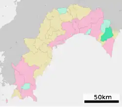
Location of Kitagawa in Kōchi Prefecture | |
 | |
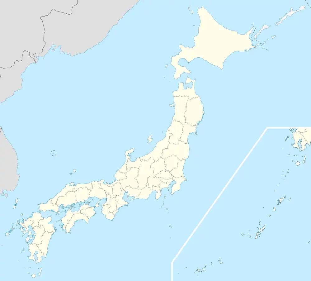 Kitagawa Location in Japan | |
| Coordinates: 33°27′N 134°3′E | |
| Country | Japan |
| Region | Shikoku |
| Prefecture | Kōchi |
| District | Aki |
| Area | |
| • Total | 196.73 km2 (75.96 sq mi) |
| Population (June 30, 2022) | |
| • Total | 1,228 |
| • Density | 6.2/km2 (16/sq mi) |
| Time zone | UTC+09:00 (JST) |
| City hall address | 1530 Notomo Kō, Kitagawa-mura, Aki-gun, Kōchi-ken 781-6441 |
| Website | Official website |
| Symbols | |
| Bird | Warbling white-eye |
| Flower | Pyrus pyrifolia |
| Tree | Paulownia tomentosa |
Geography
Kitagawa is located in northeastern Kōchi Prefecture on the island of Shikoku. It is situated on a mountainous area.
Climate
Kitagawa has a Humid subtropical climate (Köppen Cfa) characterized by warm summers and cool winters with light snowfall. The average annual temperature in Kitagawa is 14.3 °C. The average annual rainfall is 2543 mm with September as the wettest month. The temperatures are highest on average in Kitagawa, at around 24.1 °C, and lowest in January, at around 4.3 °C.[2]
Demographics
Per Japanese census data,[3] the population of Kitagawa has been decreased rapidly since the 1960s.
| Year | Pop. | ±% |
|---|---|---|
| 1920 | 3,514 | — |
| 1930 | 4,836 | +37.6% |
| 1940 | 3,509 | −27.4% |
| 1950 | 4,537 | +29.3% |
| 1960 | 6,000 | +32.2% |
| 1970 | 2,584 | −56.9% |
| 1980 | 1,907 | −26.2% |
| 1990 | 1,706 | −10.5% |
| 2000 | 1,591 | −6.7% |
| 2010 | 1,367 | −14.1% |
History
As with all of Kōchi Prefecture, the area of Kitagawa was part of ancient Tosa Province. The name of Aki District appears in Nara period . During the Edo period, the area was part of the holdings of Tosa Domain ruled by the Yamauchi clan from their seat at Kōchi Castle. The village of Kitagawa was established with the creation of the modern municipalities system on October 1, 1889.
Government
Kitagawa has a mayor-council form of government with a directly elected mayor and a unicameral village council of eight members. Kitagawa, together with the other municipalities of Aki District, contributes one member to the Kōchi Prefectural Assembly. In terms of national politics, the village is part of Kōchi 1st district of the lower house of the Diet of Japan.
Education
Kitagawa has one public elementary school and one public middle school operated by the village government. The village does not have a high school.
Transportation
Railway
The village does not have any passenger railway service. The nearest train station is Nahari Station on the Tosa Kuroshio Railway.
Highways
Local attractions
- Yanase Dam
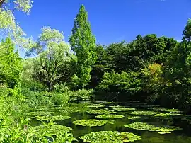
- Kitagawa Monet Marmottan Water Garden
Noted people from Kitagawa
- Nakaoka Shintarō, Bakumatsu period samurai
References
External links
 Media related to Kitagawa, Kōchi at Wikimedia Commons
 Geographic data related to Kitagawa, Kōchi at OpenStreetMap
- Kitagawa official website (in Japanese)
| Core city | ||
|---|---|---|
| Cities | ||
| Districts | ||