Kiunga Rural LLG
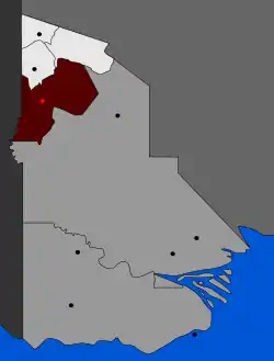
Kiunga Rural LLG is a local-level government area situated in North Fly District of Western Province of Papua New Guinea. In the year 2000, the LLG had a population of 13,249 people. The township of Kiunga is within the boundaries of this LLG, but has its own urban LLG.[1][2]
Kiunga Rural LLG | |
|---|---|
 | |
| Country | Papua New Guinea |
| Province | Western Province |
| City | Kiunga |
| Time zone | UTC+10 (AEST) |
The Kiunga genus of fish is named after the LLG and town of Kiunga.
Wards
- 01. Briompinai
- 02. Timindemasok
- 03. Atkamba
- 04. Dome
- 05. Gi
- 06. Gre
- 07. Griengas
- 08. Drindamasuk
- 09. Drimgas
- 10. Gasuke
- 11. Gusiore
- 12. Timingondok
- 13. Drimskai
- 14. Timinsiriap
- 15. Kukujaba
- 16. Membok
- 17. Erekta
- 18. Moian
- 19. Komokpin
- 20. Menemsore
- 21. Miasomnai
- 22. Tiomnai
- 23. Konkonda
- 24. Yulawas
- 25. Diabi
- 26. Dabike
- 27. Ieran
- 28. Iogi
- 29. Ralengre
- 30. Tamifen
- 31. Refugee Settlement
References
- "Census Figures by Wards - Southern Region". www.nso.gov.pg. 2011 National Population and Housing Census: Ward Population Profile. Port Moresby: National Statistical Office, Papua New Guinea. 2014. Archived from the original on 2019-10-30. Retrieved 2019-06-04.
- "Final Figures". www.nso.gov.pg. 2011 National Population and Housing Census: Ward Population Profile. Port Moresby: National Statistical Office, Papua New Guinea. 2014. Archived from the original on 2015-09-06. Retrieved 2019-06-04.
- OCHA FISS (2018). "Papua New Guinea administrative level 0, 1, 2, and 3 population statistics and gazetteer". Humanitarian Data Exchange. 1.31.9.
- United Nations in Papua New Guinea (2018). "Papua New Guinea Village Coordinates Lookup". Humanitarian Data Exchange. 1.31.9.
This article is issued from Wikipedia. The text is licensed under Creative Commons - Attribution - Sharealike. Additional terms may apply for the media files.