Kizer Island
Kizer Island is an ice-covered island about 30 kilometres (15 nmi) long, lying 20 kilometres (10 nmi) southwest of Cronenwett Island at the west end of the Sulzberger Ice Shelf off Saunders Coast, Marie Byrd Land, Antarctica. It was mapped from surveys by the United States Geological Survey (USGS) and from U.S. Navy air photos (1959–65), and was named for Lieutenant T.L. Kizer, U.S. Navy, a helicopter pilot on the USS Glacier (AGB-4) who sighted the island from the air on January 26, 1962.[1][2]
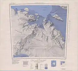 Topographic map sheet with Kizer Island in the Northeast | |
 Kizer Island Location in Antarctica | |
| Geography | |
|---|---|
| Location | Antarctica |
| Coordinates | 77°16′S 150°48′W |
| Length | 30 km (19 mi) |
| Highest elevation | 465 m (1526 ft) |
| Administration | |
| Administered under the Antarctic Treaty System | |
| Demographics | |
| Population | Uninhabited |
References
- "Kizer Island". Geographic Names Information System. United States Geological Survey, United States Department of the Interior. Retrieved 2013-05-09.
- Alberts, Fred G., ed. (June 1995). Geographic Names of the Antarctic (PDF) (second ed.). United States Board on Geographic Names. p. 395. Retrieved 2012-04-05.
![]() This article incorporates public domain material from "Kizer Island". Geographic Names Information System. United States Geological Survey.
This article incorporates public domain material from "Kizer Island". Geographic Names Information System. United States Geological Survey.
This article is issued from Wikipedia. The text is licensed under Creative Commons - Attribution - Sharealike. Additional terms may apply for the media files.