Kocasinan
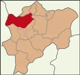
Kocasinan is a municipality and district of Kayseri Province, Turkey.[2] Its area is 1,471 km2,[3] and its population is 409,005 (2022).[1] It covers the northern part of the agglomeration of Kayseri and the adjacent countryside.
Kocasinan | |
|---|---|
 Map showing Kocasinan District in Kayseri Province | |
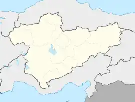
 Kocasinan Location in Turkey  Kocasinan Kocasinan (Turkey Central Anatolia) | |
| Coordinates: 38°44′N 35°29′E | |
| Country | Turkey |
| Province | Kayseri |
| Government | |
| • Mayor | Ahmet Çolakbayrakdar (AKP) |
| Area | 1,471 km2 (568 sq mi) |
| Population (2022)[1] | 409,005 |
| • Density | 280/km2 (720/sq mi) |
| Time zone | TRT (UTC+3) |
| Area code | 0352 |
| Website | www |
The name comes from Mimar Sinan, the Great, Ottoman architect. The mayor is Ahmet Çolakbayrakdar (AKP). The district Kocasinan was created in 1998 from part of the former central district of Kayseri, along with the district Melikgazi.[4][5] At the 2013 Turkish local government reorganisation, the rural part of the district was integrated into the municipality, the villages becoming neighbourhoods.[6]
Composition
There are 93 neighbourhoods in Kocasinan District:[7]
- Ahievren
- Akçatepe
- Akin
- Alsancak
- Amarat
- Argıncık
- Barbaros
- Barsama
- Bayramhacı
- Beyazşehir
- Beydeğirmeni
- Boğazköprü
- Boyacı
- Boztepe
- Buğdaylı
- Camiikebir
- Çevril
- Cırgalan
- Dadağı
- Doruklu
- Düver
- Ebiç
- Elagöz
- Elmalı
- Emmiler
- Erciyesevler
- Erkilet
- Ertuğrul Gazi
- Eskiömerler
- Eyim
- Fevziçakmak
- Fevzioğlu
- Generalemir
- Gevhernesibe
- Gömeç
- Güneşli
- Hacısaki
- Hasanarpa
- Hasancı
- Himmetdede
- Hırka
- Höbek
- Hoca Ahmet Yesevi
- Kalkancık
- Karahüyük
- Karakimse
- Kaş
- Kayabaşı
- Kemer
- Kızık
- Kocasinan
- Kuşcağız
- Kuşcu
- Mahzemin
- Mevlana
- Mimarsinan
- Mithatpaşa
- Mollahacı
- Molu
- Obruk
- Oruçreis
- Osmangazi
- Oymaağaç
- Sahabiye
- Salur
- Sanayi
- Sancaktepe
- Saraybosna
- Saraycık
- Şeker
- Seyrani
- Sümer
- Talatpaşa
- Taşhan
- Turgutreis
- Uğurevler
- Vatan
- Yakut
- Yavuz
- Yavuzselim
- Yazır
- Yemliha
- Yenidoğan
- Yenimahale
- Yenişehir
- Yeşil
- Yıldızevler
- Yukarıhasinli
- Yunusemre
- Yüreğil
- Yuvalı
- Ziyagökalp
- Zümrüt
References
- "Address-based population registration system (ADNKS) results dated 31 December 2022, Favorite Reports" (XLS). TÜİK. Retrieved 19 September 2023.
- Büyükşehir İlçe Belediyesi, Turkey Civil Administration Departments Inventory. Retrieved 19 September 2023.
- "İl ve İlçe Yüz ölçümleri". General Directorate of Mapping. Retrieved 19 September 2023.
- Kanun No. 3508, Resmî Gazete, 14 December 1998.
- "İl İdaresi ve Mülki Bölümler Şube Müdürlüğü İstatistikleri - İl ve İlçe Kuruluş Tarihleri" (PDF) (in Turkish). p. 51. Retrieved 21 September 2023.
- "Law No. 6360". Official Gazette (in Turkish). 6 December 2012.
- Mahalle, Turkey Civil Administration Departments Inventory. Retrieved 19 September 2023.
This article is issued from Wikipedia. The text is licensed under Creative Commons - Attribution - Sharealike. Additional terms may apply for the media files.
