Kolomyia Raion
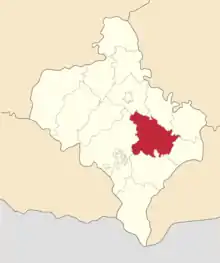
Kolomyia Raion (Ukrainian: Коломи́йський райо́н) is a raion (district) of Ivano-Frankivsk Oblast (region). The administrative center of the raion is the city of Kolomyia. Population: 272,628 (2022 estimate).[2]
Kolomyia Raion
Коломийський район | |
|---|---|
| Kolomyiskyi raion | |
 Flag  Coat of arms | |
 | |
| Coordinates: 48°35′10″N 24°59′32″E | |
| Country | |
| Oblast | |
| Established | 1940 |
| Admin. center | Kolomyia |
| Subdivisions | 13 hromadas |
| Government | |
| • Governor | Mykhailo Vintoniak |
| Area | |
| • Total | 2,480 km2 (960 sq mi) |
| Population (2022)[2] | |
| • Total | 272,628 |
| • Density | 110/km2 (280/sq mi) |
| Time zone | UTC+02:00 (EET) |
| • Summer (DST) | UTC+03:00 (EEST) |
| Postal index | 285800 |
| Area code | 380 |
| Website | [?] |
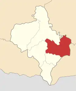
On 18 July 2020, as part of the administrative reform of Ukraine, the number of raions of Ivano-Frankivsk Oblast was reduced to six, and the area of Kolomyia Raion was significantly expanded. Two abolished raions, Horodenka and Sniatyn Raions, as well as the city of Kolomyia, which was previously incorporated as a city of oblast significance and did not belong to the raion, were merged into Kolomyia Raion.[3][4] The January 2020 estimate of the raion population was 96,573 (2020 est.).[5]
Subdivisions
Current
After the reform in July 2020, the raion consisted of 13 hromadas:[4]
- Chernelytsia settlement hromada with the administration in the urban-type settlement of Chernelytsia, transferred from Horodenka Raion;[6]
- Horodenka urban hromada with the administration in the city of Horodenka, transferred from Horodenka Raion;[6]
- Hvizdets settlement hromada with the administration in the urban-type settlement of Hvizdets, retained from Kolomyia Raion;
- Kolomyia urban hromada with the administration in the city of Kolomyia, transferred from the city of oblast significance of Kolomyia;[7]
- Korshiv rural hromada with the administration in the selo of Korshiv, retained from Kolomyia Raion;
- Mateivtsi rural hromada with the administration in the selo of Mateyivtsi, retained from Kolomyia Raion;
- Nyzhnii Verbizh rural hromada with the administration in the selo of Nyzhnii Verbizh, retained from Kolomyia Raion;
- Otyniia settlement hromada with the administration in the urban-type settlement of Otyniia, retained from Kolomyia Raion;
- Pechenizhyn settlement hromada with the administration in the urban-type settlement of Pechenizhyn, retained from Kolomyia Raion;
- Piadyky rural hromada with the administration in the selo of Piadyky, retained from Kolomyia Raion;
- Pidhaichyky rural hromada with the administration in the selo of Pidhaichyky, retained from Kolomyia Raion;
- Sniatyn urban hromada with the administration in the city of Sniatyn, transferred from Sniatyn Raion;[8]
- Zabolotiv settlement hromada with the administration in the urban-type settlement of Zabolotiv, transferred from Sniatyn Raion.[8]
Before 2020

Before the 2020 reform, the raion consisted of eight hromadas:[9]
- Hvizdets settlement hromada with the administration in Hvizdets;
- Korshiv rural hromada with the administration in Korshiv;
- Mateivtsi rural hromada with the administration in Mateivtsi;
- Nyzhnii Verbizh rural hromada with the administration in Nyzhnii Verbizh;
- Otyniia settlement hromada with the administration in Otyniia;
- Pechenizhyn settlement hromada with the administration in Pechenizhyn;
- Piadyky rural hromada with the administration in Piadyky;
- Pidhaichyky rural hromada with the administration in Pidhaichyky.
Settlements and villages
- Babyanka (Баб'янка)
- Beremiany (Берем'яни)
- Bohorodychyn (Богородичин)
- Grand Kamyanka (Велика Кам'янка)
- Grand Kliuchiv (Великий Ключів)
- Upper Verbizh (Верхній Вербіж)
- Vynohrad (Виноград)
- Vorona (Ворона)
- Voskresyntsi (Воскресинці)
- Hanniv (Ганнів)
- Hvizdets (Гвіздець) (urban-type settlement)
- Hody-Dobrovidka (Годи-Добровідка)
- Holoskiv (Голосків)
- Hrabych (Грабич)
- Hrushiv (Грушів)
- Debeslavtsi (Дебеславці)
- Dzhurkiv (Джурків)
- Zhukotyn (Жукотин)
- Zahaypil (Загайпіль)
- Zaluchia (Залуччя)
- Zakrivtsi (Закрівці)
- Zamulyntsi (Замулинці)
- Ivanivka (Іванівка)
- Kazaniv (Казанів)
- Kyidantsi (Кийданці)
- Kniazhdvir (Княждвір)
- Kobylets (Кобилець)
- Kovalivka (Ковалівка)
- Kornych (Корнич)
- Korolivka (Королівка)
- Korshiv (Коршів)
- Kropyvysche (Кропивище)
- Lisky (Ліски)
- Lisna Slobidka (Лісна Слобідка)
- Lisnyi Khlibychyn (Лісний Хлібичин)
- Little Kamyanka (Мала Кам'янка)
- Little Slobidka (Мала Слобідка)
- Little Hvizdets (Малий Гвіздець)
- Little Kliuchiv (Малий Ключів)
- Markivka (Марківка)
- Mateyivtsi (Матеївці)
- Myshyn (Мишин)
- Molodyliv (Молодилів)
- Molodiatyn (Молодятин)
- Nazirna (Назірна)
- Lower Velesnytsia (Нижня Велесниця)
- Lower Verbizh (Нижній Вербіж)
- Ostapkivtsi (Остапківці)
- Otyniia (Отинія) (urban-type settlement)
- Pyadyky (П'ядики)
- Pereryv (Перерив)
- Pechenizhyn (Печеніжин) (urban-type settlement)
- Pylypy (Пилипи)
- Pidhaychyky (Підгайчики)
- Rakivchyk (Раківчик)
- Runhury (Рунгури)
- Semakivtsi (Семаківці)
- Skopivka (Скопівка)
- Sloboda (Слобода)
- Sopiv (Сопів)
- Spas (Спас)
- Old Hvizdets (Старий Гвіздець)
- Strupkiv (Струпків)
- Sidlysche (Сідлище)
- Tovmachyk (Товмачик)
- Torhovytsia (Торговиця)
- Trostianka (Тростянка)
- Turka (Турка)
- Uhornyky (Угорники)
- Fativtsi (Фатівці)
- Tseniava (Ценява)
- Cheremkhiv (Черемхів)
- Sheparivtsi (Шепарівці)
References
- Ostapenko, Pavlo (Павло Остапенко), ed. (2020). Атлас адміністративно-територіального устрою України: Новий районний поділ та територіальні громади: 2020 (PDF) (in Ukrainian) (2nd ed.). Київ: Міністерство розвитку громад та територій України; Товариство дослідників України.
- Чисельність наявного населення України на 1 січня 2022 [Number of Present Population of Ukraine, as of January 1, 2022] (PDF) (in Ukrainian and English). Kyiv: State Statistics Service of Ukraine. Archived (PDF) from the original on 4 July 2022.
- Про утворення та ліквідацію районів. Постанова Верховної Ради України № 807-ІХ.. Голос України (in Ukrainian). 2020-07-18. Retrieved 2020-10-03.
- Нові райони: карти + склад. Міністерство розвитку громад та територій України (in Ukrainian). 2020-07-17. Retrieved 2022-04-15.
- Чисельність наявного населення України на 1 січня 2020 року / Population of Ukraine Number of Existing as of January 1, 2020 (PDF) (in Ukrainian and English). Kyiv: State Statistics Service of Ukraine.
- Городенківська районна рада (состав до 2020 г.). Gromada.info (in Russian). Retrieved 2022-04-16.
- Коломыйская городская громада. Gromada.info (in Russian). Retrieved 2022-04-16.
- Снятинська районна рада (состав до 2020 г.). Gromada.info (in Russian). Retrieved 2022-04-16.
- Коломийська районна рада (состав до 2020 г.). Gromada.info (in Russian). Retrieved 2022-04-16.
External links
- Verkhovna Rada website – Administrative divisions of Kolomyiskyi Raion (in Ukrainian)