Kowloon station (MTR)
Kowloon is a station on the Tung Chung line and the Airport Express of Hong Kong's MTR. It is one of the two Airport Express stations providing in-town check-in services for passengers departing from Hong Kong International Airport and free shuttle bus services to most major hotels in the Tsim Sha Tsui and Yau Ma Tei areas.
Kowloon 九龍 | |||||||||||||||||||||||||||||||||||||||||||||||||||||||||||||||||||||||||||||||||||||||||||||||||||||||||
|---|---|---|---|---|---|---|---|---|---|---|---|---|---|---|---|---|---|---|---|---|---|---|---|---|---|---|---|---|---|---|---|---|---|---|---|---|---|---|---|---|---|---|---|---|---|---|---|---|---|---|---|---|---|---|---|---|---|---|---|---|---|---|---|---|---|---|---|---|---|---|---|---|---|---|---|---|---|---|---|---|---|---|---|---|---|---|---|---|---|---|---|---|---|---|---|---|---|---|---|---|---|---|---|---|---|
 Exits D2 (left) and C2 (right), in Union Square | |||||||||||||||||||||||||||||||||||||||||||||||||||||||||||||||||||||||||||||||||||||||||||||||||||||||||
| Chinese name | |||||||||||||||||||||||||||||||||||||||||||||||||||||||||||||||||||||||||||||||||||||||||||||||||||||||||
| Traditional Chinese | 九龍 | ||||||||||||||||||||||||||||||||||||||||||||||||||||||||||||||||||||||||||||||||||||||||||||||||||||||||
| Simplified Chinese | 九龙 | ||||||||||||||||||||||||||||||||||||||||||||||||||||||||||||||||||||||||||||||||||||||||||||||||||||||||
| Cantonese Yale | Gáulùng | ||||||||||||||||||||||||||||||||||||||||||||||||||||||||||||||||||||||||||||||||||||||||||||||||||||||||
| Literal meaning | Nine dragons | ||||||||||||||||||||||||||||||||||||||||||||||||||||||||||||||||||||||||||||||||||||||||||||||||||||||||
| |||||||||||||||||||||||||||||||||||||||||||||||||||||||||||||||||||||||||||||||||||||||||||||||||||||||||
| General information | |||||||||||||||||||||||||||||||||||||||||||||||||||||||||||||||||||||||||||||||||||||||||||||||||||||||||
| Location | Union Square, West Kowloon Yau Tsim Mong District, Hong Kong | ||||||||||||||||||||||||||||||||||||||||||||||||||||||||||||||||||||||||||||||||||||||||||||||||||||||||
| Coordinates | 22°18′18″N 114°09′41″E | ||||||||||||||||||||||||||||||||||||||||||||||||||||||||||||||||||||||||||||||||||||||||||||||||||||||||
| Owned by | MTR Corporation | ||||||||||||||||||||||||||||||||||||||||||||||||||||||||||||||||||||||||||||||||||||||||||||||||||||||||
| Operated by | MTR Corporation | ||||||||||||||||||||||||||||||||||||||||||||||||||||||||||||||||||||||||||||||||||||||||||||||||||||||||
| Line(s) | |||||||||||||||||||||||||||||||||||||||||||||||||||||||||||||||||||||||||||||||||||||||||||||||||||||||||
| Platforms | 4 (1 island platform on Tung Chung line and 2 side platforms on Airport Express) | ||||||||||||||||||||||||||||||||||||||||||||||||||||||||||||||||||||||||||||||||||||||||||||||||||||||||
| Tracks | 4 | ||||||||||||||||||||||||||||||||||||||||||||||||||||||||||||||||||||||||||||||||||||||||||||||||||||||||
| Connections |
| ||||||||||||||||||||||||||||||||||||||||||||||||||||||||||||||||||||||||||||||||||||||||||||||||||||||||
| Construction | |||||||||||||||||||||||||||||||||||||||||||||||||||||||||||||||||||||||||||||||||||||||||||||||||||||||||
| Structure type | Underground | ||||||||||||||||||||||||||||||||||||||||||||||||||||||||||||||||||||||||||||||||||||||||||||||||||||||||
| Platform levels | 2 | ||||||||||||||||||||||||||||||||||||||||||||||||||||||||||||||||||||||||||||||||||||||||||||||||||||||||
| Accessible | Yes | ||||||||||||||||||||||||||||||||||||||||||||||||||||||||||||||||||||||||||||||||||||||||||||||||||||||||
| Architect | Farrells | ||||||||||||||||||||||||||||||||||||||||||||||||||||||||||||||||||||||||||||||||||||||||||||||||||||||||
| Other information | |||||||||||||||||||||||||||||||||||||||||||||||||||||||||||||||||||||||||||||||||||||||||||||||||||||||||
| Station code | KOW | ||||||||||||||||||||||||||||||||||||||||||||||||||||||||||||||||||||||||||||||||||||||||||||||||||||||||
| History | |||||||||||||||||||||||||||||||||||||||||||||||||||||||||||||||||||||||||||||||||||||||||||||||||||||||||
| Opened |
| ||||||||||||||||||||||||||||||||||||||||||||||||||||||||||||||||||||||||||||||||||||||||||||||||||||||||
| Previous names | West Kowloon (During planning) | ||||||||||||||||||||||||||||||||||||||||||||||||||||||||||||||||||||||||||||||||||||||||||||||||||||||||
| Services | |||||||||||||||||||||||||||||||||||||||||||||||||||||||||||||||||||||||||||||||||||||||||||||||||||||||||
| |||||||||||||||||||||||||||||||||||||||||||||||||||||||||||||||||||||||||||||||||||||||||||||||||||||||||
| |||||||||||||||||||||||||||||||||||||||||||||||||||||||||||||||||||||||||||||||||||||||||||||||||||||||||
| Location | |||||||||||||||||||||||||||||||||||||||||||||||||||||||||||||||||||||||||||||||||||||||||||||||||||||||||
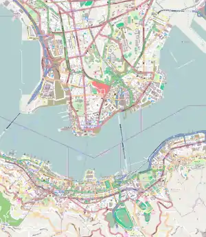
 Kowloon Location within the MTR system  Kowloon Kowloon (Hong Kong urban core)  Kowloon Kowloon (Hong Kong Island) | |||||||||||||||||||||||||||||||||||||||||||||||||||||||||||||||||||||||||||||||||||||||||||||||||||||||||
The station is located less than two hundred meters west of the Guangzhou–Shenzhen–Hong Kong Express Rail Link Hong Kong section West Kowloon Terminus, five hundred meters west of Austin on the Tuen Ma line and a kilometre west of Jordan station on the Tsuen Wan line.
Escalators link Elements directly with the station concourse.
History
The station was designed by TFP Farrells.[1] During the planning stage, it was called West Kowloon station (西九龍站).
On 16 September 2000, the new shopping mall "Dickson CyberExpress" (迪生數碼世界) was opened by Dickson Poon. The size was 70,000 square feet (6,500 m2) spread over four levels of the station with six shopping areas.[2] However, the mall did not have the expected volume of customers and business was weak. After half a year, the mall shrank in size. The mall's management company planned to decrease the level of the mall from 4 levels to 3 levels and to combine some of the shopping areas.[3] Business remained poor due to sparse population near the station and a recession at that time. The mall finally closed its operation in 2005.[4]
The station was proposed as the terminus of the unbuilt East Kowloon line; the proposal indicated using a reserved confined space under the Tung Chung line platforms.[5]
The station is connected via footbridges to Austin on the Tuen Ma line. The station is connected to West Kowloon Terminus of the Guangzhou–Shenzhen–Hong Kong Express Rail Link Hong Kong section.
Station layout
As in other Airport Express stations, the Airport Express and the Tung Chung line have separated paid areas. Platform 2 is only used for disembarking passengers from Hong Kong International Airport or AsiaWorld–Expo, except during morning rush hours from Monday to Saturday for boarding passengers traveling on the line to Hong Kong station with a Morning Express Ticket.[6]
| U5 |
Residential and commercial area |
Exits, Union Square, The Waterfront, Sorrento |
| The Harbourside, The Arch, International Commerce Centre, The Cullinan | ||
| U4 | ||
| Tung Chung line concourse |
Exit, Elements mall | |
| U3 | Airport Express concourse |
Exit, Elements mall |
| Tung Chung line concourse |
Exit, Elements mall, escalator to U5 | |
| G | Airport Express check-in |
Customer service, drop-off area, in-town check-in, left luggage |
| MTRshops, vending machines, toilets, police post | ||
| Tung Chung line concourse |
Exits, customer service, car park, toilet | |
| Airport Express shuttle bus, public transport interchange | ||
| MTRshops, Hang Seng Bank, automatic teller machines | ||
| L2 Platforms |
Airport Express concourse |
Customer service, drop-off area, toilets |
| Side platform, doors will open on the left | ||
| Platform 1 | Airport Express towards Airport and AsiaWorld–Expo (Tsing Yi) → | |
| Platform 2 | ← Airport Express towards Hong Kong (Terminus) | |
| Side platform, doors will open on the left | ||
| Airport Express concourse |
Customer service, taxi stand, MTRshops, toilets | |
| L4 Platforms |
Platform 3 | Tung Chung line towards Tung Chung (Olympic) → |
| Island platform, doors will open on the right | ||
| Platform 4 | ← Tung Chung line towards Hong Kong (Terminus) | |
| - | Confined space | Reserved for East Kowloon line |
Entrances and exits
- Tung Chung line Concourse (G)[8]
- A - Station Car Park

- B - Airport Express Shuttle Bus

- C and D - Elements mall
- C1 - Public transport interchange, Cross Boundary Coach Terminus, Elements, International Commerce Centre

- C2 - Sorrento, The Arch, The Harbourside, The Waterfront

- D1 - Elements mall
- D2 - Sorrento, International Commerce Centre, The Arch, The Harbourside, The Waterfront
- C1 - Public transport interchange, Cross Boundary Coach Terminus, Elements, International Commerce Centre
- Airport Express In-town Check In (G)[8]
- E1-E5 - West Kowloon Cultural District, West Kowloon Waterfront Promenade, Western Harbour Crossing bus stops
Gallery
 The long escalator
 Airport Express check-in desk, from Elements
 Platform 1 (Airport Express)
 Airport Express Check-in Concourse
 Platform 1 (Airport Express)
 Platform 3 (Tung Chung line)
 Platform 3 (Tung Chung Line)
 Platform 3 (Tung Chung Line)
References
- "Hong Kong / Kowloon Station Development – Transport Super City". Fundamentally Hong Kong? Delta Four 1984 - 2044. Venice Biennale (Hong Kong). Archived from the original on 16 April 2015. Retrieved 16 April 2015.
- Leung, Ambrose (12 September 2000). "Dickson CyberExpress, the physical mall of the online luxury shopping portal Dickson Cyber.com, is to be launched on Saturday by Chief Executive Tung Chee-hwa". South China Morning Post. p. 2.
- Tsang, Denise (2 March 2001). "Dickson in moves to enliven its mall". South China Morning Post.
- "Dickson Warehouse at Kowloon Station". Archived from the original on 25 March 2004.
- "地鐵神秘景點".
- 港鐵公司. "機場快綫列車服務 - 免費服務 - 免費市區預辦登機服務" (in Chinese). 港鐵公司. Retrieved 16 May 2009.
- "Kowloon Station layout" (PDF). MTR Corporation. Retrieved 29 March 2015.
- "Kowloon Station street map" (PDF). MTR Corporation. Retrieved 29 March 2015.
External links
 Media related to Kowloon Station at Wikimedia Commons