Kpété
Kpété is a village in Rafaï Subprefecture, Mbomou prefecture, Central African Republic. It is located at around 4°59′31.3908″N 23°53′27.222″E, in the elevation of around 581 metres.[1]
Kpété | |
|---|---|
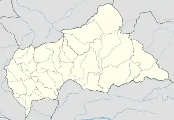
 Kpété Location in Central African Republic | |
| Coordinates: 4°59′31.3908″N 23°53′27.222″E | |
| Country | |
| Prefecture | Mbomou |
| Sub-prefecture | Rafaï |
| Commune | Rafai |
| Elevation | 1,906.2 ft (581 m) |
| Time zone | UTC+1 (West Africa Time) |
Climate
Kpété has a Tropical savanna climate (Aw) with dry, warm winters and wet, cooler summers.
| Climate data for Lujulo | |||||||||||||
|---|---|---|---|---|---|---|---|---|---|---|---|---|---|
| Month | Jan | Feb | Mar | Apr | May | Jun | Jul | Aug | Sep | Oct | Nov | Dec | Year |
| Average high °C (°F) | 31 (88) |
32 (90) |
31.7 (89.1) |
30.3 (86.5) |
30.2 (86.4) |
29.2 (84.6) |
28.8 (83.8) |
28.8 (83.8) |
29.4 (84.9) |
29.5 (85.1) |
29.8 (85.6) |
30.3 (86.5) |
30.1 (86.2) |
| Daily mean °C (°F) | 24.2 (75.6) |
25 (77) |
25.3 (77.5) |
25.1 (77.2) |
24.7 (76.5) |
24 (75) |
23.7 (74.7) |
23.6 (74.5) |
23.9 (75.0) |
24 (75) |
23.9 (75.0) |
23.9 (75.0) |
24.3 (75.7) |
| Average low °C (°F) | 17.5 (63.5) |
18 (64) |
18.9 (66.0) |
19.9 (67.8) |
19.3 (66.7) |
18.9 (66.0) |
18.6 (65.5) |
18.5 (65.3) |
18.5 (65.3) |
18.6 (65.5) |
18 (64) |
17.6 (63.7) |
18.5 (65.3) |
| Average precipitation mm (inches) | 17 (0.7) |
56 (2.2) |
103 (4.1) |
157 (6.2) |
203 (8.0) |
199 (7.8) |
208 (8.2) |
232 (9.1) |
223 (8.8) |
253 (10.0) |
116 (4.6) |
29 (1.1) |
1,796 (70.8) |
| Source: Climate-Data.org[2] | |||||||||||||
This article is issued from Wikipedia. The text is licensed under Creative Commons - Attribution - Sharealike. Additional terms may apply for the media files.