Kuhi
Kuhi is a town and a tehsil in the Umred subdivision of the Nagpur district in Nagpur, India. Kuhi is located 40 km from Nagpur District.Kuhi is two town areas. One is Kuhi and other is Bhojapur.[1] It comes under the revenue division of Berar region in the state of Maharashtra.
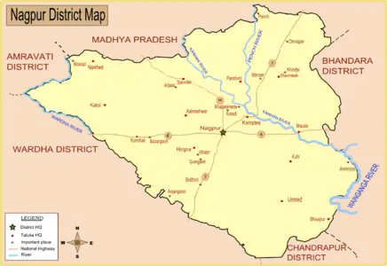
Map of Nagpur district showing Kuhi.
Kuhi
kuhikar | |
|---|---|
Town and Tehsil | |
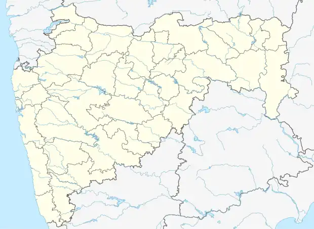 Kuhi Location in Maharashtra, India | |
| Coordinates: = 2011) 21.0108242°N 79.3524241°E | |
| Country | |
| State | Maharashtra |
| District | Nagpur |
| Government | |
| • Body | Nagarpanchayat |
| Area | |
| • Total | 3.5 km2 (1.4 sq mi) |
| Population | |
| • Total | 10,436 = 2,011 |
| • Density | 139.22/km2 (360.6/sq mi) |
| Languages | |
| • Official | Marathi |
| Time zone | UTC+5:30 (IST) |
| PIN | 441202 |
| Telephone code | 07100 |
| Vehicle registration | MH-40 |
| Nearest city | Mandhal, Umrer, Nagpur |
| Lok Sabha constituency | Ramtek |
| Civic agency | Nagarpanchayat President (vacant) |
It is located along the banks of the Nag River.
Demographics
AS per Indian government census of 2011, the population was 1,23,977.[2]
| Year | Male | Female | Total Population | Change | Religion (%) | |||||||
|---|---|---|---|---|---|---|---|---|---|---|---|---|
| Hindu | Muslim | Christian | Sikhs | Buddhist | Jain | Other religions and persuasions | Religion not stated | |||||
| 2001[3] | 64066 | 62250 | 126316 | - | 79.830 | 1.014 | 0.126 | 0.021 | 18.853 | 0.051 | 0.039 | 0.066 |
| 2011[2] | 63104 | 60873 | 123977 | -1.852 | 80.661 | 1.212 | 0.140 | 0.028 | 17.210 | 0.058 | 0.013 | 0.678 |
References
- "Administrative divisions of Nagpur district". National Informatic Center. Government of Maharashtra. Archived from the original on 10 April 2009. Retrieved 9 January 2009.
- Census India 2011.
- Census India 2001.
as a citizen of Nagpur...
This article is issued from Wikipedia. The text is licensed under Creative Commons - Attribution - Sharealike. Additional terms may apply for the media files.