Umred
Umred is a town and a municipal council in the Nagpur district[2] of Maharashtra, India.[2] According to the 2011 census the city has a population of 53971.[3]
Umred | |
|---|---|
town | |
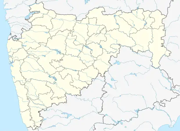 Umred Location in Maharashtra, India. | |
| Coordinates: 20.85°N 79.33°E | |
| Country | |
| State | Maharashtra |
| District | Nagpur |
| Government | |
| • Body | Umred Municipal cooperation chairperson. = Vijayalakshmi Bhadoriya |
| Elevation | 292 m (958 ft) |
| Population (2011)[1] | |
| • Total | 53,971 |
| Languages | |
| • Official | Marathi |
| Time zone | UTC+5:30 (IST) |
| PIN | 441203 |
| Telephone code | 07116 |
| Vehicle registration | MH-40 |
Geography
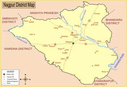
Map of Nagpur district with major towns(including Umred) and rivers Aam.
Umred is located at 20° 51' 14N and 17° 19' 29E, at an elevation of 290 meters above sea level.[2] It's STD code is 07116.
Demographics
As of the 2011 India census,[4] Umred had a population of 53,971. Males account for 27,456 residents and females for 26515 36,947 of the city's residents are considered literate.
| Year | Male | Female | Total Population | Change | Religion (%) | |||||||
|---|---|---|---|---|---|---|---|---|---|---|---|---|
| Hindu | Muslim | Christian | Sikhs | Buddhist | Jain | Other religions and persuasions | Religion not stated | |||||
| 2001[5] | 25454 | 24123 | 49577 | - | 84.569 | 4.038 | 0.175 | 0.075 | 10.848 | 0.109 | 0.071 | 0.115 |
| 2011[4] | 27456 | 26515 | 53971 | 8.863 | 81.894 | 4.358 | 0.248 | 0.069 | 11.749 | 0.080 | 1.025 | 0.578 |
Transportation and Communication
Umred is also connected to Nagpur via State Highway No. 9.
References
- "Census of India: Search Details". Archived from the original on 24 September 2015. Retrieved 11 May 2014.
- Falling Rain Genomics, Inc - Umred
- "Census of India 2001: Data from the 2001 Census, including cities, villages and towns (Provisional)". Census Commission of India. Archived from the original on 16 June 2004. Retrieved 1 November 2008.
- Census India 2011.
- Census India 2001.
| History | .svg.png.webp) | ||||||||||||
|---|---|---|---|---|---|---|---|---|---|---|---|---|---|
| Geography | |||||||||||||
| Cities and towns | |||||||||||||
| Villages | |||||||||||||
| Monuments | |||||||||||||
| Education |
| ||||||||||||
| Transport |
| ||||||||||||
| Constituencies |
| ||||||||||||
This article is issued from Wikipedia. The text is licensed under Creative Commons - Attribution - Sharealike. Additional terms may apply for the media files.