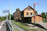
Kupferzell
Kupferzell is a small German town in the district of Hohenlohe in Baden-Württemberg, Germany named after the Kupfer river flowing through it. The largest neighbouring towns are Künzelsau (to the north) and Schwäbisch Hall (to the south).
Kupferzell | |
|---|---|
 Coat of arms | |
Location of Kupferzell within Hohenlohekreis district 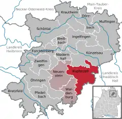 | |
 Kupferzell 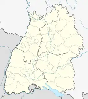 Kupferzell | |
| Coordinates: 49°14′N 9°41′E | |
| Country | Germany |
| State | Baden-Württemberg |
| Admin. region | Stuttgart |
| District | Hohenlohekreis |
| Municipal assoc. | Hohenloher Ebene |
| Subdivisions | 21 |
| Government | |
| • Mayor (2019–27) | Christoph Spieles[1] |
| Area | |
| • Total | 54.28 km2 (20.96 sq mi) |
| Elevation | 340 m (1,120 ft) |
| Population (2021-12-31)[2] | |
| • Total | 6,318 |
| • Density | 120/km2 (300/sq mi) |
| Time zone | UTC+01:00 (CET) |
| • Summer (DST) | UTC+02:00 (CEST) |
| Postal codes | 74635 |
| Dialling codes | 07944 |
| Vehicle registration | KÜN |
| Website | www.kupferzell.de |
History
Kupferzell was first mentioned in 1236 and as early as the 14th century, the Count of Hohenlohe owned property there.
During the late Middle Ages, Kupferzell always was referred to as "Celle", with a closer localization of "uf dem Ornwaldt". It was only in the 15th century that the current name appeared after its location on the Kupfer (river). From 1721 to 1727/1729, Count Philipp Ernst had a castle built here. From 1767 until 1884 Kupferzell was the residence of the duke of Hohenlohe-Waldenburg-Schillingsfürst; after mediatization in 1806, Kupferzell became part of the Königreich Württemberg under administration of the High Office of Öhringen.[3]
On January 1, 1972, Kupferzell fused with Eschental, Feßbach, Mangoldsall, Goggenbach and Westernach to the town of Kupferzell.[4]
In March 2020, the town was particularly affected by COVID-19 and became one of Germany's hotspots in the Hohenlohe district. Mid May, the Robert Koch-Institut started a seroepidemiology study named "Corona Monitoring lokal" attempting to enroll 2000 of the town's 6000 inhabitants for antibody testing and a throat swab for SARS-CoV-2.[5]
Sons and daughters of the town
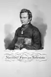
- Prince Alexander of Hohenlohe-Waldenburg-Schillingsfürst (1794-1849), Catholic priest
- Eberhard Finckh, (1899-1944), career officer and resistance fighter of 20 July 1944
References
- Aktuelle Wahlergebnisse, Staatsanzeiger, accessed 13 September 2021.
- "Bevölkerung nach Nationalität und Geschlecht am 31. Dezember 2021" [Population by nationality and sex as of December 31, 2021] (CSV) (in German). Statistisches Landesamt Baden-Württemberg. June 2022.
- "Kupferzell. Ein gutes Stück Hohenlohe". hohenlohekreis.de. 19 May 2020.
- Statistisches Bundesamt, ed. (1983). Historisches Gemeindeverzeichnis für die Bundesrepublik Deutschland. Namens-, Grenz- und Schlüsselnummernänderungen bei Gemeinden, Kreisen und Regierungsbezirken vom 27.5.1970 bis 31.12.1982. Stuttgart/Mainz: W. Kohlhammer. ISBN 3-17-003263-1.
- "Kupferzell: Antikörper-Studie des Robert Koch-Instituts zur Verbreitung der Coronavirus-Infektion (Studieninformation)". www.rki.de. 18 May 2020. Retrieved 19 May 2020.
- "Kupferzell (Hohenlohekreis, Baden-Württemberg, Deutschland) - Einwohnerzahlen, Grafiken, Karte, Lage, Wetter und Web-Informationen". www.citypopulation.de. Retrieved 23 May 2023.
Towns and municipalities in Hohenlohe (district) | ||
|---|---|---|