L'Épiphanie, Quebec (parish)
L'Épiphanie is a former parish municipality in the Lanaudière region of Quebec, Canada, part of the L'Assomption Regional County Municipality.
L'Épiphanie | |
|---|---|
.jpg.webp) | |
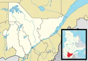
_Quebec_location_diagram.png.webp) Location within L'Assomption RCM. | |
 L'Épiphanie Location in central Quebec. | |
| Coordinates: 45°51′N 73°29′W[1] | |
| Country | |
| Province | |
| Region | Lanaudière |
| RCM | L'Assomption |
| Constituted | July 1, 1855 |
| Dissolved | May 23, 2018 |
| Government | |
| • Mayor | Denis Lévesque |
| • Federal riding | Repentigny |
| • Prov. riding | L'Assomption |
| Area | |
| • Total | 55.80 km2 (21.54 sq mi) |
| • Land | 54.22 km2 (20.93 sq mi) |
| Population | |
| • Total | 3,296 |
| • Density | 60.8/km2 (157/sq mi) |
| • Pop 2006–2011 | |
| • Dwellings | 1,307 |
| Time zone | UTC−5 (EST) |
| • Summer (DST) | UTC−4 (EDT) |
| Postal code(s) | |
| Area code(s) | 450 and 579 |
| Highways | |
| Website | www |
On May 23, 2018, the parish ceased to exist when it was merged into the Town of L'Épiphanie.[4]
Demographics
Population trend:[5]
- Population in 2011: 3296 (2006 to 2011 population change: 5.3%)
- Population in 2006: 3129
- Population in 2001: 2931
- Population in 1996: 2739
- Population in 1991: 2421
Private dwellings occupied by usual residents: 1,212 (total dwellings: 1,307)
Mother tongue:
- English as first language: 0%
- French as first language: 96.5%
- English and French as first language: 1%
- Other as first language: 2.5%
Education
The Sir Wilfrid Laurier School Board operates anglophone public schools, including:
- Joliette Elementary School in Saint-Charles-Borromée[6]
References
- "Reference number 35561 in Banque de noms de lieux du Québec". toponymie.gouv.qc.ca (in French). Commission de toponymie du Québec.
- "Geographic code 60040 in the official Répertoire des municipalités". www.mamh.gouv.qc.ca (in French). Ministère des Affaires municipales et de l'Habitation.
- Statistics Canada 2011 Census - L'Épiphanie census profile
- "Modifications aux municipalités du Québec" (PDF). Modifications Aux Municipalités du Québec. Institut de la statistique du Québec. May 2018. ISSN 1715-6408. Retrieved 30 September 2019.
- Statistics Canada: 1996, 2001, 2006, 2011 census
- "JOLIETTE ELEMENTARY ZONE Archived 2017-09-17 at the Wayback Machine." Sir Wilfrid Laurier School Board. Retrieved on September 17, 2017.
Adjacent Municipal Subdivisions | ||||||||||||||||
|---|---|---|---|---|---|---|---|---|---|---|---|---|---|---|---|---|
| ||||||||||||||||
| Cities/towns | |
|---|---|
| Municipalities | |
| |
This article is issued from Wikipedia. The text is licensed under Creative Commons - Attribution - Sharealike. Additional terms may apply for the media files.