Lacmalac, New South Wales
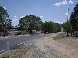
Lacmalac is a rural community in the central east part of the Riverina. It is situated by road, about 9 kilometres east of Tumut and 19 kilometres south east of Gocup.
| Lacmalac New South Wales | |
|---|---|
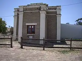
 Lacmalac Hall | |
 Lacmalac Location in New South Wales | |
| Coordinates | 35°19′06″S 148°19′32″E |
| Population | 146 (SAL 2021)[1] |
| Postcode(s) | 2720 |
| Elevation | 374 m (1,227 ft) |
| Location | |
| County | Buccleuch |
| State electorate(s) | Wagga Wagga |
A part of the localities now known as Lacmalac and Little River was one of the sites proposed for Australia's national capital city. it was one of two sites near Tumut; the other being at Gadara to the west of Tumut. If the proposal for a new city at Little River-Laclamac had come to fruition, the Tumut railway line would have been extended to the area and a dam built on Goobarragandra River to provide a water supply.[2][3][4]

Lacmalac
Notes and references
- Australian Bureau of Statistics (28 June 2022). "Lacmalac (Suburb and Locality)". Australian Census 2021 QuickStats. Retrieved 28 June 2022.
- "TUMUT AS THE CAPITAL". Daily Telegraph (Sydney, NSW : 1883 - 1930). 10 October 1903. p. 9. Retrieved 19 March 2021.
- "General plan of country surrounding suggested Federal Capital site in the locality of Tumut, N.S.W. No. 15 [cartographic material] : shewing approximately city site, proposed water supply, railways, &c". Trove. Retrieved 19 March 2021.
- "Sketch map showing proposed Federal Territory and capital site at Tumut [cartographic material] : Parishes of Adelong, Calafat, Gadara, Gilmore, Minjary, Tumut, Werebolder & Wondalga, County of Wynyard N.S.W., 1900". Trove. Retrieved 19 March 2021.
Wikimedia Commons has media related to Lacmalac, New South Wales.
This article is issued from Wikipedia. The text is licensed under Creative Commons - Attribution - Sharealike. Additional terms may apply for the media files.