Lambert's Bay
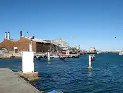
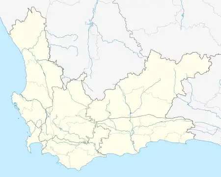
Lambert's Bay is a small fishing town in the Western Cape province of South Africa situated 280 kilometres (170 mi) north of Cape Town. It is part of the Cederberg Municipality.
Lambert's Bay
Lambertsbaai | |
|---|---|
 Lambert's Bay | |
 Lambert's Bay  Lambert's Bay | |
| Coordinates: 32°5′S 18°18′E | |
| Country | South Africa |
| Province | Western Cape |
| District | West Coast |
| Municipality | Cederberg |
| Area | |
| • Total | 45.73 km2 (17.66 sq mi) |
| Population (2011)[1] | |
| • Total | 6,120 |
| • Density | 130/km2 (350/sq mi) |
| Racial makeup (2011) | |
| • Black African | 9.0% |
| • Coloured | 74.5% |
| • Indian/Asian | 0.2% |
| • White | 15.9% |
| • Other | 0.4% |
| First languages (2011) | |
| • Afrikaans | 90.9% |
| • Xhosa | 5.8% |
| • English | 1.7% |
| • Other | 1.6% |
| Time zone | UTC+2 (SAST) |
| Postal code (street) | 8130 |
| PO box | 8130 |
| Area code | 027 |
The coast town has been proclaimed 'the Diamond of the West Coast' because of its white beaches, wildlife and lobsters. Although primarily a fishing town, it has become a significant tourist attraction on the West Coast due to its moderate all-year climate.
Birding
- Bird Island Nature Reserve – The nesting and breeding ground of thousands of Cape gannets, penguins and other bird species can be reached by walking on a breakwater wall.
History
Lambert's Bay is named after Admiral Lambert of the British Navy who did a marine survey of the bay between 1826 and 1840.
In 1887 Mr Stephan bought the commercial buildings and built the hotel in 1888. Lambert's Bay was used as a lay-up for British warships during the war of 1900–1902 and in 1901 HMS Sybille was wrecked opposite Steenbokfontein.
The first crayfish factory was started by Mr Lindström in 1918.
References
- "Main Place Lambert's Bay". Census 2011.
.svg.png.webp)