Nang County
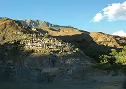
Nang County (Tibetan: སྣང་རྫོང་།; Chinese: 朗县) is a county under the jurisdiction of Nyingtri City in the Tibet Autonomous Region, China.
Nang County
朗县 • སྣང་རྫོང་། | |
|---|---|
 | |
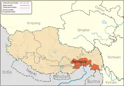
.png.webp) Location of Nang County (red) within Nyingchi City (yellow) and Tibet | |
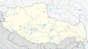
 Nang Location of the seat in Tibet  Nang Nang (China) | |
| Coordinates: 29°17′40″N 93°22′30″E | |
| Country | China |
| Autonomous region | Tibet |
| Prefecture-level city | Nyingchi |
| County seat | Nang |
| Area | |
| • Total | 4,120 km2 (1,590 sq mi) |
| Population (2020)[1] | |
| • Total | 17,648 |
| • Density | 4.3/km2 (11/sq mi) |
| Time zone | UTC+8 (China Standard) |
| Website | www |
| Nang County | |||||||
|---|---|---|---|---|---|---|---|
| Chinese name | |||||||
| Simplified Chinese | 朗县 | ||||||
| Traditional Chinese | 朗縣 | ||||||
| |||||||
| Tibetan name | |||||||
| Tibetan | སྣང་རྫོང་། | ||||||
| |||||||
Geography
Nang is located in the south-west of Nyingtri, at the middle and lower reaches of the Yarlung Tsangpo River. The county de jure covers an area of 4,120 square kilometres, including the area claimed but de facto under control of the Arunachal Pradesh, India. The average altitude is 5,000 metres above sea level.
Administrative divisions
Nang County contains 3 towns and 3 townships.
| Name | Chinese | Hanyu Pinyin | Tibetan | Wylie | |||
|---|---|---|---|---|---|---|---|
| Towns | |||||||
| Nang Town | 朗镇 | Lǎng zhèn | སྣང་གྲོང་རྡལ། | snang grong rdal | |||
| Dromda Town | 仲达镇 | Zhòngdá zhèn | སྒྲོམ་མདའ་གྲོང་རྡལ། | sgrom mda' grong rdal | |||
| Dungkar Town | 洞嘎镇 | Dònggā zhèn | དུང་དཀར་གྲོང་རྡལ། | dung dkar grong rdal | |||
| Townships | |||||||
| Latok Township | 拉多乡 | Lāduō xiāng | ལ་ཐོག་ཤང་། | la thog shang | |||
| Kyemtong Township | 金东乡 | Jīndōng xiāng | སྐྱེམས་སྟོང་ཤང་། | skyem stong shang | |||
| Dem Township | 登木乡 | Dēngmù xiāng | ལྡེམ་ཤང་། | ldem shang | |||
* includes areas claimed but currently under control of the Indian state of Arunachal Pradesh. | |||||||
Gallery
References
- "林芝市第七次全国人口普查主要数据公报" (in Chinese). Government of Nyingchi. 2021-06-17.
External links
This article is issued from Wikipedia. The text is licensed under Creative Commons - Attribution - Sharealike. Additional terms may apply for the media files.


