Purang County
Purang County[3][4] or Burang County[5] (Tibetan: སྤུ་ཧྲེང་རྫོང; Chinese: 普兰县)[6] is an administrative division of Ngari Prefecture in the Tibet Autonomous Region (TAR) of China. The county seat is Purang Town, known as Taklakot in Nepali.[7] The county covers an area of 12,539 square kilometres (4,841 sq mi), and has a population of 9,657 as of 2010.[1][8]
Purang County
སྤུ་ཧྲེང་རྫོང · 普兰县 Burang | |
|---|---|
| Burang County | |
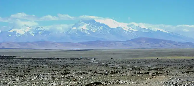
 Gurla Mandhata 7,694 metres (25,243 ft) | |
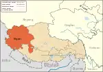
.png.webp) Location of Purang County within Tibet | |
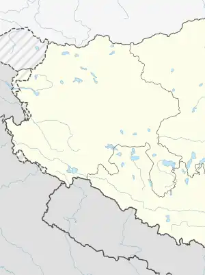
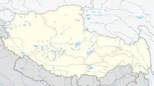
 Purang Location of the seat in the Tibet AR  Purang Purang (Tibet)  Purang Purang (China) | |
| Coordinates (Purang County government): 30°17′25″N 81°10′38″E | |
| Country | China |
| Autonomous region | Tibet |
| Prefecture | Ngari |
| County seat | Purang |
| Area | |
| • Total | 12,539 km2 (4,841 sq mi) |
| Population (2020)[2] | |
| • Total | 12,242 |
| • Density | 0.98/km2 (2.5/sq mi) |
| Time zone | UTC+8 (China Standard) |
| Postal code | 859500 |
| Website | pl |
| Purang County | |||||||||||
|---|---|---|---|---|---|---|---|---|---|---|---|
| Chinese name | |||||||||||
| Simplified Chinese | 普兰县 | ||||||||||
| Traditional Chinese | 普蘭縣 | ||||||||||
| |||||||||||
| Tibetan name | |||||||||||
| Tibetan | སྤུ་ཧྲེང་རྫོང | ||||||||||
| |||||||||||
Geography
Political geography
Purang County has TAR's south-western border with Nepal's Sudurpashchim and Karnali province, Darchula, Bajhang and Humla District. Further west, India's Uttarakhand State, Pithoragarh district and Chamoli district borders. Buddhist, Hindu and Jain pilgrims going to Lake Manasarovar and Mount Kailash enter from Nepal via Simikot,[9] and from India via Dharchula.[10]
The county is bounded by other counties in the Ngari Prefecture, including Zanda to the west, Gar to the northwest and Gê'gyai to the north.[1] To the east is Zhongba County of Shigatse Prefecture.[1]
Physical geography
The county covers an area of 12,539 square kilometres (4,841 sq mi), and has a population of some 9,058 people as of 2010.[1][8] The county seat, located in the Jirang Neighborhood Committee,[1] is located only 20 kilometres (12 mi) from Nepalese territory, and 450 kilometres (280 mi) north-west of Kathmandu. It is an important Chinese customs point between Tibet, Nepal and India. Much of the county consists of river valleys of mountains and lakes such as Kangrinboqê (also known as Mount Kailash), The Naimonany Peak Gunrla and Lake Maponen Yamco Lake Manasarowar. The Karnali River fed by Mabja Zangbo is also a prominent geographical feature of the landscape. Wildlife commonly seen in the far south-western Tibetan county are wild donkeys, wild yaks, yellow goats, antelope, rock goat, lynxes, foxes, leopards and marmots.
Climate
The annual average temperature in the county is −3.5 °C (25.7 °F), and annual precipitation averages 100 mm (3.9 in).[1] Bomê has a monsoon-influenced oceanic climate (Köppen climate classification Cwb). The average annual temperature in Bomê is 9.0 °C (48.2 °F). The average annual rainfall is 890.9 mm (35.07 in) with December as the wettest month. The temperatures are highest on average in July, at around 16.9 °C (62.4 °F), and lowest in January, at around 0.7 °C (33.3 °F).
| Climate data for Burang County (1991–2020 normals, extremes 1981–2010) | |||||||||||||
|---|---|---|---|---|---|---|---|---|---|---|---|---|---|
| Month | Jan | Feb | Mar | Apr | May | Jun | Jul | Aug | Sep | Oct | Nov | Dec | Year |
| Record high °C (°F) | 11.3 (52.3) |
13.7 (56.7) |
15.8 (60.4) |
18.8 (65.8) |
23.5 (74.3) |
27.0 (80.6) |
28.4 (83.1) |
26.7 (80.1) |
25.8 (78.4) |
20.3 (68.5) |
16.7 (62.1) |
12.9 (55.2) |
28.4 (83.1) |
| Average high °C (°F) | 0.2 (32.4) |
1.3 (34.3) |
5.4 (41.7) |
10.6 (51.1) |
15.2 (59.4) |
19.4 (66.9) |
21.5 (70.7) |
20.8 (69.4) |
18.3 (64.9) |
12.6 (54.7) |
8.3 (46.9) |
4.5 (40.1) |
11.5 (52.7) |
| Daily mean °C (°F) | −7.4 (18.7) |
−6.0 (21.2) |
−1.9 (28.6) |
3.4 (38.1) |
7.9 (46.2) |
12.4 (54.3) |
14.7 (58.5) |
14.1 (57.4) |
11.2 (52.2) |
4.5 (40.1) |
−0.5 (31.1) |
−4.4 (24.1) |
4.0 (39.2) |
| Average low °C (°F) | −13.8 (7.2) |
−12.4 (9.7) |
−8.3 (17.1) |
−2.7 (27.1) |
1.7 (35.1) |
6.5 (43.7) |
9.3 (48.7) |
8.9 (48.0) |
5.3 (41.5) |
−2.3 (27.9) |
−7.5 (18.5) |
−11.3 (11.7) |
−2.2 (28.0) |
| Record low °C (°F) | −28.4 (−19.1) |
−25.6 (−14.1) |
−24.0 (−11.2) |
−15.6 (3.9) |
−9.7 (14.5) |
−1.9 (28.6) |
0.2 (32.4) |
1.6 (34.9) |
−3.2 (26.2) |
−9.4 (15.1) |
−17.2 (1.0) |
−29.4 (−20.9) |
−29.4 (−20.9) |
| Average precipitation mm (inches) | 12.6 (0.50) |
16.4 (0.65) |
19.4 (0.76) |
10.4 (0.41) |
6.8 (0.27) |
11.7 (0.46) |
18.5 (0.73) |
25.6 (1.01) |
11.3 (0.44) |
7.7 (0.30) |
3.8 (0.15) |
3.1 (0.12) |
147.3 (5.8) |
| Average precipitation days (≥ 0.1 mm) | 4.1 | 4.2 | 5.7 | 4.4 | 3.8 | 3.7 | 7.3 | 9.3 | 3.8 | 1.4 | 0.8 | 0.9 | 49.4 |
| Average snowy days | 6.3 | 6.4 | 8.5 | 8.1 | 4.5 | 0.3 | 0.1 | 0 | 0.3 | 1.8 | 1.7 | 2.1 | 40.1 |
| Average relative humidity (%) | 41 | 45 | 46 | 45 | 45 | 50 | 58 | 60 | 53 | 42 | 34 | 31 | 46 |
| Mean monthly sunshine hours | 223.3 | 216.9 | 270.9 | 284.1 | 311.4 | 294.3 | 265.7 | 256.8 | 264.9 | 287.7 | 258.9 | 248.7 | 3,183.6 |
| Percent possible sunshine | 69 | 68 | 72 | 73 | 73 | 70 | 62 | 64 | 73 | 83 | 82 | 79 | 72 |
| Source: China Meteorological Administration[11][12] | |||||||||||||
Administrative divisions
The county is divided into 1 town and 2 townships.[1] The county government is seated in the Gyitang Residential Community (སྐྱིད་ཐང་སྡེ་ཁུལ་གྲོང་ལྷན།, 吉让社区居委会), Purang Town.[1]
| Name | Chinese | Hanyu Pinyin | Tibetan | Wylie |
|---|---|---|---|---|
| Town | ||||
| Purang Town | 普兰镇 | Pǔlán zhèn | སྤུ་ཧྲེང་གྲོང་རྡལ། | spu hreng grong rdal |
| Townships | ||||
| Baga Township (Parga) |
巴嘎乡 | Bāgā xiāng | བར་ག་ཤང་། | bar ga shang |
| Hor Township | 霍尔乡 | Huò'ěr xiāng | ཧོར་ཤང་། | hor shang |
History

Some historians believe that Tegla kar (Lying Tiger fort) near Purang was built during the Zhangzhung dynasty which was conquered by the Tibetan king Songtsen Gampo in the early 7th century CE. It became the main fort of the Purang Kingdom, in the 10th century under King Kori, one of the two sons of Tashi Gon, King of the Guge Kingdom. The Guge and Purang kingdoms were separated about the late 11th century, when king Logtsha Tsensong founded an independent realm. In about 1330 the 13th king Sonam De took over the important Khasa Malla kingdom (alias Yatse; not to be confused with the Malla dynasty of central Nepal) in western Nepal on the extinction of the local dynasty. The dynasty of Purang kings died out shortly before 1376. The territory was subsequently dominated in turns by the neighbouring kingdoms Guge and Mustang. region.[13] region. During Dogra-Tibetan War, General Zorawar Singh had captured Purang and Zanda County, in order to create a land border with Kingdom of Nepal
Ali Sher Khan Anchan the most powerful king, fifteenth in the kings of the Maqpon Dynasty of Baltistan, conquered Ladakh and Western Tibet up to Purang in the east and Gilgit and Chitral in the west during his reign (1590-1625 AD).
Economy
In 2010, the county reported a GDP of 140 million Renminbi, fiscal revenue of 4.27 million Renminbi, and retail sales totaling 26.97 million Renminbi.[14]
Purang is an important barley-growing region and traditionally barley and salt from the salt lakes to the north of Taklakot made up the bulk of the trade to the south, while rice and a wide range of luxuries were traded back into Tibet from Nepal. The local villagers (known as Purangpa) carried the produce across the ranges into Nepal on caravans of sheep and goats during the summer and autumn.[15] Sheep and goats are fitted with double packs which can carry up to 30 kg (70 lb) of barley or salt on the 3 week journey to the terai or low-lands of Nepal.[16] In winter and early spring the region is often in total isolation, cut off by heavy snow falls.
Transport
China National Highway 219 passes through the county.[1]
References
- 普兰县概况地图. xzqh.org. 2016-03-01. Archived from the original on 2020-06-17. Retrieved 2020-06-17.
- "阿里地区第七次全国人口普查主要数据公报" (in Chinese). Administrative Commission of Ngari Prefecture. 2021-06-10.
- Strachey, Physical Geography of Western Tibet (1854), pp. 12–13.
- Dorje, Footprint Tibet (1999), p. 328.
- China Report, No. 234, Foreign Broadcast Information Service, Government of the United States, 1981 – via archive.org
- "Ngari prefecture". Geographical names of Tibet AR (China). Institute of the Estonian Language. 2018-06-03. Retrieved 9 January 2020.
- Dorje, Gyurme (1999). Footprnt Tibet Handbook (2nd ed.). Bath, England: Footprint Handbooks. ISBN 978-1-900949-33-0.
- 普兰县历史沿革. xzqh.org (in Chinese). 2016-04-05. Archived from the original on 2020-06-17. Retrieved 2020-06-17.
- Thubron, Colin (2011). To a Mountain in Tibet. New York: Harper Collins. Archived from the original on 2013-12-15. Retrieved Dec 14, 2013.
- "Kailash Mansarovar Yatra". India Tours Guide. Archived from the original on 22 December 2013. Retrieved 13 December 2013.
- 中国气象数据网 – WeatherBk Data (in Simplified Chinese). China Meteorological Administration. Retrieved 27 August 2023.
- 中国气象数据网 (in Simplified Chinese). China Meteorological Administration. Retrieved 27 August 2023.
- R. Vitali (1996), The kingdoms of Gu.ge Pu.hrang. Dharamsala: Tho.ling gtsug.lag. In Tibetan (the text, from p. 1) and English (from p. 89)

- 西藏和平解放60周年:三国交界边境县普兰变了样. The Central People's Government of the People's Republic of China (in Chinese). 2011-05-09. Archived from the original on 2020-06-17. Retrieved 2020-06-17.
- von Fürer-Haimendorf, Christoph. (1975). Himalayan Traders: Life in Highland Nepal, pp. 251-256. John Murray, London. Reprint: 1988 Time Books International. New Delhi.
- Tibet Handbook, p. 352. (1999). Edited by Sarah Thorowgood. Passport Books, Chicago. ISBN 0-8442-2190-2.
Bibliography
- Dorje, Gyurme (1999), Footprint Tibet Handbook with Bhutan (2nd ed.), Bath: Footprint Handbooks, ISBN 0-8442-2190-2 – via archive.org
- Strachey, Henry (1854), Physical Geography of Western Tibet, London: William Clows and Sons – via archive.org

