Lanier County, Georgia
Lanier County is a county in the south central portion of the U.S. state of Georgia. As of the 2020 census, the population was 9,877.[2] The county seat and only incorporated municipality is Lakeland.[3] The county is named after the Georgia poet Sidney Lanier.[4]
Lanier County | |
|---|---|
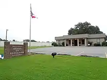
 Lanier County Courthouse in Lakeland | |
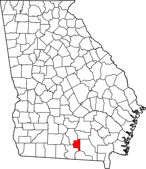 Location within the U.S. state of Georgia | |
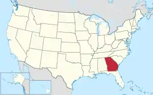 Georgia's location within the U.S. | |
| Coordinates: 31°02′16″N 83°03′46″W | |
| Country | |
| State | |
| Founded | August 7, 1920 |
| Named for | Sidney Lanier |
| Seat | Lakeland |
| Largest city | Lakeland |
| Area | |
| • Total | 200 sq mi (500 km2) |
| • Land | 185 sq mi (480 km2) |
| • Water | 15 sq mi (40 km2) 7.3% |
| Population (2020) | |
| • Total | 9,877 |
| • Density | 53/sq mi (20/km2) |
| Time zone | UTC−5 (Eastern) |
| • Summer (DST) | UTC−4 (EDT) |
| Congressional district | 8th |
| Website | laniercountyboc |
| [1] | |
Lanier County is part of the Valdosta, GA Metropolitan Statistical Area. Lanier shares Moody Air Force Base with Lowndes County on its western boundary.
Geography
According to the U.S. Census Bureau, the county has an area of 200 square miles (520 km2), of which 185 square miles (480 km2) is land and 15 square miles (39 km2) (7.3%) is water.[5]
The vast majority of Lanier County is in the Alapaha River sub-basin of the Suwannee River basin. Just a narrow section of the western border of the county, northeast and southeast of Ray City, is in the Withlacoochee River sub-basin of the same Suwannee River basin, and a very narrow section of the eastern border of Lanier County is in the Upper Suwannee River sub-basin of the same Suwannee River basin.[6]
Major highways
Major waterways
Previous
Defunct
- Atlantic and Gulf Railroad
- Atlantic Coast Line Railroad
- Lakeland Railroad (Defunct, it was used from 1929 to 1957. It ran along the same path as the Milltown Air Line Railroad)
- Milltown Air Line Railroad (Defunct, it was used from 1904 to 1928. It ran from Lakeland to Naylor, Georgia)
- Plant System
- Waycross and Western Railroad (Defunct, it was used from 1912 to 1925 from Waycross, Georgia to Lakeland, Georgia. It roughly followed current Georgia State Route 122)
Adjacent counties
- Berrien County - northwest
- Atkinson County - north
- Clinch County - east
- Echols County - south
- Lowndes County - southwest
National protected area

The Banks Lake National Wildlife Refuge, established in 1985, hosts approximately 20,000 visitors annually. It provides hiking, fishing, and boating opportunities on more than 4,000 acres (16 km2) of water, Banks Lake marsh, and swamp. The Robert Simpson III Nature Trail, dedicated in August 2001, is in the Lakeland, Georgia city limits on 75 acres (300,000 m2) of pine and hardwood forests. The county is known for its excellent fishing in the Alapaha River, Banks Lake National Wildlife Refuge as well as in its many small lakes.
Demographics
| Census | Pop. | Note | %± |
|---|---|---|---|
| 1930 | 5,190 | — | |
| 1940 | 5,632 | 8.5% | |
| 1950 | 5,151 | −8.5% | |
| 1960 | 5,097 | −1.0% | |
| 1970 | 5,031 | −1.3% | |
| 1980 | 5,654 | 12.4% | |
| 1990 | 5,531 | −2.2% | |
| 2000 | 7,847 | 41.9% | |
| 2010 | 10,078 | 28.4% | |
| 2020 | 9,877 | −2.0% | |
| U.S. Decennial Census[7] 1790-1960[8] 1900-1990[9] 1990-2000[10] 2010-2013[11] | |||
2000 census
As of the census[12] of 2000, there were 7,847 people, 2,893 households, and 1,931 families living in the county. The population density was 39 inhabitants per square mile (15/km2). There were 3,011 housing units at an average density of 16 per square mile (6.2/km2). The racial makeup of the county was 76.61% White, 20.63% African American, 0.57% Native American, 0.36% Asian, 0.04% Pacific Islander, 0.59% from other races, and 1.20% from two or more races. 1.74% of the population were Hispanic or Latino of any race.
There were 2,593 households, out of which 37.60% had children under the age of 18 living with them, 55.00% were married couples living together, 13.70% had a female householder with no husband present, and 25.50% were non-families. 21.80% of all households were made up of individuals, and 9.40% had someone living alone who was 65 years of age or older. The average household size was 2.69 and the average family size was 3.12.
In the county, the population was spread out, with 27.40% under the age of 18, 11.00% from 18 to 24, 30.50% from 25 to 44, 20.50% from 45 to 64, and 10.60% who were 65 years of age or older. The median age was 33 years. For every 100 females, there were 102.70 males. For every 100 females age 18 and over, there were 101.80 males.
The median income for a household in the county was $50,171, and the median income for a family was $54,512. Males had a median income of $46,023 versus $39,021 for females. The per capita income for the county was $43,690. About 5.30% of families and 8.50% of the population were below the poverty line, including 12.90% of those under age 18 and 14.20% of those age 65 or over.
2010 census
As of the 2010 United States Census, there were 10,078 people, 3,608 households, and 2,626 families living in the county.[13] The population density was 54.4 inhabitants per square mile (21.0/km2). There were 4,249 housing units at an average density of 22.9 per square mile (8.8/km2).[14] The racial makeup of the county was 70.6% white, 23.7% black or African American, 1.0% Asian, 0.5% American Indian, 1.7% from other races, and 2.3% from two or more races. Those of Hispanic or Latino origin made up 4.6% of the population.[13] In terms of ancestry, 14.0% were Irish, 11.5% were American, 11.0% were German, and 10.1% were English.[15]
Of the 3,608 households, 40.7% had children under the age of 18 living with them, 52.0% were married couples living together, 15.6% had a female householder with no husband present, 27.2% were non-families, and 22.3% of all households were made up of individuals. The average household size was 2.72 and the average family size was 3.18. The median age was 33.4 years.[13]
The median income for a household in the county was $37,522 and the median income for a family was $43,162. Males had a median income of $32,782 versus $21,712 for females. The per capita income for the county was $16,894. About 18.0% of families and 20.4% of the population were below the poverty line, including 28.8% of those under age 18 and 10.6% of those age 65 or over.[16]
2020 census
| Race | Num. | Perc. |
|---|---|---|
| White (non-Hispanic) | 6,595 | 66.77% |
| Black or African American (non-Hispanic) | 2,138 | 21.65% |
| Native American | 31 | 0.31% |
| Asian | 81 | 0.82% |
| Pacific Islander | 14 | 0.14% |
| Other/Mixed | 446 | 4.52% |
| Hispanic or Latino | 572 | 5.79% |
As of the 2020 United States census, there were 9,877 people, 3,714 households, and 2,536 families residing in the county.
Economy
The county's economy has remained rural in nature, but the educational, health and social service sector was the largest employment category in 2006. Factors contributing to this economy include the presence of Moody Air Force Base (shared by adjoining Lowndes County), the several lakes and nature reserve, the hospital, and a large state correctional facility.
The top ten employers in Lanier County are:
- Moody Air Force Base
- Farmers & Merchants Bank
- Louis Smith Hospital
- Patten Probation Detention Center
- Georgia Department of Corrections
- Patten Seed Company
- City of Lakeland, Georgia
- Wausau Homes, Inc
- J.H. Harvey Co, LLC (parent company of Harveys Supermarkets)
Media
- Lanier County News - Legal organ and hometown newspaper since 1913. The paper was originally named The Milltown Advocate, but changed its name after Lanier County was formed in 1920.
- Lanier County Advocate (newspaper) - Legal organ newspaper as of January 1, 2015.
Historic sites
Historic sites include Governor Eurith D. Rivers' home, which was moved from its original spot on Banks Lake to West Main Street in Lakeland in the early 1980s; Union Baptist Church, located near Georgia Highway 135; and Fender Cemetery, located east of Lakeland at the junction of U.S. 221 and Georgia Highway 37 on land that once belonged to David Fender. The site of the cemetery, in which many of the area's first settlers are buried, was chosen so that mourners would not have to ferry their dead across the river for burial. Also, the "Murals of Milltown," which depict community life in the 1920s, grace the exteriors of buildings in downtown Lakeland.
Education
The Lanier County School District operates four schools: Lanier County Primary School, Lanier County Elementary School, Lanier County Middle School, and Lanier County High School.
Politics
| Year | Republican | Democratic | Third party | |||
|---|---|---|---|---|---|---|
| No. | % | No. | % | No. | % | |
| 2020 | 2,509 | 70.16% | 1,019 | 28.50% | 48 | 1.34% |
| 2016 | 1,984 | 69.10% | 806 | 28.07% | 81 | 2.82% |
| 2012 | 1,820 | 61.11% | 1,114 | 37.41% | 44 | 1.48% |
| 2008 | 1,787 | 62.05% | 1,062 | 36.88% | 31 | 1.08% |
| 2004 | 1,641 | 63.38% | 931 | 35.96% | 17 | 0.66% |
| 2000 | 1,048 | 55.04% | 832 | 43.70% | 24 | 1.26% |
| 1996 | 519 | 34.55% | 818 | 54.46% | 165 | 10.99% |
| 1992 | 600 | 35.03% | 811 | 47.34% | 302 | 17.63% |
| 1988 | 725 | 50.81% | 698 | 48.91% | 4 | 0.28% |
| 1984 | 852 | 53.48% | 741 | 46.52% | 0 | 0.00% |
| 1980 | 470 | 29.30% | 1,116 | 69.58% | 18 | 1.12% |
| 1976 | 207 | 14.02% | 1,269 | 85.98% | 0 | 0.00% |
| 1972 | 850 | 81.50% | 193 | 18.50% | 0 | 0.00% |
| 1968 | 241 | 15.63% | 277 | 17.96% | 1,024 | 66.41% |
| 1964 | 719 | 52.10% | 661 | 47.90% | 0 | 0.00% |
| 1960 | 198 | 15.88% | 1,049 | 84.12% | 0 | 0.00% |
| 1956 | 152 | 14.59% | 890 | 85.41% | 0 | 0.00% |
| 1952 | 170 | 16.75% | 845 | 83.25% | 0 | 0.00% |
| 1948 | 92 | 13.53% | 486 | 71.47% | 102 | 15.00% |
| 1944 | 40 | 6.02% | 625 | 93.98% | 0 | 0.00% |
| 1940 | 16 | 2.56% | 607 | 97.12% | 2 | 0.32% |
| 1936 | 30 | 3.59% | 800 | 95.81% | 5 | 0.60% |
| 1932 | 3 | 1.38% | 211 | 97.24% | 3 | 1.38% |
| 1928 | 138 | 31.29% | 303 | 68.71% | 0 | 0.00% |
| 1924 | 46 | 11.41% | 356 | 88.34% | 1 | 0.25% |
See also
Notes
- "Lanier County Act Amended, No. 505". Acts of the General Assembly of the State of Georgia. 1920. pp. 45–48. Retrieved November 13, 2022.
- "Census - Geography Profile: Lanier County, Georgia". United States Census Bureau. Retrieved December 27, 2022.
- "Find a County". National Association of Counties. Retrieved June 7, 2011.
- Krakow, Kenneth K. (1975). Georgia Place-Names: Their History and Origins (PDF). Macon, GA: Winship Press. p. 129. ISBN 0-915430-00-2. Archived (PDF) from the original on April 14, 2004.
- "US Gazetteer files: 2010, 2000, and 1990". United States Census Bureau. February 12, 2011. Retrieved April 23, 2011.
- "Georgia Soil and Water Conservation Commission Interactive Mapping Experience". Georgia Soil and Water Conservation Commission. Retrieved November 27, 2015.
- "U.S. Decennial Census". United States Census Bureau. Retrieved June 23, 2014.
- "Historical Census Browser". University of Virginia Library. Retrieved June 23, 2014.
- "Population of Counties by Decennial Census: 1900 to 1990". United States Census Bureau. Retrieved June 23, 2014.
- "Census 2000 PHC-T-4. Ranking Tables for Counties: 1990 and 2000" (PDF). United States Census Bureau. Archived (PDF) from the original on March 27, 2010. Retrieved June 23, 2014.
- "State & County QuickFacts". United States Census Bureau. Archived from the original on June 7, 2011. Retrieved June 23, 2014.
- "U.S. Census website". United States Census Bureau. Retrieved May 14, 2011.
- "DP-1 Profile of General Population and Housing Characteristics: 2010 Demographic Profile Data". United States Census Bureau. Archived from the original on February 13, 2020. Retrieved December 30, 2015.
- "Population, Housing Units, Area, and Density: 2010 - County". United States Census Bureau. Archived from the original on February 13, 2020. Retrieved December 30, 2015.
- "DP02 SELECTED SOCIAL CHARACTERISTICS IN THE UNITED STATES – 2006-2010 American Community Survey 5-Year Estimates". United States Census Bureau. Archived from the original on February 13, 2020. Retrieved December 30, 2015.
- "DP03 SELECTED ECONOMIC CHARACTERISTICS – 2006-2010 American Community Survey 5-Year Estimates". United States Census Bureau. Archived from the original on February 13, 2020. Retrieved December 30, 2015.
- "Explore Census Data". data.census.gov. Retrieved December 18, 2021.
- Leip, David. "Dave Leip's Atlas of U.S. Presidential Elections". uselectionatlas.org. Retrieved March 20, 2018.
References
External links
Places adjacent to Lanier County, Georgia | ||||||||||||||||
|---|---|---|---|---|---|---|---|---|---|---|---|---|---|---|---|---|
| ||||||||||||||||
Municipalities and communities of Lanier County, Georgia, United States | ||
|---|---|---|
| Cities | Map of Georgia highlighting Lanier County | |
| CDP | ||
| Footnotes | ‡This populated place also has portions in an adjacent county or counties. | |