Lanlivery
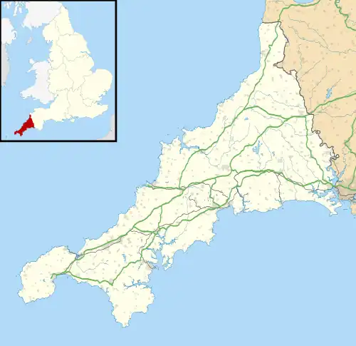
Lanlivery (Cornish: Lannlyvri)[2] is a village and civil parish in Cornwall, England, United Kingdom. The village is about 1+1⁄2 miles (2.4 km) west of Lostwithiel and five miles (8 km) south of Bodmin.[3] The Saints' Way runs past Lanlivery.[4] Helman Tor, Red Moor and Breney Common nature reserves lie within the parish.
Lanlivery
| |
|---|---|
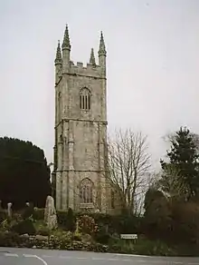
 The Crown Inn, Lanlivery | |
 Lanlivery Location within Cornwall | |
| Population | 519 (United Kingdom Census 2011 including Boslymon) |
| OS grid reference | SX079591 |
| Civil parish |
|
| Unitary authority | |
| Ceremonial county | |
| Region | |
| Country | England |
| Sovereign state | United Kingdom |
| Post town | LOSTWITHIEL[1] |
| Postcode district | PL22 (parish), PL30 (village) |
| Dialling code | 01208 |
| Police | Devon and Cornwall |
| Fire | Cornwall |
| Ambulance | South Western |
| UK Parliament | |
Other settlements
Other settlements in the parish of Lanlivery include Redmoor, Sweetshouse, Milltown and Tangier (now a suburb of Lostwithiel). The manor of Penkneth or Penknight was one of the original 17 Antiqua maneria of the Duchy of Cornwall. (The seal of the borough of Lostwithiel was a shield charged with a castle rising from water between two thistles, in the water two fish, with the legend "Sigillum burgi de Lostwithyel et Penknight in Cornubia".[5]) At Pelyn is a 17th-century house which was formerly the seat of the family of Kendall. It was originally E-shaped but only one side survives and the centre was completely redone in the early Victorian period.[6]
Parish church


The parish church is dedicated to St Brevita or Bryvyth, a saint of whom nothing is known. Evidence for this dedication is found in the will of a vicar of Lanlivery dated 1539.[7] The building was originally cruciform but was enlarged in the 15th century by the addition of a magnificent tower and the south aisle. The churches of Lostwithiel and Luxulyan were originally chapelries dependent on Lanlivery.[8] "One of the great churches of Cornwall" according to John Betjeman.[9]
There is a holy well dedicated to St Bryvyth in woodland just outside the village.[10]
There are four stone crosses in the parish: Trethew Cross consists of a crosshead which was found in 1900 and a separate base; Trevorry or Sandyway Cross was found in 1936; Menawink Cross is a cross with a mutilated head which was found c. 1990 and erected shortly thereafter on the opposite side of the road; Crewel Cross was first reported in 1870 built into a stile (in 1900 the two separate parts were joined together and erected on a base).[11] Two stone crosses from Lanlivery were removed in the 1840s and turned into monuments: one was taken to Boconnoc and one to St Winnow.[12]
References
- Post towns: LOSTWITHIEL (parish), BODMIN (village)
- Place-names in the Standard Written Form (SWF) Archived 15 May 2013 at the Wayback Machine : List of place-names agreed by the MAGA Signage Panel Archived 2013-05-15 at the Wayback Machine. Cornish Language Partnership.
- Ordnance Survey: Landranger map sheet 200 Newquay & Bodmin ISBN 978-0-319-22938-5
- GENUKI website; Lanlivery. Retrieved April 2010.
- Pascoe, W. H. (1979). A Cornish Armory. Padstow, Cornwall: Lodenek Press. p. 133. ISBN 0-902899-76-7.
- Pevsner, N. (1970) Cornwall; 2nd ed., revised by E. Radcliffe. Harmondsworth: Penguin: ; p. 132
- The Cornish Church Guide (1925) Truro: Blackford; p. 131
- The Cornish Church Guide (1925) Truro: Blackford; p. 131
- Betjeman, J. (ed.) (1968) Collins Pocket Guide to English Parish Churches: the South. London: Collins; p. 148
- "St Bryvyth's Well Holy Well or Sacred Spring: The Megalithic Portal and Megalith Map". Megalithic.co.uk. Retrieved 27 December 2015.
- Langdon, A. G. (2002) Stone Crosses in Mid Cornwall; 2nd ed. Federation of Old Cornwall Societies; pp. 50-52
- Langdon, A. G. (2005) Stone Crosses in East Cornwall; 2nd ed. Federation of Old Cornwall Societies; pp. 24 & 71
External links
- "Online Catalogue for Lanlivery". Cornwall Record Office.