Leusden-Zuid
Leusden-Zuid is a neighbourhood and former village in the Dutch province of Utrecht. It is a part of the municipality of Leusden, and lies about 6 km south of Amersfoort. The village is now part of Leusden.[3]
Leusden-Zuid | |
|---|---|
Neighbourhood and former village | |
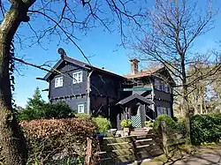
 Villa Klein Schutterhoef | |
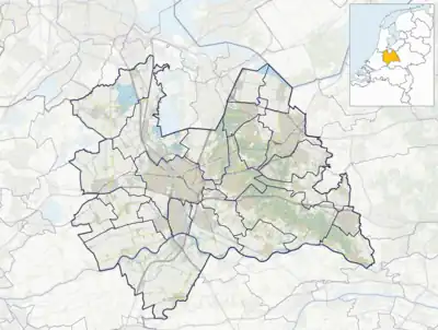
 Leusden-Zuid Location in the Netherlands  Leusden-Zuid Leusden-Zuid (Netherlands) | |
| Coordinates: 52°7′9″N 5°24′23″E | |
| Country | Netherlands |
| Province | Utrecht |
| Municipality | Leusden |
| Area | |
| • Total | 27.70 km2 (10.70 sq mi) |
| Elevation | 3 m (10 ft) |
| Population (2004)[1] | |
| • Total | 5,210 |
| • Density | 190/km2 (490/sq mi) |
| Time zone | UTC+1 (CET) |
| • Summer (DST) | UTC+2 (CEST) |
| Postal code | 3832[1] |
| Dialing code | 033 |
Until about 1969, the village was named "Leusbroek".[3] The reformed church of the village dates from 1827;[4] until that date the villagers went to church in the nearby village of Oud-Leusden.
The Estate Den Treek was built in 1807. A nature area of forests and heaths covering almost 22 square kilometres (8.5 sq mi) is part of the estate and covers five municipalities which makes Den Treek, the largest family owned estate. The nature area is publicly accessible for the recreational purposes.[5]
 Church in Leusden-Zuid
 Estate Den Treek
 Foxes statue by W. Albers Pistorius
 House in Leusden-Zuid
References
- "Kerncijfers wijken en buurten 2021". Central Bureau of Statistics. Retrieved 28 March 2022.
- "Postcodetool for 3832AA". Actueel Hoogtebestand Nederland (in Dutch). Het Waterschapshuis. Retrieved 28 March 2022.
- "Leusden". Plaatsengids (in Dutch). Retrieved 28 March 2022.
- "Hervormde Dorpskerk". Kerk en Orgel (in Dutch). Retrieved 28 March 2022.
- "Het Landgoed". Den Treek Henschoten (in Dutch). Retrieved 28 March 2022.
This article is issued from Wikipedia. The text is licensed under Creative Commons - Attribution - Sharealike. Additional terms may apply for the media files.