Lewedorp
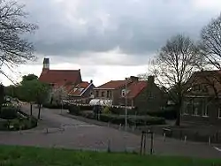
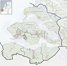
Lewedorp is a village in the Dutch province of Zeeland. It is a part of the municipality of Borsele, and lies about 9 km east of Middelburg.
Lewedorp | |
|---|---|
Village | |
 | |
 Lewedorp Location in the province of Zeeland in the Netherlands  Lewedorp Lewedorp (Netherlands) | |
| Coordinates: 51°29′43″N 3°44′57″E | |
| Country | Netherlands |
| Province | Zeeland |
| Municipality | Borsele |
| Area | |
| • Total | 14.72 km2 (5.68 sq mi) |
| Elevation | 1.5 m (4.9 ft) |
| Population (2021)[1] | |
| • Total | 1,735 |
| • Density | 120/km2 (310/sq mi) |
| Time zone | UTC+1 (CET) |
| • Summer (DST) | UTC+2 (CEST) |
| Postal code | 4456[1] |
| Dialing code | 0113 |
The village was first mentioned in 1913 as Noordkraaijert. It was renamed on 13 August 1929 and refers to Unico Evert Lewe van Neijenstein, the mayor of 's-Heer Arendskerke between 1892 until 1933.[3][4] The village used to be located near the ferry to Zuid-Beveland and Walcheren which operated from 1755 until 1872.[4]
The Catholic St Eligius Church was built in 1929 and designed by Pierre Cuypers jr..[4] Lewedorp used to be part of 's-Heer Arendskerke until 1970 when it was merged into Borsele.[4]
Gallery
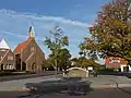 View on the church
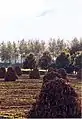 Hay in the fields
References
- "Kerncijfers wijken en buurten 2021". Central Bureau of Statistics. Retrieved 19 April 2022.
- "Postcodetool for 4456AA". Actueel Hoogtebestand Nederland (in Dutch). Het Waterschapshuis. Retrieved 19 April 2022.
- "Lewedorp - (geografische naam)". Etymologiebank (in Dutch). Retrieved 19 April 2022.
- "Lewedorp". Plaatsengids (in Dutch). Retrieved 19 April 2022.
Wikimedia Commons has media related to Lewedorp.
This article is issued from Wikipedia. The text is licensed under Creative Commons - Attribution - Sharealike. Additional terms may apply for the media files.