Lhozhag County
Lhozhag County (Tibetan: ལྷོ་བྲག་རྫོང་།; Chinese: 洛扎县) is a county of Shannnan located in the south-east of the Tibet Autonomous Region, China.
Lhozhag County
洛扎县 • ལྷོ་བྲག་རྫོང་། | |
|---|---|
.png.webp) Location of Lhozhag County (red) within Shannan City (yellow) and Tibet | |
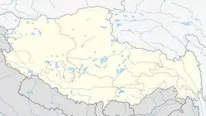
 Lhozhag Location of the seat in Tibet  Lhozhag Lhozhag (China) | |
| Coordinates: 28°23′46″N 91°07′50″E | |
| Country | China |
| Autonomous region | Tibet |
| Prefecture-level city | Shannan (Lhoka) |
| County seat | Lhozhag |
| Area | |
| • Total | 5,022.73 km2 (1,939.29 sq mi) |
| Population (2020)[1] | |
| • Total | 19,865 |
| • Density | 4.0/km2 (10/sq mi) |
| Time zone | UTC+8 (China Standard) |
| Website | www |
| Lhozhag County | |||||||
|---|---|---|---|---|---|---|---|
| Chinese name | |||||||
| Simplified Chinese | 洛扎县 | ||||||
| Traditional Chinese | 洛扎縣 | ||||||
| |||||||
| Tibetan name | |||||||
| Tibetan | ལྷོ་བྲག་རྫོང་། | ||||||
| |||||||
Geography
Lhozhag Nub Qu (ལྷོ་བྲག་ནུབ་ཆུ་; 洛扎怒曲) is situated in Lhozhag County.[2]
Administrative divisions
Lhozhag County contains 2 towns and 5 townships.
| Name | Chinese | Hanyu Pinyin | Tibetan | Wylie |
|---|---|---|---|---|
| Towns | ||||
| Lhozhag Town | 洛扎镇 | Luòzhā zhèn | ལྷོ་བྲག་གྲོང་རྡལ། | lho brag grong rdal |
| Lhakang Town | 拉康镇 | Lākāng zhèn | ལྷ་ཁང་གྲོང་རྡལ། | lha khang grong rdal |
| Townships | ||||
| Zara Township | 扎日乡 | Zhārì xiāng | རྫ་ར་ཤང་། | rdza ra shang |
| Se Township | 色乡 | Sè xiāng | སྲས་ཤང་། | sras shang |
| Sengge Township | 生格乡 | Shēnggé xiāng | སེང་གེ་ཤང་། | seng ge shang |
| Benpa Township | 边巴乡 | Biānbā xiāng | བེན་པ་ཤང་། | ben pa shang |
| La'gyab Township | 拉郊乡 | Lājiāo xiāng | ལ་རྒྱབ་ཤང་། | la ryab shang |
References
- "山南市第七次全国人口普查主要数据公报" (in Chinese). Statistics Bureau of Lhoka. 2021-06-24.
- "山南洛扎县旅游地图_★西藏旅游攻略★". www.laomaoniu.com. Archived from the original on 2014-05-12.
This article is issued from Wikipedia. The text is licensed under Creative Commons - Attribution - Sharealike. Additional terms may apply for the media files.
