Lippetal
Lippetal is a municipality in the district of Soest, in North Rhine-Westphalia, Germany.
Lippetal | |
|---|---|
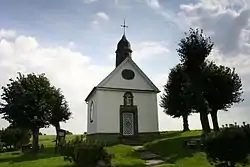 St. Anna chapel in Nordwald | |
 Coat of arms | |
Location of Lippetal within Soest district 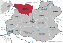 | |
 Lippetal 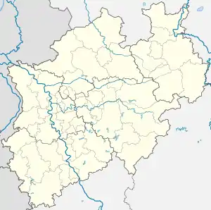 Lippetal | |
| Coordinates: 51°39′N 08°05′E | |
| Country | Germany |
| State | North Rhine-Westphalia |
| Admin. region | Arnsberg |
| District | Soest |
| Government | |
| • Mayor (2020–25) | Matthias Lürbke[1] (CDU) |
| • Governing parties | CDU |
| Area | |
| • Total | 126.58 km2 (48.87 sq mi) |
| Highest elevation | 155 m (509 ft) |
| Lowest elevation | 69 m (226 ft) |
| Population (2021-12-31)[2] | |
| • Total | 11,837 |
| • Density | 94/km2 (240/sq mi) |
| Time zone | UTC+01:00 (CET) |
| • Summer (DST) | UTC+02:00 (CEST) |
| Postal codes | 59510 |
| Dialling codes | 02923 (Herzfeld) 02527 (Lippborg) |
| Vehicle registration | SO |
| Website | www.lippetal.de |
Geography
Lippetal is located north and south of the river Lippe between the cities of Lippstadt (15 km (9.3 mi)) and Hamm (10 km (6.2 mi)). Lippetal is situated at the northern boundary of the Soester Börde, south of the river Lippe and the southern Münsterland in north of the river. The river Lippe flows from east to the west through the municipality.
Division of the municipality
There are eleven villages in Lippetal:
|
|
History
The municipality Lippetal was created by administrative reorganization in 1969. Lippetal was made with eleven villages from three different districts.
The villages are mostly old Saxon settlements. The villages Oestinghausen and Lippborg were first mentioned in 1189, Hovestadt in 1213, and the place of pilgrimage Herzfeld in a document in 786.
Personalities
- William Finnemann (1882-1942), priest of the Society of the Divine Word, auxiliary bishop of Manila and apostolic vicar of Calapan,
- Leon (* 1969 as Jürgen Göbel ) German percussionist
- Dirk Langerbein (* 1971) former football goalkeeper, now goalkeeper coach
References
- Wahlergebnisse in NRW Kommunalwahlen 2020, Land Nordrhein-Westfalen, accessed 30 June 2021.
- "Bevölkerung der Gemeinden Nordrhein-Westfalens am 31. Dezember 2021" (in German). Landesbetrieb Information und Technik NRW. Retrieved 20 June 2022.
External links
- Official site (in German)
Towns and municipalities in Soest (district) | ||
|---|---|---|
Coat of Arms of Soest district | ||