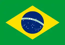
Outline of Brazil
The following outline is provided as an overview of and topical guide to Brazil:
.svg.png.webp)
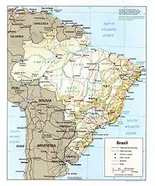
An enlargeable relief map of the Federative Republic of Brazil
Brazil – largest country in both South America and the Latin America region. It is the world's fifth largest country, both by geographical area, 8.5 million km2, and by population, with over 206 million people.[1][2] It is the largest lusophone country in the world, and the only one in the Americas.[2]
General reference

An enlargeable basic map of Brazil
- Pronunciation: /brəˈzɪl/ ⓘ
- Portuguese: [bɾaˈziw]
- Common English country name: Brazil
- Official English country name: The Federative Republic of Brazil
- Common endonym: Brasil
- Official endonym: República Federativa do Brasil
- Adjectival and denomynic: Brazilian
- Etymology: Name of Brazil
- International rankings of Brazil
- ISO country codes: BR, BRA, 076
- ISO region codes: See ISO 3166-2:BR
- Internet country code top-level domain: .br
Geography of Brazil

An enlargeable topographic map of Brazil
- Brazil is: a megadiverse country
- Location:
- Western Hemisphere, on the Equator
- Time zones:
- UTC-02: Fernando de Noronha, Trindade and Martin Vaz, Atol das Rocas, Saint Peter and Paul Rocks
- UTC-03: Alagoas, Amapá, Bahia, Ceará, Distrito Federal, Espírito Santo, Goiás, Maranhão, Minas Gerais, Pará, Paraíba, Paraná, Pernambuco, Piauí, Rio de Janeiro, Rio Grande do Norte, Rio Grande do Sul, Santa Catarina, São Paulo, Sergipe, Tocantins
- UTC-04: Amazonas, Mato Grosso, Mato Grosso do Sul, Rondônia, Roraima
- UTC-05: Acre
- Extreme points of Brazil
- High: Pico da Neblina 2,994 m (9,823 ft)
- Low: Atlantic Ocean 0 m
- Land boundaries: 16,885 km
.svg.png.webp) Bolivia 3,423 km
Bolivia 3,423 km Peru 2,995 km
 Venezuela 2,200 km
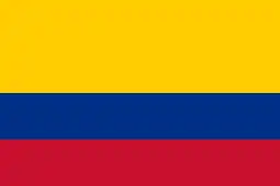 Colombia 1,644 km
 Guyana 1,606 km
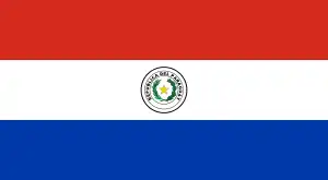 Paraguay 1,365 km
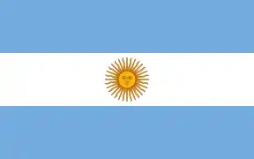 Argentina 1,261 km
 Uruguay 1,068 km
 French Guiana 730 km
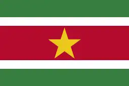 Suriname 593 km
- Coastline: 7,491 km
- Population of Brazil: 207,752,291 (2023) - 5th most populous country
- Area of Brazil: 8,514,877 square kilometres (3,287,612 sq mi) - 5th largest country
- Atlas of Brazil
Environment of Brazil
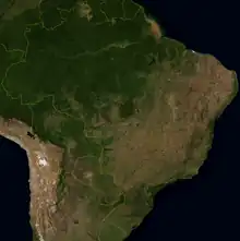
An enlargeable satellite image of Brazil
Natural geographic features of Brazil
Regions of Brazil
Statistical regions
Socio-geographic divisions
Ecoregions of Brazil
Administrative divisions of Brazil
States of Brazil
| Flag | State | Abbreviation | Capital | Area (km2) | Area (sq mi) | Population (2014) | Density (per km2, 2014) | Density (per sq mi, 2014) | GDP (billion R$ and % total, 2012) | GDP per capita (R$, 2012) | HDI[3] (2021) | Literacy (2014) | Infant mortality (2014) | Life expectancy (years, 2014) |
|---|---|---|---|---|---|---|---|---|---|---|---|---|---|---|
| Acre | AC | Rio Branco | 152,581.4 | 58,912 | 790,101 | 4.47 | 13 | 9.629 (0.2%) | 12,690 | 0.710 | 94% | 1.6% | 75.4 | |
| Alagoas | AL | Maceió | 27,767.7 | 10,721 | 3,321,730 | 112.3 | 309 | 29.545 (0.7%) | 9,333 | 0.684 | 90% | 1.7% | 73.5 | |
| Amapá | AP | Macapá | 142,814.6 | 55,151 | 750,912 | 4.69 | 13 | 10.420 (0.2%) | 14,914 | 0.688 | 99% | 1.6% | 75.4 | |
| Amazonas | AM | Manaus | 1,570,745.7 | 606,470 | 3,873,743 | 2.23 | 6 | 64.120 (1.7%) | 17,855 | 0.700 | 96% | 1.9% | 73.7 | |
| Bahia | BA | Salvador | 564,692.7 | 218,030 | 15,126,371 | 24.82 | 69 | 167.727 (3.8%) | 11,832 | 0.691 | 91% | 2.0% | 74.3 | |
| Ceará | CE | Fortaleza | 148,825.6 | 57,462 | 8,842,791 | 56.8 | 153 | 90.132 (2.0%) | 10,473 | 0.734 | 93% | 1.65% | 74.9 | |
| Distrito Federal | DF | Brasília | 5,822.1 | 2,249.9 | 2,852,372 | 444.66 | 1,268 | 171.236 (3.9%) | 64,653 | 0.814 | 98.8% | 0.65% | 79.8 | |
| Espírito Santo | ES | Vitória | 46,077.5 | 17,791 | 3,885,049 | 76.25 | 218 | 107.329 (2.2%) | 29,996 | 0.771 | 99% | 0.48% | 80.1 | |
| Goiás | GO | Goiânia | 340,086.7 | 131,310 | 6,523,222 | 17.65 | 49 | 123.926 (2.4%) | 20,134 | 0.737 | 97% | 0.9% | 75.9 | |
| Maranhão | MA | São Luís | 331,983.3 | 128,180 | 6,850,884 | 19.81 | 53 | 58.920 (1.2%) | 8,760 | 0.676 | 90% | 1.9% | 72.5 | |
| Mato Grosso | MT | Cuiabá | 903,357.9 | 348,790 | 3,224,357 | 3.36 | 9 | 80.830 (1.5%) | 25,945 | 0.736 | 94% | 1.3% | 74.6 | |
| Mato Grosso do Sul | MS | Campo Grande | 357,125.0 | 137,890 | 2,619,657 | 6.86 | 19 | 54.471 (1.0%) | 21,744 | 0.742 | 97% | 0.7% | 76.1 | |
| Minas Gerais | MG | Belo Horizonte | 586,528.3 | 226,460 | 20,734,097 | 33.41 | 91 | 403.551 (9.2%) | 20,324 | 0.774 | 98.6% | 0.61% | 78.7 | |
| Pará | PA | Belém | 1,247,689.5 | 481,740 | 8,073,924 | 6.07 | 16 | 91.009 (1.9%) | 11,678 | 0.690 | 94% | 1.6% | 74.2 | |
| Paraíba | PB | João Pessoa | 56,439.8 | 21,792 | 3,943,885 | 66.70 | 180 | 38.731 (0.8%) | 10,151 | 0.698 | 92% | 1.7% | 74.1 | |
| Paraná | PR | Curitiba | 199,314.9 | 76,956 | 11,081,692 | 52.40 | 143 | 255.927 (5.8%) | 24,194 | 0.769 | 98% | 0.7% | 77.8 | |
| Pernambuco | PE | Recife | 98,311.6 | 37,958 | 9,277,727 | 89.62 | 244 | 117.340 (2.3%) | 13,138 | 0.719 | 92% | 1.9% | 74.8 | |
| Piauí | PI | Teresina | 251,529.2 | 97,726 | 3,194,178 | 12.4 | 32 | 25.721 (0.5%) | 8,137 | 0.690 | 90% | 1.8% | 72.7 | |
| Rio de Janeiro | RJ | Rio de Janeiro | 43,696.1 | 16,871 | 16,461,173 | 365.23 | 975 | 504.221 (11.5%) | 31,064 | 0.762 | 99% | 1.3% | 77.1 | |
| Rio Grande do Norte | RN | Natal | 52,796.8 | 20,385 | 3,408,510 | 59.99 | 167 | 39.544 (0.9%) | 12,249 | 0.728 | 95.1% | 1.38% | 76.7 | |
| Rio Grande do Sul | RS | Porto Alegre | 281,748.5 | 108,780 | 11,207,274 | 37.96 | 103 | 277.658 (6.3%) | 25,779 | 0.771 | 99% | 0.4% | 79.3 | |
| Rondônia | RO | Porto Velho | 237,576.2 | 91,729 | 1,748,531 | 6.58 | 19 | 29.362 (0.6%) | 13,075 | 0.700 | 94.6% | 1.85% | 73.7 | |
| Roraima | RR | Boa Vista | 224,299.0 | 86,602 | 496,936 | 2.01 | 5 | 7.314 (0.2%) | 15,557 | 0.699 | 94.5% | 1.51% | 73.5 | |
| Santa Catarina | SC | Florianópolis | 95,346.2 | 36,813 | 6,727,148 | 65.27 | 182 | 177.276 (4.0%) | 27,771 | 0.792 | 99% | 0.30% | 81 | |
| São Paulo | SP | São Paulo | 248,209.4 | 95,834 | 44,035,304 | 166.23 | 459 | 1,408.904 (32.1%) | 33,624 | 0.806 | 99% | 0.45% | 79.8 | |
| Sergipe | SE | Aracaju | 21,910.3 | 8,459.6 | 2,219,514 | 94.36 | 262 | 27.823 (0.6%) | 13,180 | 0.702 | 93% | 1.8% | 73.0 | |
| Tocantins | TO | Palmas | 277,620.9 | 107,190 | 1,496,880 | 4.98 | 13 | 19.530 (0.4%) | 13,775 | 0.731 | 94% | 1.7% | 74.5 | |
Demography of Brazil
Demographics of Brazil For demographics data, see chart presented under "States of Brazil", above.
Government and politics of Brazil
- Form of government: federal presidential representative democratic republic
- Capital of Brazil: Brasília
- Elections in Brazil
- Political parties in Brazil
Branches of government
Executive branch of the government of Brazil
Legislative branch of the government of Brazil
Judicial branch of the government of Brazil
State-level judiciary
Superior courts
Second instance Courts
First instance courts
- Brazil Labor Courts
- Brazil Electoral Courts
- Brazil Federal Courts
- Brazil Military Courts
Foreign relations of Brazil
International organization membership
The Federative Republic of Brazil is a member of:[4]
Law and order in Brazil
Military of Brazil
Local government in Brazil
Local government in Brazil
History of Brazil
Culture of Brazil
- Architecture of Brazil
- Cuisine of Brazil
- Languages of Brazil
- National symbols of Brazil
- People of Brazil
- Prostitution in Brazil
- Public holidays in Brazil
- Religion in Brazil
- World Heritage Sites in Brazil
Art in Brazil
Economy and infrastructure of Brazil
- Economic rank, by nominal GDP (2016): 9th (ninth)
- Agriculture in Brazil
- Banking in Brazil
- Communications in Brazil
- Companies of Brazil
- Currency of Brazil: Real
- Economic history of Brazil
- Energy in Brazil
- Health care in Brazil
- Industry in Brazil
- Mining in Brazil
- São Paulo Stock Exchange
- Tourism in Brazil
- Transport in Brazil
- Water supply and sanitation in Brazil
Education in Brazil
Health in Brazil
- MORHAN: Movimento de Reintegração das Pessoas Atingidas pela Hanseníase, Movement of Reintegration of Persons Afflicted by Hansen's disease
See also
- All pages with titles beginning with Brazil
- All pages with titles containing Brazil
- All pages with titles beginning with Brazilian
- All pages with titles containing Brazilian
- List of Brazil-related topics
- List of international rankings
- Member state of the Group of Twenty Finance Ministers and Central Bank Governors
- Member state of the United Nations
- Latin America
- Outline of South America
References
- IBGE. 2011 Population Projection
- "Geography of Brazil". The World Factbook. Central Intelligence Agency. 2008. Retrieved 2008-06-03.
- "Atlas do Desenvolvimento Humano no Brasil. Pnud Brasil, Ipea e FJP, 2022". www.atlasbrasil.org.br. Retrieved 2023-06-11.
- "Brazil". The World Factbook. United States Central Intelligence Agency. July 2, 2009. Retrieved July 23, 2009.
External links
- Government and administration
- Brazilian Federal Government
- Chamber of Deputies
- (in Portuguese) Federal Senate
- Presidency of Brazil Archived July 29, 2008, at the Wayback Machine
- Information and statistics
- Brazilian Institute of Geography and Statistics
- Brazil. The World Factbook. Central Intelligence Agency.
- (in Portuguese) Institute of Applied Economics Research
- National Bank for Social and Economical Development
- U.S. Library of Congress
- Economy and business
- Brazilian Central Bank
- Brazilian-American Chamber of Commerce
- Britcham in Brazil
- São Paulo Stock Exchange
- Tourism and sports
- Accommodation in Brazil Archived September 25, 2008, at the Wayback Machine
 Brazil travel guide from Wikivoyage
- (in Portuguese) Sport in Brazil
- Tourism in Brazil
- Non-Governmental Organizations
This article is issued from Wikipedia. The text is licensed under Creative Commons - Attribution - Sharealike. Additional terms may apply for the media files.
