List of Old Colony Railroad stations
The following is a list of historic Old Colony Railroad (OCRR) stations, at the time of the 1893 lease by the New York, New Haven and Hartford Railroad and shortly after.[1] City/town include current town name, some of which were incorporated after 1893. Stations currently used by the Massachusetts Bay Transportation Authority or Amtrak are indicated within the notes column.
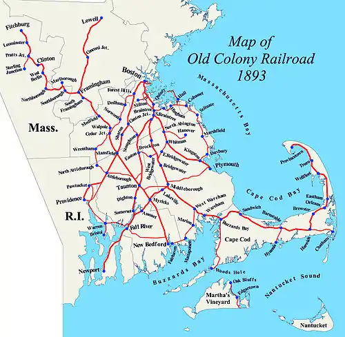
Map of OCRR lines, 1893
All stations are located in the state of Massachusetts unless otherwise noted.
Central Division
Boston to Plymouth
| Location | Station | Miles (km) | Image | Notes |
|---|---|---|---|---|
| Boston | Boston | 0.0 (0.0) | 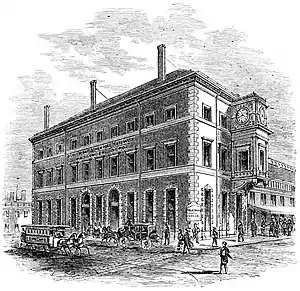 |
Boston terminus moved from Kneeland Street to South Station in 1899 |
| South Boston | 0.7 (1.1) |  |
||
| Crescent Avenue | 2.4 (3.9) |  |
Present location of JFK/UMass station on the Red Line, Greenbush Line, Kingston Line, and Middleborough/Lakeville Line | |
| Savin Hill | 3.0 (4.8) |  |
Present location of Savin Hill station on the Red Line | |
| Harrison Square | 3.6 (5.8) | _(14738154136).jpg.webp) |
Junction with Shawmut Branch | |
| Popes Hill | 4.3 (6.9) | |||
| Neponset | 4.9 (7.9) |  |
Junction with Dorchester and Milton Branch | |
| Quincy | Atlantic | 5.5 (8.9) |  |
Junction with Granite Branch |
| Norfolk Downs | 6.1 (9.8) |  | ||
| Wollaston Heights | 6.7 (10.8) | .jpg.webp) |
Present location of Wollaston station on the Red Line | |
| Quincy | 8.0 (12.9) | 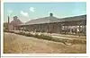 |
Present location of Quincy Center on the Red Line, Greenbush Line, Kingston Line, and Middleborough/Lakeville Line | |
| Quincy Adams | 8.7 (14.0) | Originally named South Quincy Present location of Quincy Adams station on the Red Line | ||
| Braintree | Braintree | 10.1 (16.3) | 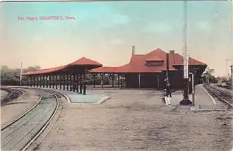 |
Junction with South Shore Branch |
| South Braintree | 11.4 (18.3) | 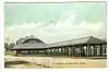 |
Junction with Middleborough-Fall River main line | |
| Weymouth | South Weymouth | 14.9 (24.0) |  |
|
| Abington | North Abington | 17.8 (28.6) | 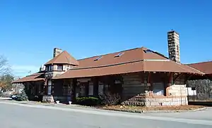 |
Junction with Hanover Branch |
| Abington | 19.2 (30.9) |  |
Present location of Abington station on the Kingston Line | |
| Whitman | Whitman | 21.1 (34.0) |  |
Junction with East Bridgewater Branch Present location of Halifax station on the Kingston Line |
| Hanson | North Hanson | 23.1 (37.2) | ||
| South Hanson | 24.6 (39.6) |  |
Present location of Hanson station on the Kingston Line | |
| Burrage | 26.2 (42.2) |  |
Also called Bournetown | |
| Monponsett | 27.1 (43.6) | 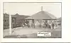 |
||
| Halifax | Halifax | 28.4 (45.7) | 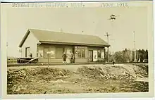 |
Present location of Halifax station on the Kingston Line |
| Kingston | Silver Lake | 29.9 (48.1) | Also called Plympton | |
| Kingston | 33.3 (53.6) | 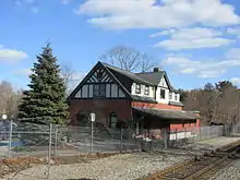 |
Junction with South Shore Branch | |
| Plymouth | Cordage | 35.4 (57.0) | 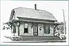 |
Originally named North Plymouth and later Seaside Present location of Plymouth station on the Kingston Line |
| Plymouth | 37.4 (60.2) |  |
Junction with Plymouth and Middleborough Branch |
Shawmut Branch
| Location | Station | Miles (km) | Image | Notes |
|---|---|---|---|---|
| Boston | Harrison Square | 3.6 (5.8) | |
Junction with Boston-Plymouth main line |
| Fields Corner | 4.0 (6.4) |  |
Present location of Fields Corner station on the Red Line | |
| Shawmut | 4.6 (7.4) |  |
Consolidated from stations at Melville Avenue and Centre Street in 1884 Present location of Shawmut station on the Red Line | |
| Ashmont | 5.2 (8.4) |  |
Present location of Ashmont station on the Red Line and Mattapan Trolley | |
| Cedar Grove | 5.6 (9.0) |  |
Present location of Cedar Grove station on the Mattapan Trolley | |
| Milton | Milton | 6.4 (10.3) |  |
Junction with Dorchester and Milton Branch Previously named Milton Lower Mills Present location of Milton station on the Mattapan Trolley |
Dorchester and Milton Branch
| Location | Station | Miles (km) | Image | Notes |
|---|---|---|---|---|
| Boston | Neponset | 4.9 (7.9) | |
Junction with Boston-Plymouth main line |
| Granite Bridge | 5.9 (9.5) | |||
| Milton | Milton | 6.8 (10.9) | |
Junction with Shawmut Branch Previously named Milton Lower Mills and Milton Mills Present location of Milton station on the Mattapan Trolley |
| Central Avenue | 7.1 (11.4) | .jpg.webp) |
Present location of Central Avenue station on the Mattapan Trolley | |
| Boston | Mattapan | 8.1 (13.0) |  |
Present location of Mattapan station on the Mattapan Trolley |
Granite Branch
| Location | Station | Mile (km) | Image | Notes |
|---|---|---|---|---|
| Quincy | Atlantic | 5.5 (8.9) | |
Junction with Boston-Plymouth main line |
| Montclair | 6.1 (9.8) | |||
| Milton | East Milton | 7.5 (12.1) |  |
|
| Quincy | West Quincy | 8.6 (13.8) |  |
South Shore Branch
| Location | Station | Mile (km) | Image | Notes |
|---|---|---|---|---|
| Braintree | Braintree | |
Junction with Boston-Plymouth main line | |
| East Braintree |  |
|||
| Weymouth | Weymouth |  |
Now Weymouth Landing/East Braintree, served by Greenbush Line | |
| Weymouth Heights | .jpg.webp) |
|||
| East Weymouth |  |
Now served by Greenbush Line | ||
| Hingham | West Hingham | Now served by Greenbush Line | ||
| Hingham |  |
|||
| Old Colony House | Junction with Nantasket Beach Branch; now Nantasket Junction, served by Greenbush Line | |||
| North Cohasset | .jpg.webp) |
|||
| Cohasset | King Street | |||
| Cohasset | ||||
| Beechwood | ||||
| Scituate | North Scituate |  |
Now served by Greenbush Line | |
| Egypt | 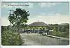 |
|||
| Scituate |  |
|||
| Greenbush |  |
Now served by Greenbush Line | ||
| Marshfield | East Marshfield |  |
||
| Sea View |  |
|||
| Marshfield Centre | ||||
| Marshfield |  |
|||
| Webster Place | _station_postcard.jpg.webp) |
|||
| Duxbury | Duxbury |  |
||
| South Duxbury |  |
|||
| Island Creek | ||||
| Kingston | Kingston | |
Junction with Boston-Plymouth main line |
Nantasket Beach Branch
| Location | Station | Mile (km) | Image | Notes |
|---|---|---|---|---|
| Hingham | Old Colony House | Junction with South Shore Branch; now Nantasket Junction, served by Greenbush Line | ||
| Hull | Nantasket |  |
||
| Surfside | ||||
| Irvington | ||||
| Kenberma | 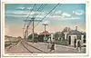 |
|||
| Strawberry Hill | ||||
| Bay Side | ||||
| Allerton | ||||
| Windermere | ||||
| Stony Beach | ||||
| Hull | ||||
| Pemberton |
Hanover Branch
| Location | Station | Mile (km) | Image | Notes |
|---|---|---|---|---|
| Abington | North Abington | |
Junction with Boston-Plymouth main line; station building is now a restaurant | |
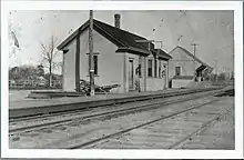
| Rockland | Rockland | 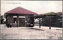 |
||
| Hanover | West Hanover |  |
||
| Winslows Crossing | ||||
| South Hanover |  |
|||
| Curtis Crossing | 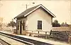 |
|||
| Hanover |  |
Whitman to Bridgwater Junction
| Location | Station | Mile (km) | Image | Notes |
|---|---|---|---|---|
| Whitman | Whitman | |
Junction with Boston-Plymouth main line; now served by Kingston/Plymouth Line | |
| Washington Street |  |
|||
| East Bridgewater | Browns Station | |||
| East Bridgewater |  |
|||
| Elmwood | 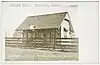 |
|||
| West Bridgewater | Westdale |  |
Junction with South Braintree-Fall River main line |
Plymouth and Middleborough Branch
| Location | Station | Mile (km) | Image | Notes |
|---|---|---|---|---|
| Plymouth | Plymouth | |
Junction with Boston-Plymouth main line | |
| Darby | 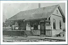 |
|||
| Carver | North Carver | |||
| Middleborough | East Middleborough | |||
| Middleborough |  |
Junction with South Braintree-Fall River, Cape Cod and Taunton lines; future station to be served by South Coast Rail and Middleborough/Lakeville Line |
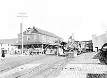
South Braintree to Fall River
_(14766729382).jpg.webp)
%252C_December_2021.JPG.webp)
Mayflower Park to Fall River
| Location | Station | Mile (km) | Image | Notes |
|---|---|---|---|---|
| Braintree | Mayflower Park |  |
Junction with South Braintree-Fall River main line; also known as Braintree Highlands | |
| Randolph | Randolph | |||
| Stoughton | North Stoughton | |||
| Stoughton | 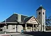 |
Junction with Boston and Providence Railroad Stoughton Branch; now served by Providence/Stoughton Line | ||
| Easton | North Easton |  |
||
| Easton | junction with Easton Branch | |||
| Raynham | Raynham | 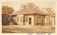 |
junction with Whittenton Branch | |
| Taunton | Dean Street | 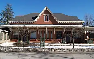 |
Future Taunton station to be served by South Coast Rail | |
| Weir Junction | 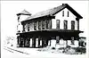 |
|||
| Weir Village | 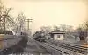 |
|||
| North Dighton | ||||
| Dighton | Dighton | |||
| Somerset | Somerset | |||
| Fall River | Somerset Junction | Junction with South Braintree-Fall River main line |
Fall River to Newport
| State | Location | Station | Mile (km) | Image | Notes |
|---|---|---|---|---|---|
| MA | Fall River | Ferry Street | 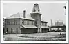 |
Future Battleship Cove station to be served by South Coast Rail | |
| RI | Tiverton | Tiverton | |||
| Portsmouth | Bristol Ferry | ||||
| Coal Mines | |||||
| Portsmouth Grove | |||||
| Newport | Middletown | ||||
| Newport | Served by heritage Newport and Narragansett Bay Railroad |
Easton Branch
| Location | Station | Mile (km) | Image | Notes |
|---|---|---|---|---|
| Easton | Easton | junction with Mayflower Park-Fall River main line | ||
| South Easton | ||||
| Sequosett | ||||
| West Bridgewater | Cocheset | |||
| West Bridgewater | ||||
| Matfield | 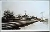 |
junction with South Braintree-Fall River main line |
Middleborough to Taunton
| Location | Station | Mile (km) | Image | Notes |
|---|---|---|---|---|
| Middleborough | Middleborough | 0 (0) | |
Junction with South Braintree-Fall River, Cape Cod, and Plymouth lines; future station to be served by South Coast Rail and Middleborough/Lakeville Line |
| Lakeville | Turnpike | 2.0 (3.2) | ||
| North Lakeville | 2.9 (4.7) | |||
| Taunton | Chage's | 3.8 (6.1) | ||
| East Taunton | 5.8 (9.3) | |||
| Cotley Junction | 7.9 (12.7) | 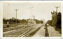 |
Not a station - junction with Taunton and New Bedford lines |
Cape Cod Division
Middleborough to Provincetown
| Location | Station | Miles (km) | Image | Notes |
|---|---|---|---|---|
| Middleborough | Middleborough | 34.6 (55.7) | 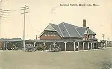 |
Junction with South Braintree-Fall River, Taunton, and Plymouth branches; future station to be served by South Coast Rail and Middleborough/Lakeville Line |
| Rock | 39.5 (63.6) | |||
| South Middleboro | 41.7 (67.1) | |||
| Wareham | Tremont | 45.6 (73.4) | 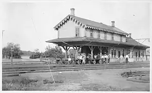 |
Junction with Fairhaven Branch; also known as Tremont |
| South Wareham | 47.2 (76.0) | |||
| Parker Mills | 48.6 (78.2) | |||
| Wareham | 49.3 (79.3) |  |
Now Wareham Village, served by CapeFlyer | |
| Tempest Knob | 49.8 (80.1) | |||
| Onset | 51.3 (82.6) |  |
Also called Agawam, East Wareham, and Onset Junction | |
| Onset | 52.7 (84.8) | Also called Onset Bay. Closed in 1891.[2] | ||
| Bourne | Buzzards Bay | 54.6 (87.9) | 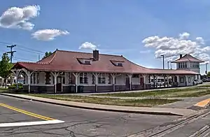 |
Junction with Woods Hole Branch; originally named Cohasset Narrows, now served by CapeFlyer and heritage Cape Cod Central Railroad |
| Bourne | 56.0 (90.1) | 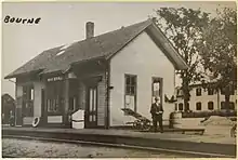 |
Originally named Monument, now served by CapeFlyer | |
| Bournedale | 58.8 (94.6) | 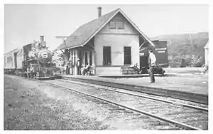 |
||
| Sandwich | Sagamore | 60.0 (96.6) |  |
Served by the heritage Cape Cod Central Railroad |
| Sandwich | 62.5 (100.6) | 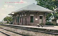 |
||
| East Sandwich | 65.2 (104.9) | 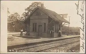 |
||
| Barnstable | West Barnstable | 69.7 (112.2) |  |
Served by the heritage Cape Cod Central Railroad |
| Pond Village | 72.3 (116.4) | Short-lived station – only in service briefly after the line opened | ||
| Barnstable | 73.3 (118.0) | 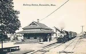 |
||
| Yarmouth | Yarmouth | 75.8 (122.0) |  |
Junction with Hyannis Branch; also known as Yarmouthport |
| Bass River | 78.7 (126.7) | 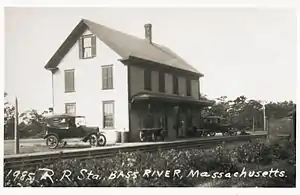 |
Also known as South Yarmouth | |
| Dennis | South Dennis | 81.4 (131.0) | 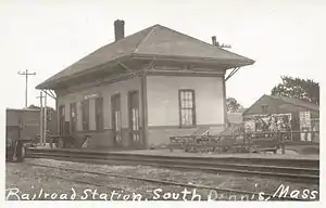 |
|
| Harwich | North Harwich | 83.0 (133.6) | 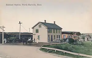 |
|
| Harwich | 84.9 (136.6) | 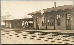 |
Junction with Chatham Branch | |
| Pleasant Lake | 86.8 (139.7) | 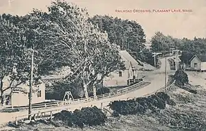 |
||
| Brewster | Brewster | 89.7 (144.4) |  |
|
| East Brewster | 92.2 (148.4) |  |
||
| Orleans | Orleans | 94.6 (152.2) | 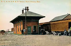 |
|
| Eastham | Eastham | 97.5 (156.9) |  |
|
| North Eastham | 99.9 (160.8) |  |
||
| Wellfleet | South Wellfleet | 103.5 (166.6) |  |
|
| Wellfleet | 106.2 (170.9) | 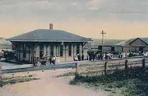 |
||
| Truro | South Truro | 109.1 (175.6) | 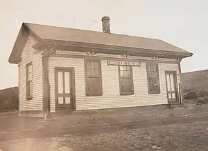 |
|
| Truro | 111.0 (178.6) | 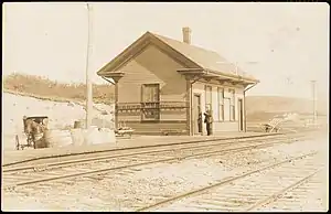 |
||
| Corn Hill | 111.6 (179.6) |  |
||
| North Truro | 114.0 (183.5) | 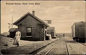 |
Later named Moorland | |
| Provincetown | Puritan Heights | 117.7 (189.4) | ||
| Provincetown | 120.1 (193.3) |  |
Fairhaven Branch
| Location | Station | Miles (km) | Image | Notes |
|---|---|---|---|---|
| Wareham | Tremont | 45.6 (73.4) | |
Junction with Cape Cod main line; also known as Tremont |
| Marion | Marion | 50.6 (81.4) |  |
|
| Mattapoisett | Mattapoisett | 55.4 (89.2) | ||
| Fairhaven | Fairhaven | 60.5 (97.4) |  |
Woods Hole Branch
| Location | Station | Miles (km) | Image | Notes |
|---|---|---|---|---|
| Bourne | Buzzards Bay | 54.6 (87.9) | |
Junction with Cape Cod main line, now served by CapeFlyer and heritage Cape Cod Central Railroad |
| Gray Gables | 55.4 (89.2) | 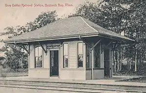 |
||
| Monument Beach | 56.4 (90.8) | 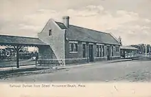 |
||
| Pocasset | 58.2 (93.7) | 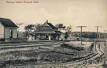 |
||
| Cataumet | 60.1 (96.7) |  |
||
| Falmouth | North Falmouth | 61.3 (98.7) | 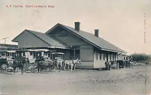 |
Junction with Camp Edwards spur |
| West Falmouth | 64.6 (104.0) |  |
||
| Falmouth | 68.4 (110.1) |  |
||
| Woods Hole | 72.0 (115.9) |  |
Hyannis Branch
| Location | Station | Miles (km) | Image | Notes |
|---|---|---|---|---|
| Yarmouth | Yarmouth | 75.8 (122.0) | |
Junction with Cape Cod main line |
| Camp | 77.0 (123.9) |  |
||
| Barnstable | Hyannis | 79.2 (127.5) | 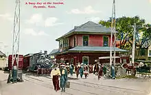 |
Now Hyannis Transportation Center, served by Cape Flyer and heritage Cape Cod Central Railroad |
| Hyannisport | 80.85 (130.1) | 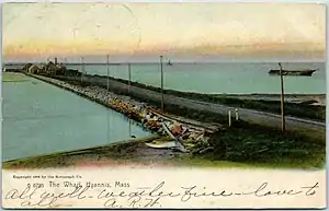 |
Chatham Branch
| Location | Station | Miles (km) | Image | Notes |
|---|---|---|---|---|
| Harwich | Harwich | 84.9 (136.6) | |
Junction with Cape Cod main line |
| Harwich Center | 85.7 (137.9) | 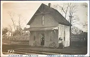 |
||
| South Harwich | 87.6 (141.0) | 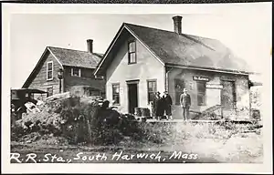 |
||
| Chatham | South Chatham | 88.7 (142.7) |  |
|
| West Chatham | 90.1 (145.0) | |||
| Chatham | 92.0 (148.1) |  |
Now the Chatham Railroad Museum[3] |
Martha's Vineyard Railroad
| Location | Station | Miles (km) | Image | Notes |
|---|---|---|---|---|
| Oak Bluffs | Oak Bluffs | 0.0 (0.0) |  |
|
| Edgartown | Edgartown | 5.5 (8.9) | ||
| Katama | 8.6 (13.8) | .jpg.webp) |
At Mattakeset Lodge | |
| South Beach | 8.6 (13.8) | On a short branch that left the mainline west of Katama |
Taunton and New Bedford lines
Mansfield to New Bedford
| Location | Station | Mile (km) | Image | Notes |
|---|---|---|---|---|
| Mansfield | Mansfield | 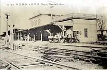 | Junction with Boston and Providence line; current MBTA Commuter Rail station | |
| Norton | Norton | %252C_December_2022.jpg.webp) | historic depot now a private residence | |
| Taunton | Cranes |  | ||
| Attleborough Junction | Junction with Taunton-Attleborough Branch | |||
| Whittenton | Junction with Whittenton Branch | |||
| Taunton Central |  | site now a shopping plaza | ||
| Weir Junction | | Junction with Mayflower Park-Fall River main line | ||
| Cotley Junction | | Not a station - junction with Middleborough–Taunton branch | ||
| Berkley | Myricks |  | Junction with South Braintree-Fall River main line | |
| Freetown | East Freetown | |||
| Braleys |  | |||
| New Bedford | Acushnet |  | Planned site of Church Street station | |
| Mount Pleasant Junction | Junction with Fall River line | |||
| New Bedford | 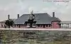 | |||
| New Bedford Wharf |
New Bedford to Fall River
| Location | Station | Mile (km) | Image | Notes |
|---|---|---|---|---|
| New Bedford | Mount Pleasant | 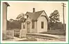 | near junction with Taunton-New Bedford line | |
| Dartmouth | North Dartmouth | |||
| Hicksville |  | |||
| Westport | Westport Factory | located at Highland Road | ||
| Hemlock | ||||
| North Westport | ||||
| Fall River | Flint Village | located at Quequechan Street | ||
| Watuppa | 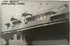 | located at what is now Plymouth Avenue |
Taunton to Attleborough
| Location | Station | Mile (km) | Image | Notes |
|---|---|---|---|---|
| Taunton | Junction with Taunton-Mansfield line | | ||
| Norton | Norton Furnace | |||
| Barrowsville |  | |||
| Chartley |  | |||
| Attleborough | Bearcroft | |||
| Attleboro |  |
Northern Division
Mansfield to Fitchburg
| Location | Station | Mile (km) | Image | Notes |
|---|---|---|---|---|
| Mansfield | Mansfield | | junction with Boston and Providence line; Mansfield (MBTA station) Commuter Rail stop | |
| Foxborough | Foxborough | .jpg.webp) | ||
| North Foxborough |  | |||
| Walpole | South Walpole |  | crosses Wrentham-Dedham line | |
| Walpole | 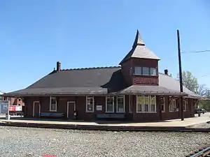 | crosses New York and New England Railroad main line | ||
| Medfield | Medfield |  | ||
| Sherborn | South Sherborn | |||
| Framingham | South Framingham | 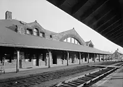 | line crosses Boston and Albany Railroad main line; Framingham (MBTA station) Commuter Rail stop located behind historic Boston and Albany station, which is now a restaurant | |
| Lake View | 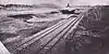 | |||
| Framingham | 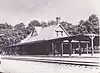 | junction with Framingham and Lowell line | ||
| Southborough | Fayville | |||
| Southborough | 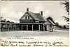 | |||
| Marlborough | Marlborough Junction | junction with short branch to Marlborough | ||
| Northborough | Rock Hill | |||
| Northborough | ||||
| Berlin | Berlin | |||
| West Berlin | 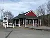 | crosses Boston & Maine Central Mass. Division line | ||
| Bolton | Ballville | |||
| Clinton | Lancaster Mills Branch | Junction with Lancaster Mills Branch | ||
| Clinton |  | crosses Boston & Maine Worcester, Nashua and Portland Division line | ||
| Sterling | Pratts Junction | Junction with Fitchburg and Worcester Branch; south to Sterling and Sterling Junction | ||
| Leominster | Gates Crossing | |||
| Leominster | 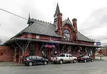 | |||
| West Leominster | ||||
| Fitchburg | South Fitchburg | |||
| Fitchburg | .jpg.webp) | junction with Fitchburg Railroad; Fitchburg (MBTA station) Commuter Rail stop |
Framingham to Lowell
| Location | Station | Mile (km) | Image | Notes |
|---|---|---|---|---|
| Framingham | Framingham | | junction with Mansfield-Fitchburg line | |
| North Framingham |  | |||
| Sudbury | South Sudbury |  | ||
| Sudbury |  | |||
| North Sudbury | ||||
| Concord | Concord Junction |  | ||
| Middlesex Junction | ||||
| Acton | Acton | |||
| North Acton | 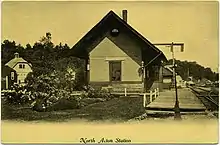 | Junction with Concord Railroad, Nashua Branch | ||
| Carlisle | Carlisle | |||
| Chelmsford | South Chelmsford | |||
| Chelmsford | ||||
| Lowell | Lowell |  | Junction with Boston and Maine Railroad at Ayers City; Lowell (MBTA station) Commuter Rail stop located just north of former junction; historic Lowell B&M station was located further north on Dutton Street |
Boston and Providence Division
Boston to Providence
| State | Location | Station | Mile (km) | Image | Notes |
|---|---|---|---|---|---|
| MA | Boston | Boston (Park Square) | 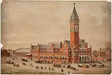 | Replaced by South Station in 1899 | |
| Columbus Avenue |  | Crossing of Boston and Albany Railroad, now the site of Back Bay station | |||
| Chickering | |||||
| Roxbury |  | Now the site of Roxbury Crossing station | |||
| Heath Street | Now the site of Jackson Square station | ||||
| Boylston |  | Now the site of Stony Brook station | |||
| Jamaica Plain | .jpg.webp) | Now the site of Green Street station | |||
| Forest Hills |  | Junction with West Roxbury Branch | |||
| Mount Hope |  | ||||
| Clarendon Hills | 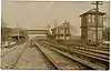 | ||||
| Hazelwood |  | ||||
| Hyde Park | 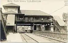 | Still an active station | |||
| Readville |  | Junction with Midland Branch and Dedham Branch; still an active station | |||
| Dedham | Green Lodge | Now the site of Route 128 station | |||
| Canton | Canton Junction |  | Junction with Stoughton Branch; still an active station | ||
| Sharon | Sharon |  | Still an active station | ||
| Sharon Heights |  | ||||
| Foxborough | East Foxborough |  | |||
| Mansfield | Mansfield | | Junction with Framingham and New Bedford lines; still an active station | ||
| West Mansfield |  | ||||
| Attleborough | Attleboro | | Junction with Taunton and Attleborough branches; still an active station. | ||
| Dodgeville | |||||
| East Junction | Junction with East Junction Branch | ||||
| Hebronville | |||||
| RI | Central Falls | Central Falls | Junction with Providence and Worcester Railroad. Replaced by Pawtucket–Central Falls station in 1916. | ||
| Pawtucket | Pawtucket | 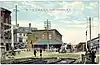 | Replaced by Pawtucket–Central Falls station in 1916 | ||
| Woodlawn |  | Junction with Moshassuck Valley Railroad | |||
| Providence | Providence |  | Replaced by Providence station in 1986 |
Stoughton Branch
| Location | Station | Mile (km) | Image | Notes |
|---|---|---|---|---|
| Canton | Canton Junction | | junction with Boston and Providence main line | |
| Canton |  | |||
| Springdale | 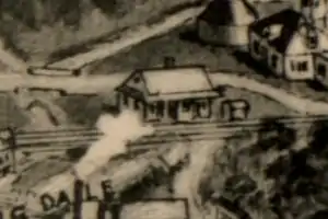 | |||
| Stoughton | West Stoughton | |||
| Stoughton Central | | |||
| Junction with Mayflower Park-Fall River main line |
West Roxbury to Attleborough
| Location | Station | Mile (km) | Image | Notes |
|---|---|---|---|---|
| Boston | Forest Hills | | Junction with Boston–Providence mainline; still an active station | |
| Roslindale |  | Still an active station | ||
| Bellevue |  | Still an active station | ||
| Highland |  | Still an active station | ||
| West Roxbury | 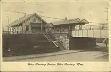 | Still an active station. Junction with Needham Cutoff after 1907. | ||
| Spring Street | ||||
| Dedham | Dedham |  | junction with Dedham-Readville Branch | |
| Westwood | Islington |  | Junction with New York and New England Railroad; still an active station | |
| Norwood | Ellis | |||
| Norwood | Still an active station | |||
| Norwood Central |  | Still an active station | ||
| Winslow | Junction with New York and New England Railroad | |||
| Walpole | Cedar Junction | junction with Mansfield-Framingham line | ||
| Norfolk | Pondville | |||
| Wrentham | Wrentham |  | ||
| Wampum | 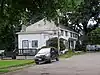 | |||
| Plainville | Plainville | |||
| North Attleborough | North Attleborough | 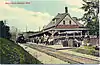 | After 1903, junction with line to Valley Falls. | |
| Chestnut Street | 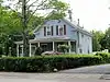 | |||
| Falls Village | ||||
| Attleborough | Farmers | |||
| Attleborough | | Junction with Boston–Providence mainline |
East Junction Branch
| Location | Station | Mile (km) | Image | Notes |
|---|---|---|---|---|
| Attleborough | East Junction | Junction with Boston–Providence mainline | ||
| Seekonk | Perrins | |||
| Perrins Bridge | ||||
| East Providence | Rumford | |||
| Junction with East Providence Branch | ||||
| East Providence | ||||
| Junction with Providence-Bristol line | Original junction was at the east end of India Point Railroad Bridge. In 1908, it was moved north to the Crook Point Bascule Bridge when the East Side Railroad Tunnel was opened. | |||
| Providence | Fox Point |
Other lines
Providence to Bristol
| Location | Station | Mile (km) | Image | Notes |
|---|---|---|---|---|
| Providence | Providence / Fox Point | Relocated to Providence Union Station with the opening of the East Side Railroad Tunnel in 1908. | ||
| East Providence | Junction with East Junction Branch | Junction with East Providence Branch and East Junction Branch. Junction relocated north to Crook Point Bascule Bridge in 1908. | ||
| East Providence | ||||
| Kettle Point | ||||
| Squantum | ||||
| Silver Spring | ||||
| Union Club | ||||
| Pomham Club | ||||
| Riverside | 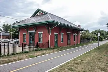 | |||
| Bullocks Point | 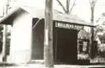 | |||
| Barrington | Drownsville | |||
| West Barrington |  | |||
| Nayatt | ||||
| Barrington |  | |||
| Warren | Warren |  | Junction with Warren-Fall River branch | |
| Bristol | Bristol |
Warren to Fall River
| Location | Station | Mile (km) | Image | Notes |
|---|---|---|---|---|
| Warren | Warren | | junction with Providence-Bristol line | |
| Swansea | Coles | |||
| South Swansea | ||||
| Somerset | Brayton Point | |||
| Fall River | Bowenville | crosses Taunton River at Slades Ferry Bridge and joins Fall River main line |
References
- 1891 Massachusetts State Atlas, Geo H Walker & Co
- "Onset's Union Depo". Boston Globe. May 14, 1891. p. 5 – via Newspapers.com.
- Chatham Railroad Museum Archived 2010-10-16 at the Wayback Machine
This article is issued from Wikipedia. The text is licensed under Creative Commons - Attribution - Sharealike. Additional terms may apply for the media files.