National Register of Historic Places listings in Douglas County, Nebraska
This is a list of the National Register of Historic Places listings in Douglas County, Nebraska.
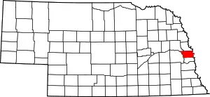
This is intended to be a complete list of the properties and districts on the National Register of Historic Places in Douglas County, Nebraska, United States. The locations of National Register properties and districts for which the latitude and longitude coordinates are included below, may be seen in a map.[1]
There are 192 properties and districts listed on the National Register in the county, including 3 National Historic Landmarks. Six properties were once listed on the National Register, but have since been removed.
This National Park Service list is complete through NPS recent listings posted October 20, 2023.[2]
Current listings
| [3] | Name on the Register[4] | Image | Date listed[5] | Location | City or town | Description |
|---|---|---|---|---|---|---|
| 1 | 10th and Pierce Car Barn | 10th and Pierce Car Barn |
November 12, 2015 (#15000792) |
1125 S. 11th St.[6] 41°14′54″N 95°55′48″W |
Omaha | |
| 2 | Ackerhurst-Eipperhurst Dairy Barn | Ackerhurst-Eipperhurst Dairy Barn |
March 28, 2002 (#02000272) |
15220 Military Rd. 41°20′12″N 96°09′10″W |
Bennington | |
| 3 | Allas Apartments | _from_NE_1.jpg.webp) Allas Apartments |
July 22, 2016 (#16000479) |
1609 Binney St. 41°17′09″N 95°56′16″W |
Omaha | A.k.a. Atlas Apartments[7] |
| 4 | The Anderson Building | The Anderson Building |
November 20, 2009 (#09000938) |
701 S. 24th St. and 2243 Jones 41°15′11″N 95°56′49″W |
Omaha | Sullivanesque commercial and residential building which is a "textbook example" of its type |
| 5 | Anheuser-Busch Beer Depot | 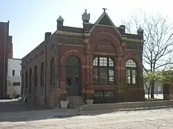 Anheuser-Busch Beer Depot |
February 1, 1979 (#79001440) |
1207-1215 Jones St. 41°15′11″N 95°55′57″W |
Omaha | |
| 6 | Apartments at 2514 North 16th Street | 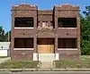 Apartments at 2514 North 16th Street |
August 30, 2010 (#10000607) |
2514 N. 16th St. 41°16′55″N 95°56′16″W |
Omaha | Apartments, Flats and Tenements in Omaha, Nebraska from 1880-1962 MPS |
| 7 | Aquila Court Building | _from_NW_1.JPG.webp) Aquila Court Building |
October 2, 1973 (#73001059) |
1615 Howard St. 41°15′19″N 95°56′16″W |
Omaha | Now operated as Magnolia Hotel[8] |
| 8 | Astro Theater | 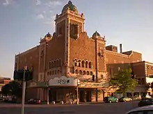 Astro Theater |
August 13, 1974 (#74001108) |
2001 Farnam St. 41°15′26″N 95°56′33″W |
Omaha | Renovated in the 1990s and renamed Rose Blumkin Performing Arts Center (The Rose) |
| 9 | Bank of Florence | 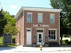 Bank of Florence |
October 15, 1969 (#69000130) |
8502 N. 30th St. 41°20′15″N 95°57′38″W |
Omaha | |
| 10 | Barker Building |  Barker Building |
July 2, 2008 (#08000605) |
306 S. 15th St. 41°15′30″N 95°56′29″W |
Omaha | |
| 11 | Beebe and Runyan Furniture Showroom and Warehouse |  Beebe and Runyan Furniture Showroom and Warehouse |
July 23, 1998 (#98000895) |
105 S. 9th St. 41°15′33″N 95°55′39″W |
Omaha | |
| 12 | Bemis Omaha Bag Company Building |  Bemis Omaha Bag Company Building |
January 11, 1985 (#85000066) |
614-624 S. 11th St. and 1102-1118 Jones St. 41°15′13″N 95°55′52″W |
Omaha | |
| 13 | Bennington State Bank | 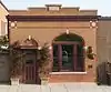 Bennington State Bank |
November 8, 2006 (#06000998) |
15411 S. 2nd St. 41°21′47″N 96°09′23″W |
Bennington | |
| 14 | Benson Commercial Historic District | 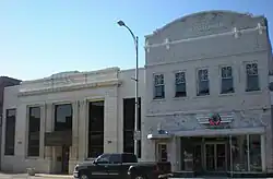 Benson Commercial Historic District |
November 13, 2020 (#100005766) |
Centered along Maple St. between North 59th and North 63rd Sts. 41°17′06″N 96°00′26″W |
Omaha | |
| 15 | The Berkeley Apartments | _from_SW_2.JPG.webp) The Berkeley Apartments |
July 19, 1996 (#96000767) |
649 S. 19th Ave. 41°15′12″N 95°56′29″W |
Omaha | |
| 16 | Blackstone Hotel | 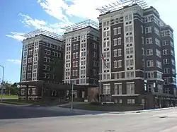 Blackstone Hotel |
January 11, 1985 (#85000067) |
302 S. 36th St. 41°15′26″N 95°57′59″W |
Omaha | |
| 17 | Bradford-Pettis House | 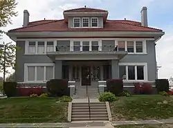 Bradford-Pettis House |
July 21, 1983 (#83001090) |
400 S. 39th St.[9] 41°15′25″N 95°58′20″W |
Omaha | |
| 18 | J. L. Brandeis and Sons Store Building | _from_NE_3.JPG.webp) J. L. Brandeis and Sons Store Building |
October 20, 1982 (#82000601) |
200 S. 16th St. 41°15′30″N 95°56′16″W |
Omaha | |
| 19 | Brandeis-Millard House | 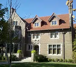 Brandeis-Millard House |
November 28, 1980 (#80002446) |
500 S. 38th St. 41°15′22″N 95°58′11″W |
Omaha | |
| 20 | Broomfield Rowhouse | 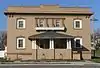 Broomfield Rowhouse |
March 21, 2007 (#07000179) |
2502-2504 Lake St. 41°16′54″N 95°56′56″W |
Omaha | |
| 21 | Burlington Headquarters Building | .jpg.webp) Burlington Headquarters Building |
December 4, 1974 (#74001109) |
1004 Farnam St. 41°15′27″N 95°55′46″W |
Omaha | |
| 22 | Burlington Train Station | 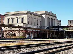 Burlington Train Station |
August 7, 1974 (#74001110) |
925 S. 10th St. 41°14′59″N 95°55′42″W |
Omaha | |
| 23 | Cabanne Archeological Site | May 5, 1972 (#72000749) |
Address Restricted |
Omaha | ||
| 24 | Capitol Garage | _from_SE_3.JPG.webp) Capitol Garage |
May 11, 2012 (#12000102) |
202 N. 19th St. 41°15′40″N 95°56′29″W |
Omaha | |
| 25 | Center School | .jpg.webp) Center School |
August 23, 1985 (#85001796) |
1730 S. 11th St. 41°14′30″N 95°55′50″W |
Omaha | |
| 26 | Champe-Fremont 1 Archeological Site | October 21, 1975 (#75001091) |
Address restricted[10] |
Omaha | Extends into Sarpy County | |
| 27 | Chiodo Apartments | 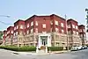 Chiodo Apartments |
November 9, 2017 (#100001798) |
2556 Marcy St. 41°15′05″N 95°57′00″W |
Omaha | |
| 28 | Clifton Hill Commercial Historic District | 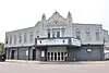 Clifton Hill Commercial Historic District |
October 25, 2022 (#100008316) |
1900-2200 blks. Military Ave. 41°16′42″N 95°58′48″W |
Omaha | |
| 29 | City National Bank Building and Creighton Orpheum Theater | _from_NW_1.JPG.webp) City National Bank Building and Creighton Orpheum Theater |
March 26, 1973 (#73001061) |
16th and Harney Sts. 41°15′23″N 95°56′13″W |
Omaha | |
| 30 | Columbian School | _from_NE_2.jpg.webp) Columbian School |
November 28, 1990 (#90001769) |
3819 Jones St. 41°15′12″N 95°58′12″W |
Omaha | |
| 31 | Joel N. Cornish House | 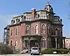 Joel N. Cornish House |
August 13, 1974 (#74001111) |
1404 S. 10th St. 41°14′43″N 95°55′47″W |
Omaha | |
| 32 | Country Club Historic District |  Country Club Historic District |
December 30, 2004 (#04001410) |
Roughly 50th to 56th Sts. and Corby to Seward Sts. 41°16′46″N 95°59′46″W |
Omaha | |
| 33 | Gen. George Crook House | 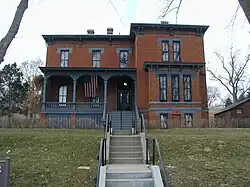 Gen. George Crook House |
April 16, 1969 (#69000131) |
Quarters No. 1, Fort Omaha 41°18′38″N 95°57′36″W |
Omaha | |
| 34 | Danish Brotherhood in America National Headquarters Building | _from_NE_1.jpg.webp) Danish Brotherhood in America National Headquarters Building |
July 22, 2016 (#16000480) |
3717 Harney St. 41°15′25″N 95°58′07″W |
Omaha | |
| 35 | M. A. Disbrow and Company Buildings |  M. A. Disbrow and Company Buildings |
August 1, 2008 (#08000768) |
1201-1221 Nicholas St. and 1206, 1218, and 1224 Izard St. 41°16′10″N 95°55′57″W |
Omaha | |
| 36 | Douglas County Courthouse |  Douglas County Courthouse |
October 11, 1979 (#79003683) |
1700 Farnam St. 41°15′25″N 95°56′20″W |
Omaha | |
| 37 | Drake Court Historic District |  Drake Court Historic District |
November 10, 1980 (#80002447) |
221-223, 2230, and 2236 Jones St. 41°15′12″N 95°56′37″W |
Omaha | Boundary increase and decrease, and name change, on 2014-06-04; originally listed as Drake Court Apartments and the Dartmore Apartments Historic District |
| 38 | Druid Hall | _from_SW_4.JPG.webp) Druid Hall |
July 7, 2015 (#15000393) |
2412 Ames Ave. 41°17′59″N 95°56′52″W |
Omaha | |
| 39 | Drummond Motor Company |  Drummond Motor Company |
July 16, 2018 (#100002661) |
2600 Farnam St. 41°15′28″N 95°57′01″W |
Omaha | |
| 40 | Dundee-Happy Hollow Historic District | 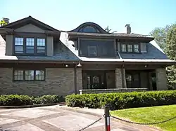 Dundee-Happy Hollow Historic District |
July 22, 2005 (#05000726) |
Roughly Hamilton on the north, JE George and Happy Hollow on the west, Leavenworth on the south, and 48th on the east 41°15′54″N 95°59′25″W |
Omaha | |
| 41 | Eggerss-O'Flyng Building | 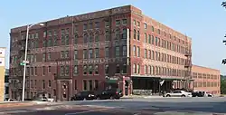 Eggerss-O'Flyng Building |
December 13, 1991 (#91001759) |
801 S. 15th St. 41°15′07″N 95°56′08″W |
Omaha | |
| 42 | Elkhorn Town Hall | 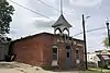 Elkhorn Town Hall |
March 7, 2022 (#100007505) |
20515 Corby St. 41°17′01″N 96°14′10″W |
Elkhorn | |
| 43 | Fairacres Historic District | July 24, 2017 (#100001353) |
Roughly bounded by Fairacres Rd., Dodge, N. 62nd, California & N 68th Sts. 41°15′43″N 96°00′48″W |
Omaha | ||
| 44 | Farm Credit Building | _from_NE_4.JPG.webp) Farm Credit Building |
March 29, 2011 (#11000148) |
206 S. 19th St. 41°15′30″N 95°56′29″W |
Omaha | |
| 45 | Farnam Building |  Farnam Building |
March 9, 2000 (#00000171) |
1607-1617 Farnam St. 41°15′27″N 95°56′16″W |
Omaha | |
| 46 | Father Flanagan's Boys' Home | 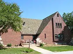 Father Flanagan's Boys' Home |
February 4, 1985 (#85002439) |
14153 Grodinsky Circle 41°15′52″N 96°07′58″W |
Boys Town | |
| 47 | Father Flanagan's House | _office_1.JPG.webp) Father Flanagan's House |
September 6, 1979 (#79001439) |
Off U.S. Route 6 41°15′44″N 96°08′06″W |
Boys Town | |
| 48 | Federal Office Building | 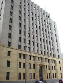 Federal Office Building |
March 17, 2009 (#09000131) |
106 S. 15th St. 41°15′34″N 95°56′10″W |
Omaha | |
| 49 | Field Club Historic District | 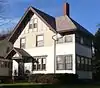 Field Club Historic District |
November 15, 2000 (#00001380) |
Roughly bounded by Pacific, 32nd Ave., Center St., and 36th St. 41°14′39″N 95°57′47″W |
Omaha | |
| 50 | Firestone Tire and Rubber Building | 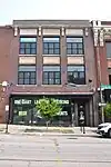 Firestone Tire and Rubber Building |
July 16, 2018 (#100002663) |
2570 Farnam St. 41°15′28″N 95°57′02″W |
Omaha | |
| 51 | First National Bank Building | _from_NE_(1).JPG.webp) First National Bank Building |
June 25, 1982 (#82003187) |
300-312 16th St. and 1601-1605 Farnam St. 41°15′26″N 95°56′15″W |
Omaha | |
| 52 | First Unitarian Church of Omaha |  First Unitarian Church of Omaha |
March 27, 1980 (#80002448) |
3114 Harney St. 41°15′25″N 95°57′30″W |
Omaha | |
| 53 | Flatiron Hotel | _from_S_1.JPG.webp) Flatiron Hotel |
September 21, 1978 (#78003403) |
1722 St. Mary's Ave. 41°15′19″N 95°56′22″W |
Omaha | |
| 54 | Florence Commercial Historic District | October 25, 2022 (#100008315) |
8500-8702 North 30th St. 41°20′17″N 95°57′39″W |
Omaha | ||
| 55 | Ford Hospital | 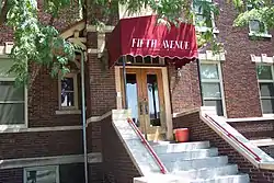 Ford Hospital |
March 20, 1986 (#86000444) |
121-129 S. 25th St. 41°15′32″N 95°56′52″W |
Omaha | |
| 56 | Fort Omaha Historic District | 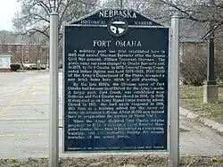 Fort Omaha Historic District |
March 27, 1974 (#74001112) |
30th St. between Fort St. and Laurel Ave. 41°18′29″N 95°57′32″W |
Omaha | |
| 57 | Franklin School | 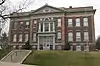 Franklin School |
February 5, 1998 (#98000070) |
4302 S. 39th Ave. 41°12′59″N 95°58′22″W |
Omaha | |
| 58 | Gallagher Building | 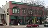 Gallagher Building |
July 1, 1994 (#94000653) |
1902-1906 S. 13th St. 41°14′28″N 95°56′01″W |
Omaha | |
| 59 | Garneau-Kilpatrick House | 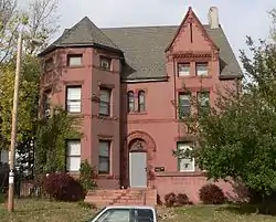 Garneau-Kilpatrick House |
October 7, 1982 (#82000602) |
3100 Chicago St. 41°15′45″N 95°57′31″W |
Omaha | |
| 60 | Georgia Row House | _from_SE_1.JPG.webp) Georgia Row House |
November 12, 1982 (#82000603) |
1040-1044 S. 29th St. 41°14′58″N 95°57′18″W |
Omaha | |
| 61 | Gold Coast Historic District |  Gold Coast Historic District |
March 14, 1997 (#97000237) |
Roughly bounded by 36th, 40th, Jones, and Cuming Sts. 41°15′39″N 95°58′08″W |
Omaha | |
| 62 | J.A. Gross Commercial Building |  J.A. Gross Commercial Building |
July 24, 2017 (#100001354) |
4801-4811 NW. Radial Hwy. 41°16′53″N 95°59′09″W |
Omaha | |
| 63 | Hanscom Apartments |  Hanscom Apartments |
November 14, 2016 (#16000773) |
1029 Park Ave. 41°14′59″N 95°57′20″W |
Omaha | As of 2016, operated as "Bristol Apartments"[11] |
| 64 | Havens-Page House |  Havens-Page House |
October 7, 1982 (#82000604) |
101 N. 39th St. 41°15′21″N 95°57′51″W |
Omaha | |
| 65 | USS HAZARD (AM-240) National Historic Landmark |  USS HAZARD (AM-240) National Historic Landmark |
January 1, 1979 (#79003712) |
2497 Freedom Park Rd 41°16′35″N 95°54′05″W |
Omaha | |
| 66 | U.S.S. HAZARD and U.S.S. MARLIN | 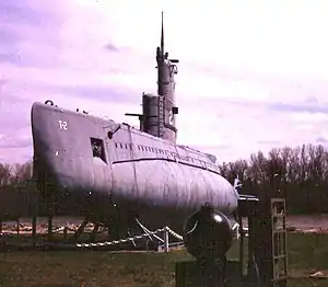 U.S.S. HAZARD and U.S.S. MARLIN |
January 17, 1979 (#79001444) |
2497 Freedom Park Rd 41°16′35″N 95°54′05″W |
Omaha | |
| 67 | Hill Hotel | _from_NW_-_Omaha%252C_Nebraska_(2022).jpg.webp) Hill Hotel |
April 20, 1988 (#88000377) |
509 S. 16th St. 41°15′19″N 95°56′12″W |
Omaha | |
| 68 | Hope Lutheran Church | 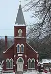 Hope Lutheran Church |
November 10, 2020 (#100005768) |
2721 North 30th St. 41°17′02″N 95°57′23″W |
Omaha | |
| 69 | Holy Family Church | _1.jpg.webp) Holy Family Church |
July 17, 1986 (#86001715) |
915 N. 18th St. 41°16′07″N 95°56′20″W |
Omaha | |
| 70 | Holy Sepulchre Cemetery | 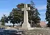 Holy Sepulchre Cemetery |
November 15, 2016 (#16000774) |
4912 Leavenworth St. 41°15′15″N 95°59′17″W |
Omaha | |
| 71 | Anton Hospe Music Warehouse | 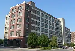 Anton Hospe Music Warehouse |
July 23, 1998 (#98000896) |
109-111 S. 10th St. 41°15′33″N 95°55′43″W |
Omaha | Now part of the Omaha Downtown Courtyard Marriott hotel; also occupied by Advanced Surgery Center. |
| 72 | Howard Street Apartment District | 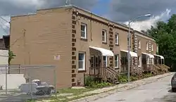 Howard Street Apartment District |
November 22, 1996 (#96001382) |
Roughly bounded by Harney St., 22nd St., Landon Ct., and 24th St. 41°15′21″N 95°56′44″W |
Omaha | |
| 73 | Hupmobile Building |  Hupmobile Building |
November 12, 2014 (#14000909) |
2523-2525 Farnam St. 41°15′27″N 95°56′57″W |
Omaha | |
| 74 | Immaculate Conception Church and School | 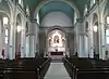 Immaculate Conception Church and School |
May 6, 1998 (#98000390) |
2708-2716 S. 24th St.[12] 41°14′01″N 95°56′51″W |
Omaha | Church still operating; school building has been converted to apartments. |
| 75 | Immanuel Deaconess Institute Nurses' Home and School for Nursing | July 24, 2017 (#100001355) |
3483 Larimore Ave. 41°18′07″N 95°57′56″W |
Omaha | ||
| 76 | Jewell Building | _from_W_1.JPG.webp) Jewell Building |
July 21, 1983 (#83001091) |
2221-2225 N. 24th St. 41°16′47″N 95°56′48″W |
Omaha | |
| 77 | George A. Joslyn Mansion | 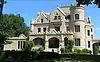 George A. Joslyn Mansion |
August 25, 1972 (#72000747) |
3902 Davenport St. 41°15′42″N 95°58′18″W |
Omaha | |
| 78 | Keeline Building | 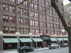 Keeline Building |
March 9, 2000 (#00000170) |
319 S. 17th St. 41°15′23″N 95°56′16″W |
Omaha | |
| 79 | George H. Kelly House |  George H. Kelly House |
July 21, 1983 (#09140009) |
1924 Binney St. 41°17′11″N 95°56′31″W |
Omaha | |
| 80 | Kennedy Building | _from_NW_2.JPG.webp) Kennedy Building |
August 23, 1985 (#85001794) |
1517 Jackson St. 41°15′15″N 95°56′13″W |
Omaha | |
| 81 | Mary Rogers Kimball House | _from_S_2.JPG.webp) Mary Rogers Kimball House |
July 19, 1996 (#96000765) |
2236 St. Mary's Ave. 41°15′15″N 95°56′46″W |
Omaha | |
| 82 | Kirschbraun and Sons Creamery, Inc. | _from_NE_3.JPG.webp) Kirschbraun and Sons Creamery, Inc. |
July 23, 1998 (#98000894) |
901 Dodge St. 41°15′34″N 95°55′41″W |
Omaha | |
| 83 | Leavenworth Park Commercial Historic District | August 1, 2023 (#100009208) |
3114-3120 St Mary’s Ave. and 3105-3512 Leavenworth St. 41°15′09″N 95°57′30″W |
Omaha | ||
| 84 | Leone, Florentine and Carpathia Apartment Buildings | _from_NW_1.JPG.webp) Leone, Florentine and Carpathia Apartment Buildings |
May 16, 1985 (#85001073) |
832 S. 24th St., 834 S. 24th St., and 907-911 S. 25th St. 41°15′04″N 95°56′53″W |
Omaha | |
| 85 | Lincoln Highway |  Lincoln Highway |
December 1, 1987 (#87002098) |
County Road 120 between 180th and 191st Sts. 41°17′00″N 96°11′45″W |
Elkhorn | |
| 86 | Lincoln Highway-Omaha to Elkhorn | .JPG.webp) Lincoln Highway-Omaha to Elkhorn |
March 13, 2003 (#03000104) |
Segment of approximately 3 miles (4.8 km) along N. 174 St. 41°16′18″N 96°12′07″W |
Elkhorn | |
| 87 | Little Bohemia |  Little Bohemia |
July 1, 2020 (#100005336) |
Roughly South 13th St. from Hickory St. to 1 block north of William St. 41°14′41″N 95°56′00″W |
Omaha | |
| 88 | Livestock Exchange Building |  Livestock Exchange Building |
July 7, 1999 (#99000751) |
2900 O Plaza 41°12′36″N 95°57′06″W |
Omaha | |
| 89 | The Logan | _from_SE_2.JPG.webp) The Logan |
July 22, 2005 (#05000721) |
1804 Dodge 41°15′36″N 95°56′25″W |
Omaha | |
| 90 | Malcolm X House Site | 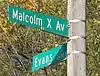 Malcolm X House Site |
March 1, 1984 (#84002463) |
3448 Pinkney St. 41°17′26″N 95°57′49″W |
Omaha | |
| 91 | The Margaret | _from_SW_1.JPG.webp) The Margaret |
May 15, 2007 (#07000427) |
2103 N. 16th St. 41°16′41″N 95°56′13″W |
Omaha | |
| 92 | Mason School | Mason School |
March 13, 1986 (#86000339) |
1012 S. 24th St. 41°15′01″N 95°56′52″W |
Omaha | |
| 93 | Charles D. McLaughlin House | _from_W_1.JPG.webp) Charles D. McLaughlin House |
November 8, 1982 (#82000605) |
507 S. 38th St. 41°15′20″N 95°58′07″W |
Omaha | |
| 94 | The Melrose | _from_SE_5.JPG.webp) The Melrose |
November 29, 1989 (#89002044) |
602 N. 33rd St. 41°15′54″N 95°57′43″W |
Omaha | |
| 95 | Memmen Apartments | _facade%252C_Memmen_Apartments%252C_Florence_Blvd.%252C_Omaha%252C_NE.JPG.webp) Memmen Apartments |
September 22, 2014 (#14000701) |
2214, 2216, 2218, and 2220 Florence Boulevard 41°16′47″N 95°56′28″W |
Omaha | |
| 96 | Dr. Samuel D. Mercer House |  Dr. Samuel D. Mercer House |
June 17, 1976 (#76001130) |
3920 Cuming St. 41°16′07″N 95°58′20″W |
Omaha | |
| 97 | Meyer and Raapke |  Meyer and Raapke |
September 4, 2013 (#13000673) |
1403-1407 Harney St.[13] 41°15′23″N 95°56′06″W |
Omaha | Part of the Warehouses in Omaha MPS |
| 98 | Military Road Segment | _(1).JPG.webp) Military Road Segment |
December 10, 1993 (#93001400) |
Junction of 82nd and Fort Sts. 41°18′31″N 96°02′34″W |
Omaha | |
| 99 | Minne Lusa Residential Historic District |  Minne Lusa Residential Historic District |
April 25, 2014 (#14000178) |
Roughly bounded by Redick Ave. and Vane, N. 30th, and N. 24th Sts. 41°19′15″N 95°57′07″W |
Omaha | |
| 100 | G.C. Moses Block | G.C. Moses Block |
March 9, 2000 (#00000169) |
1234-1244 S. 13th St. 41°14′48″N 95°56′01″W |
Omaha | |
| 101 | Moyer Row Houses | Moyer Row Houses |
March 12, 2008 (#08000171) |
2612-2614 and 2616-2618 Dewey 41°15′22″N 95°57′04″W |
Omaha | |
| 102 | Nash Block |  Nash Block |
May 16, 1985 (#85001072) |
902-912 Farnam 41°15′28″N 95°55′40″W |
Omaha | |
| 103 | National Indemnity Company Headquarters | 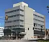 National Indemnity Company Headquarters |
May 18, 2017 (#100000765) |
3024 Harney St. 41°15′25″N 95°57′27″W |
Omaha | |
| 104 | Nebraska Buick Auto Company | June 27, 2019 (#100004138) |
1901 Howard St. 41°15′20″N 95°56′29″W |
Omaha | ||
| 105 | Nebraska School for the Deaf | 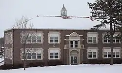 Nebraska School for the Deaf |
June 10, 2019 (#100003571) |
3223 N. 45th St. 41°17′14″N 95°58′50″W |
Omaha | |
| 106 | Henry B. Neef House | 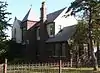 Henry B. Neef House |
September 16, 2010 (#10000758) |
2884 Iowa St. 41°19′29″N 95°57′22″W |
Omaha | |
| 107 | Nicholas Street Historic District | _E_bldg_from_SE_1.JPG.webp) Nicholas Street Historic District |
March 2, 2009 (#09000070) |
Bounded by N. 11th St., Izard, N. 14th St., and a line parallel to and roughly 450 feet (140 m) north of Nicholas St. 41°16′11″N 95°55′56″W |
Omaha | |
| 108 | Normandie Apartments | _from_SE.jpg.webp) Normandie Apartments |
December 6, 1991 (#91001758) |
1102 Park Ave. 41°14′55″N 95°57′21″W |
Omaha | |
| 109 | North 24th and Lake Streets Historic District | 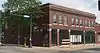 North 24th and Lake Streets Historic District |
April 12, 2016 (#16000159) |
N. 24th St. between Ohio St. and Patrick Ave., and Lake St. between 26th and 22nd Sts. 41°16′54″N 95°56′49″W |
Omaha | |
| 110 | North Presbyterian Church |  North Presbyterian Church |
March 20, 1986 (#86000443) |
3105 N. 24th St. 41°17′14″N 95°56′48″W |
Omaha | |
| 111 | Northern Natural Gas Building |  Northern Natural Gas Building |
August 26, 2009 (#09000649) |
2223 Dodge St. 41°15′34″N 95°56′47″W |
Omaha | |
| 112 | Northwestern Bell Telephone Company Regional Headquarters | _from_NE_1.JPG.webp) Northwestern Bell Telephone Company Regional Headquarters |
July 17, 2009 (#09000526) |
100 S. 19th St. 41°15′34″N 95°56′30″W |
Omaha | |
| 113 | Notre Dame Academy and Convent |  Notre Dame Academy and Convent |
March 5, 1998 (#98000192) |
3501 State St. 41°20′04″N 95°58′06″W |
Omaha | |
| 114 | The Nottingham Apartments | _804-808_N_33_St_from_E_1.JPG.webp) The Nottingham Apartments |
April 23, 2013 (#13000195) |
3304 Burt St. 41°16′02″N 95°57′43″W |
Omaha | |
| 115 | Oft-Gordon House |  Oft-Gordon House |
March 17, 2010 (#10000080) |
11523 156th St. 41°21′52″N 96°09′29″W |
Bennington | Now operated as Oft's Bed & Breakfast.[14] |
| 116 | Old Market Historic District |  Old Market Historic District |
March 23, 1979 (#79001441) |
Bounded by 13th, Farnam, 10th, and Jackson 41°15′20″N 95°55′51″W |
Omaha | |
| 117 | Old People's Home | Old People's Home |
October 21, 1987 (#87001182) |
3325 Fontenelle Boulevard 41°17′25″N 95°58′56″W |
Omaha | Now known as the Leo Vaughan Senior Manor |
| 118 | Olson's Market |  Olson's Market |
September 3, 2013 (#13000276) |
6115 Maple St. 41°17′06″N 96°00′29″W |
Omaha | |
| 119 | Omaha Auto Row Historic District | November 12, 2019 (#100004607) |
Roughly bounded by Douglas St., Dewey St., S. 24th Ave. & S. 28th St. 41°15′26″N 95°57′03″W |
Omaha | ||
| 120 | Omaha Bolt, Nut and Screw Building |  Omaha Bolt, Nut and Screw Building |
July 10, 1992 (#92000816) |
1316 Jones St. 41°15′13″N 95°56′02″W |
Omaha | |
| 121 | Omaha Ford Motor Company Assembly Plant | 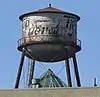 Omaha Ford Motor Company Assembly Plant |
December 29, 2004 (#04001412) |
1514-1524 Cuming St. 41°16′05″N 95°56′11″W |
Omaha | |
| 122 | Omaha High School | 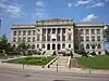 Omaha High School |
October 11, 1979 (#79003684) |
124 N. 20th St. 41°15′39″N 95°56′36″W |
Omaha | Omaha Central High School |
| 123 | Omaha National Bank Building | 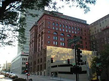 Omaha National Bank Building |
October 18, 1972 (#72000748) |
17th and Farnam Sts. 41°15′28″N 95°56′16″W |
Omaha | |
| 124 | Omaha Park and Boulevard System | _1.JPG.webp) Omaha Park and Boulevard System |
April 23, 2013 (#13000196) |
20 city parks, 4 golf courses, and 19 connecting boulevards, including Riverview, Hanscom, and Fontenelle Parks 41°14′32″N 95°57′29″W |
Omaha | |
| 125 | Omaha Power Plant Building | 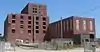 Omaha Power Plant Building |
July 1, 2015 (#15000394) |
505 Marcy St. 41°15′08″N 95°55′18″W |
Omaha | |
| 126 | Omaha Public Library | 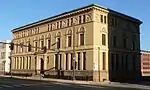 Omaha Public Library |
May 22, 1978 (#78001696) |
1823 Harney St. 41°15′23″N 95°56′26″W |
Omaha | |
| 127 | Omaha Quartermaster Depot Historic District | 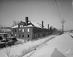 Omaha Quartermaster Depot Historic District |
July 26, 1979 (#79003685) |
Roughly bounded by Hickory and 22nd Sts., Woolworth Ave., and the Union Pacific railroad line 41°14′39″N 95°56′36″W |
Omaha | |
| 128 | Omaha Rail and Commerce Historic District |  Omaha Rail and Commerce Historic District |
July 19, 1996 (#96000769) |
Roughly bounded by Jackson, 15th, and 8th Sts., and the Union Pacific main line 41°15′09″N 95°55′46″W |
Omaha | |
| 129 | The Omaha Star | 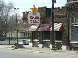 The Omaha Star |
December 27, 2007 (#07001322) |
2216 N. 24th St. 41°16′47″N 95°56′49″W |
Omaha | |
| 130 | On Leong Tong House | 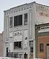 On Leong Tong House |
November 9, 2017 (#100001799) |
1518 Cass St. 41°15′49″N 95°56′12″W |
Omaha | Society house for a Chinese tong. |
| 131 | Orchard Hill Commercial Historic District | November 12, 2020 (#100005767) |
4002-4016 Hamilton St., 1324-1330, 1406-1412 North 40th St. 41°16′20″N 95°58′22″W |
Omaha | ||
| 132 | The Ottawa Block | The Ottawa Block |
April 22, 2013 (#13000197) |
2401 Farnam St. 41°15′27″N 95°56′50″W |
Omaha | |
| 133 | Packer's National Bank Building | _from_W_1.JPG.webp) Packer's National Bank Building |
May 16, 1985 (#85001071) |
4939 S. 24th St. 41°12′31″N 95°56′48″W |
Omaha | |
| 134 | Park Avenue Apartment District |  Park Avenue Apartment District |
July 2, 2008 (#08000602) |
2935 Leavenworth St., 804 Park Ave., 803 S. 30th St., 2934 Leavenworth St., 720 Park Ave., and 721 S. 30th St. 41°15′10″N 95°57′22″W |
Omaha | |
| 135 | Park School | _E_entrance_1.JPG.webp) Park School |
November 29, 1989 (#89002043) |
1320 S. 29th St. 41°14′46″N 95°57′17″W |
Omaha | |
| 136 | Frank Parker Archeological Site | March 4, 2009 (#09000069) |
Address Restricted |
Florence | Extends into Washington County[4] | |
| 137 | Peerless Motor Company | _from_SW_1.JPG.webp) Peerless Motor Company |
November 15, 2007 (#07001188) |
2562-2564 Harney St. 41°15′24″N 95°56′58″W |
Omaha | |
| 138 | Carl Penke Farm | March 21, 2007 (#07000178) |
10525 N. 168th St. 41°21′17″N 96°10′24″W |
Bennington | ||
| 139 | The Polish Home | The Polish Home |
November 16, 2015 (#15000793) |
4701 S. 25th St. 41°12′43″N 95°56′53″W |
Omaha | Now El Museo Latino[15] |
| 140 | Poppleton Block | 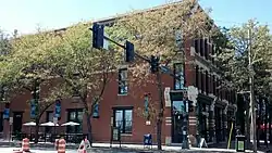 Poppleton Block |
October 7, 1982 (#82000606) |
1001 Farnam St. 41°15′26″N 95°55′45″W |
Omaha | |
| 141 | Porter-Thomsen House | _from_SE_1.JPG.webp) Porter-Thomsen House |
October 21, 1982 (#82000607) |
3426 Lincoln Boulevard 41°16′09″N 95°57′53″W |
Omaha | |
| 142 | Prague Hotel | Prague Hotel |
July 9, 1987 (#87001148) |
1402 S. 13th St. 41°14′43″N 95°56′00″W |
Omaha | |
| 143 | Redick Tower | _from_SE_3.JPG.webp) Redick Tower |
June 21, 1984 (#84002470) |
1504 Harney St. 41°15′24″N 95°56′10″W |
Omaha | |
| 144 | J. C. Robinson House | _from_NW.jpg.webp) J. C. Robinson House |
November 28, 1980 (#80002452) |
102 E. Lincoln Ave. 41°17′33″N 96°16′51″W |
Waterloo | |
| 145 | Lizzie Robinson House |  Lizzie Robinson House |
February 25, 1993 (#93000058) |
2864 Corby St. 41°17′04″N 95°57′17″W |
Omaha | |
| 146 | Rose Realty-Securities Building | _from_NW_1.JPG.webp) Rose Realty-Securities Building |
July 19, 1996 (#96000766) |
305 S. 16th St. 41°15′26″N 95°56′13″W |
Omaha | |
| 147 | Rosewater School | Rosewater School |
May 16, 1985 (#85001070) |
3764 S. 13th St. 41°13′25″N 95°56′02″W |
Omaha | |
| 148 | Sacred Heart Catholic Church Complex |  Sacred Heart Catholic Church Complex |
March 24, 1983 (#83001093) |
2218 Binney St. 41°17′11″N 95°56′45″W |
Omaha | |
| 149 | Saddle Creek Underpass | Saddle Creek Underpass |
June 29, 1992 (#92000741) |
U.S. Route 6 (Dodge St.) over Saddle Creek Rd. 41°15′35″N 95°58′50″W |
Omaha | |
| 150 | St. Cecilia's Cathedral | 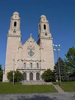 St. Cecilia's Cathedral |
January 25, 1979 (#79001442) |
701 N. 40th St. 41°15′59″N 95°58′18″W |
Omaha | |
| 151 | St. John's A.M.E. Church |  St. John's A.M.E. Church |
May 29, 1980 (#80002449) |
2402 N. 22nd St. 41°16′51″N 95°56′42″W |
Omaha | |
| 152 | Saint Joseph Parish Complex | _16th_St_from_SE_1.JPG.webp) Saint Joseph Parish Complex |
July 17, 1986 (#86001716) |
1730 S. 16th St. 41°14′30″N 95°56′15″W |
Omaha | |
| 153 | St. Martin of Tours Episcopal Church | _from_W_1.JPG.webp) St. Martin of Tours Episcopal Church |
October 21, 1982 (#82000608) |
2312 J St. 41°12′54″N 95°56′48″W |
Omaha | |
| 154 | St. Matthias' Episcopal Church |  St. Matthias' Episcopal Church |
November 23, 1980 (#80002450) |
1423 S. 10th St. 41°14′42″N 95°55′44″W |
Omaha | |
| 155 | St. Philomena's Cathedral and Rectory |  St. Philomena's Cathedral and Rectory |
January 3, 1980 (#80002451) |
1335 S. 10th St. 41°14′45″N 95°55′43″W |
Omaha | Now known as St. Frances Cabrini Church; adjacent school has been renamed All Saints |
| 156 | St. Richard's Catholic School and Rectory |  St. Richard's Catholic School and Rectory |
March 12, 2012 (#12000103) |
4318 and 4320 Fort St. 41°18′29″N 95°58′43″W |
Omaha | |
| 157 | Sanford Hotel | _from_NW_1.JPG.webp) Sanford Hotel |
September 26, 1985 (#85002556) |
1913 Farnam St. 41°15′26″N 95°56′30″W |
Omaha | Now the Conant Apartments. |
| 158 | Saunders School | _from_NW.jpg.webp) Saunders School |
March 13, 1986 (#86000336) |
415 N. 41st Ave. 41°15′48″N 95°58′28″W |
Omaha | |
| 159 | Scott-Omaha Tent and Awning Company |  Scott-Omaha Tent and Awning Company |
January 10, 2017 (#16000775) |
1501 Howard St. 41°15′19″N 95°56′10″W |
Omaha | |
| 160 | Scottish Rite Cathedral | _from_NE_3.JPG.webp) Scottish Rite Cathedral |
August 10, 2011 (#11000529) |
202 S. 20th St. 41°15′30″N 95°56′34″W |
Omaha | |
| 161 | Selby Apartments | Selby Apartments |
December 30, 2004 (#04001411) |
830 S. 37th St., 3710 Marcy St., and 825 S. 37th Ave. 41°15′05″N 95°58′04″W |
Omaha | |
| 162 | Selma Terrace |  Selma Terrace |
July 2, 2008 (#08000603) |
630, 634 and 636 Park Ave. 41°15′11″N 95°57′21″W |
Omaha | |
| 163 | M. F. Shafer and Co. Building | 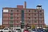 M. F. Shafer and Co. Building |
December 5, 2002 (#02001477) |
1624 Webster 41°15′57″N 95°56′17″W |
Omaha | |
| 164 | The Sherman | 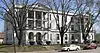 The Sherman |
March 13, 1986 (#86000334) |
2501 N. 16th St. 41°16′55″N 95°56′13″W |
Omaha | |
| 165 | Simon Brothers Company | _from_SW_1.JPG.webp) Simon Brothers Company |
April 1, 1999 (#99000423) |
1024 Dodge St. 41°15′36″N 95°55′48″W |
Omaha | |
| 166 | South Omaha Main Street Historic District |  South Omaha Main Street Historic District |
February 14, 1989 (#88002828) |
Roughly S. 24th St. between M and O Sts. 41°12′35″N 95°56′49″W |
Omaha | |
| 167 | Christian Specht Building | _from_SW_2.JPG.webp) Christian Specht Building |
September 19, 1977 (#77000828) |
1110 Douglas St. 41°15′32″N 95°55′52″W |
Omaha | |
| 168 | Stabrie Grocery | 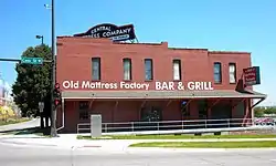 Stabrie Grocery |
November 15, 2007 (#07001189) |
501 N. 13th St. 41°15′50″N 95°56′01″W |
Omaha | |
| 169 | Standard Oil Company Building of Nebraska | _from_NE_1.JPG.webp) Standard Oil Company Building of Nebraska |
August 24, 1979 (#79001443) |
500 S. 18th St. 41°15′19″N 95°56′24″W |
Omaha | |
| 170 | Steiner Rowhouse No. 1 | _from_E_2.JPG.webp) Steiner Rowhouse No. 1 |
July 3, 1991 (#91000836) |
638-642 S. 19th St. 41°15′12″N 95°56′27″W |
Omaha | |
| 171 | Steiner Rowhouse No. 2 | 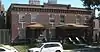 Steiner Rowhouse No. 2 |
July 3, 1991 (#91000837) |
1906-1910 Jones St. 41°15′11″N 95°56′28″W |
Omaha | |
| 172 | Stephenson and Williams Livery |  Stephenson and Williams Livery |
October 27, 2022 (#1000083147) |
1114 Florence Blvd. 41°16′14″N 95°56′28″W |
Omaha | |
| 173 | Gottlieb Storz House |  Gottlieb Storz House |
August 7, 1974 (#74001113) |
3708 Farnam St. 41°15′29″N 95°58′04″W |
Omaha | |
| 174 | Strehlow Terrace | Strehlow Terrace |
December 23, 1986 (#86003446) |
2024 and 2107 N. 16th St. 41°16′41″N 95°56′18″W |
Omaha | Now operated as Ernie Chambers Court[16] |
| 175 | Swartz Printing Company Building | _from_E_1.JPG.webp) Swartz Printing Company Building |
July 3, 2007 (#07000658) |
714 S. 15th St. 41°15′10″N 95°56′10″W |
Omaha | |
| 176 | Swoboda Bakery |  Swoboda Bakery |
July 19, 1996 (#96000768) |
1422 William St. 41°14′45″N 95°56′09″W |
Omaha | |
| 177 | Terrace Court |  Terrace Court |
July 2, 2008 (#08000604) |
836, 840, and 842 Park Ave. 41°15′04″N 95°57′21″W |
Omaha | |
| 178 | H. Thiessen Pickle Company | H. Thiessen Pickle Company |
December 13, 2011 (#11000887) |
3101 S. 24th St. 41°13′49″N 95°56′49″W |
Omaha | |
| 179 | Traver Brothers Row Houses | .JPG.webp) Traver Brothers Row Houses |
May 21, 2013 (#12001074) |
2601-2607 Jones St. and 651-672 S. 26th Ave. 41°15′11″N 95°57′03″W |
Omaha | |
| 180 | Trinity Cathedral | 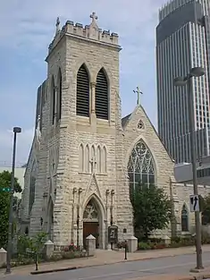 Trinity Cathedral |
August 7, 1974 (#74001114) |
113 N. 18th St. 41°15′37″N 95°56′21″W |
Omaha | |
| 181 | Turner Court Apartments | Turner Court Apartments |
November 12, 2014 (#14000910) |
3106 Dodge St. 41°15′36″N 95°57′29″W |
Omaha | |
| 182 | Twin Towers | 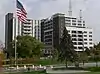 Twin Towers |
March 22, 2010 (#10000081) |
3000, 3002 and 3002½ Farnam St.; 3001 Douglas St. 41°15′29″N 95°57′25″W |
Omaha | |
| 183 | Undine Apartments | _from_SW_1.JPG.webp) Undine Apartments |
March 12, 2008 (#08000172) |
2620-2626 Dewey Ave. 41°15′22″N 95°57′05″W |
Omaha | |
| 184 | Union State Bank Building | 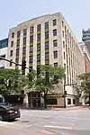 Union State Bank Building |
September 2, 2021 (#100006794) |
1904 Farnam St. 41°15′28″N 95°56′29″W |
Omaha | |
| 185 | Union Passenger Terminal | .JPG.webp) Union Passenger Terminal |
November 12, 1971 (#71000484) |
801 S. 10th St. 41°15′06″N 95°55′42″W |
Omaha | |
| 186 | Vinton School | Vinton School |
November 29, 1989 (#89002045) |
2120 Deer Park Boulevard 41°13′43″N 95°56′40″W |
Omaha | |
| 187 | Vinton Street Commercial Historic District | 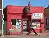 Vinton Street Commercial Historic District |
July 11, 2006 (#06000608) |
Vinton St. between Elm St. and S. 17th St. 41°14′00″N 95°56′20″W |
Omaha | |
| 188 | Weber Mill | 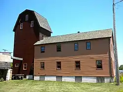 Weber Mill |
December 31, 1998 (#98001568) |
9102 N. 30th St. 41°20′37″N 95°57′41″W |
Omaha | aka Florence Mill |
| 189 | Webster Telephone Exchange Building |  Webster Telephone Exchange Building |
December 5, 1977 (#77000829) |
2213 Lake St. 41°16′53″N 95°56′44″W |
Omaha | |
| 190 | West Lawn Mausoleum |  West Lawn Mausoleum |
December 30, 2004 (#04001409) |
5701 Center St. 41°14′11″N 95°59′57″W |
Omaha | |
| 191 | Wohlner's Neighborhood Grocery | Wohlner's Neighborhood Grocery |
September 16, 2010 (#10000759) |
5203 Leavenworth St. 41°15′08″N 95°59′44″W |
Omaha | |
| 192 | Edgar Zabriskie House | 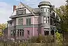 Edgar Zabriskie House |
November 28, 1978 (#78001697) |
3524 Hawthorne Ave. 41°16′13″N 95°57′56″W |
Omaha |
Former listings
Five properties were once listed but have been delisted. In addition, the historic Clarinda & Page Apartments, at 3027 Farnam Street and 305-11 Turner Boulevard in Omaha, were deemed in a report to be NRHP-eligible,[17] but they seem not to have actually been designated as eligible by the National Register program itself (as National Park Service "weekly lists" do not seem to record this).
| [3] | Name on the Register | Image | Date listed | Date removed | Location | City or town | Description |
|---|---|---|---|---|---|---|---|
| 1 | Guy C. Barton House | August 14, 1973 (#73001060) | March 5, 2018 | 3522 Farnam St. 41°15′29″N 95°57′52″W |
Omaha | Demolished in 1982 | |
| 2 | Jobbers' Canyon Historic District | 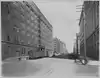 Jobbers' Canyon Historic District |
December 4, 1986[18] (#86003408) | March 26, 2002 | Roughly bounded by Farnam, 8th, Jackson, and 10th Sts. |
Omaha | Demolished in 1988.[19] |
| 3 | Main Street Bridge | Main Street Bridge |
June 29, 1992 (#92000746) | March 5, 2018 | Main St. over W. Papillion Creek 41°16′54″N 96°14′14″W |
Elkhorn | Apparently demolished and replaced with concrete slab bridge in photo. |
| 4 | Monmouth Park School | December 15, 1983 (#83003988) | March 5, 2018 | 4508 N. 33rd St. 41°17′59″N 95°57′41″W |
Omaha | Demolished in 1995.[20] | |
| 5 | John E. Reagan House |  John E. Reagan House |
May 5, 2014 (#14000201) | March 3, 2023 | 2102 Pinkney St. 41°17′27″N 95°56′38″W |
Omaha | |
| 6 | South Omaha Bridge | South Omaha Bridge |
June 29, 1992[21] (#92000742) | July 14, 2011 | U.S. Route 275/Nebraska Highway 92 over the Missouri River 41°12′47″N 95°55′57″W |
Omaha | Spanned Missouri River to Council Bluffs, Iowa; Highway Bridges in Nebraska MPS; demolished in February and March 2010[22] |
See also
References
- The latitude and longitude information provided in this table was derived originally from the National Register Information System, which has been found to be fairly accurate for about 99% of listings. Some locations in this table may have been corrected to current GPS standards.
- National Park Service, United States Department of the Interior, "National Register of Historic Places: Weekly List Actions", retrieved October 20, 2023.
- Numbers represent an alphabetical ordering by significant words. Various colorings, defined here, differentiate National Historic Landmarks and historic districts from other NRHP buildings, structures, sites or objects.
- "National Register Information System". National Register of Historic Places. National Park Service. April 24, 2008.
- The eight-digit number below each date is the number assigned to each location in the National Register Information System database, which can be viewed by clicking the number.
- See photo showing address
- "Atlas (Allas) Apartments". Omaha Landmarks Heritage Preservation Commission. Retrieved 2016-09-12.
- "Magnolia Hotel Omaha". Magnolia Hotels. Retrieved 2013-07-23.
- Address is visible on door in photo.
- Federal and state laws and practices restrict general public access to information regarding the specific location of this resource. In some cases, this is to protect archeological sites from vandalism, while in other cases it is restricted at the request of the owner. See: Knoerl, John; Miller, Diane; Shrimpton, Rebecca H. (1990), Guidelines for Restricting Information about Historic and Prehistoric Resources, National Register Bulletin, National Park Service, U.S. Department of the Interior, OCLC 20706997.
- Sources vary on the date of construction of Hanscom Apartments. Reconnaissance Survey of Selected Neighborhoods in Central Omaha, Nebraska; Historic Buildings Survey[Usurped!], p. 7, gives a construction date of 1920. "NSHPO Approves Three Nominations", Restoration Exchange Omaha, gives the date as 1921. "'Castle' purchase to help preserve affordable rentals", Omaha World-Herald, November 9, 2016, states that the apartments were built in 1922. All sources accessed January 18, 2017.
- For church's address, see "Contact". Archived 2012-02-13 at the Wayback Machine Immaculate Conception Church. Archived 2012-02-13 at the Wayback Machine Retrieved 2012-03-28. For school's address, see photo.
- "Meyer & Raapke". National Park Service. Retrieved 2013-09-30. An announcement of pending NRHP nomination, Federal Register, vol. 78, no. 160, August 19, 2013, p. 50445, gives the address as "1430-1407 Harney St."; this is probably an error, both because the addresses are out of numerical order and because odd and even addresses are on opposite sides of streets in Omaha.
- "Oft's Bed & Breakfast". Retrieved 2012-04-24.
- Hendee, David. "Streetcar barn, Polish Home — now El Museo Latino — join National Register of Historic Places". Omaha World-Herald. 2015-12-01. Retrieved 2015-12-08.
- "Omaha Housing Authority Ernie Chambers Court". Reinhardt & Associates, Architects. Retrieved 2013-07-22.
- Clarinda Karpov (June 19, 2014). "Letter to the editor: Help save historic Clarinda and Page apartments". Clarinda Herald-Journal.
- National Park Service, "Weekly list of actions taken on properties: 3/25/02 through 3/29/02". Retrieved 2011-12-13.
- "Jobbers Canyon demolition begins". The Lincoln Star. April 27, 1988. p. 20. Retrieved August 5, 2022 – via Newspapers.com.
- "Rescue Effort Fails; Historic School Razed." Omaha World-Herald. 1995-07-29. p. 54.
- National Park Service, "Weekly list of actions taken on properties: 7/11/11 through 7/15/11". Retrieved 2011-12-13.
- Kaufman, Kirby (March 14, 2010). "Rest of Veterans bridge demolished". Omaha World-Herald. Archived from the original on September 11, 2012. Retrieved July 27, 2011.
| Topics |  | |
|---|---|---|
| Lists by county |
| |
| Other lists |
| |
Municipalities and communities of Douglas County, Nebraska, United States | ||
|---|---|---|
| Cities | Map of Nebraska highlighting Douglas County | |
| Villages | ||
| CDPs | ||
| Unincorporated communities | ||
| See also | ||