List of cultural assets of Algeria
List of cultural assets of Algeria includes monuments, natural sites and parks, and other cultural assets as classed by the Algerian Ministry of Culture. The Ministry's list was updated in September 2019 with 1,030 cultural assets across the country. Skikda Province has the highest number of assets at 131.[1]
Adrar Province
There are 7 cultural assets in Adrar: 4 historical sites, 2 contemporary sites of cultural importance, and 1 nature reserve.[2]
| ID | Monument | Type | Municipality | Address | Coordinates | Image |
|---|---|---|---|---|---|---|
| 01-001 | Kasbah of Melouka | Historic | Ouled Ahmed Timmi | 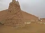 Kasbah of Melouka | ||
| 01-002 | Oasis Rouge Hotel | Contemporary | Timimoun | 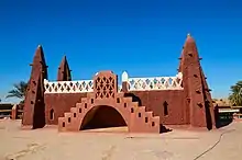 Oasis Rouge Hotel | ||
| 01-003 | Adrar El Kadim Hospital | Contemporary | Adrar |  Upload Photo | ||
| 01-004 | Touat-Gourara-Tidikelt cultural park | Nature reserve | Upload Photo | |||
| 01-005 | Ksar of Tamentit | Historic | Tamentit | 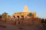 Ksar of Tamentit | ||
| 01-006 | Independence square | Historic | Timimoun | 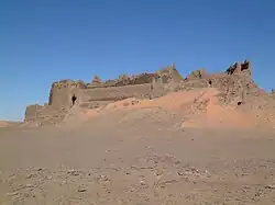 Independence square | ||
| 01-007 | Martyrs square | Historic | Adrar | 27°51′47″N 0°16′56″W | 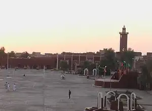 Martyrs square |
Chlef Province
| ID | Monument | Type | Municipality | Address | Coordinates | Image |
|---|---|---|---|---|---|---|
| 02-001 | Mosaic of a labyrinth, moved from St. Reparatus to Algiers Cathedral[3] | artwork/antiquity | Chlef | Upload Photo | ||
| 02-002 | Roman ruins of the Kalâa des ouled Abdallah | ruins/antiquity | Ténès | 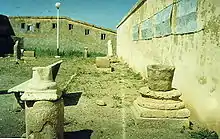 Roman ruins of the Kalâa des ouled Abdallah | ||
| 02-003 | Mosque of old Ténes | Islamic | Ténès | Upload Photo |
Laghouat Province
| ID | Monument | Type | Municipality | Address | Coordinates | Image |
|---|---|---|---|---|---|---|
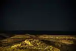
| 03-001 | Cave drawings | Artwork/prehistoric | El Ghicha | 33°55′04″N 2°04′36″E | _01.jpg.webp) Cave drawings | |
| 03-002 | Rocher Fromentin | Nature Park | Laghouat |  Rocher Fromentin | ||
| 03-003 | Oued Remailia cave drawings | Artwork/prehistoric | Sidi Makhlouf | Upload Photo | ||
| 03-004 | El Hasbaia | prehistoric site | Laghouat | Upload Photo | ||
| 03-005 | Zaouia Tidjania | Islamic | Aïn Madhi | 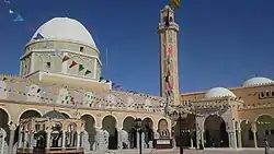 Zaouia Tidjania | ||
| 03-006 | Centrale électrique diesel de Laghouat | Modern industry | Laghouat | Upload Photo |
Oum El Bouaghi Province
| ID | Monument | Type | Municipality | Address | Coordinates | Image |
|---|---|---|---|---|---|---|
| 04-001 | Dolmens and Cromlechs | funerary/prehistoric | Sigus | Upload Photo |
Batna Province
| ID | Monument | Type | Municipality | Address | Coordinates | Image |
|---|---|---|---|---|---|---|
| 05-001 | Gorges of Tilatou | Nature Park | Tilatou | 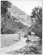 Gorges of Tilatou | ||
| 05-002 | Village of Bouzina | Nature Park | Bouzina | 35°16′52″N 6°07′01″E | 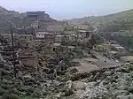 Village of Bouzina | |
| 05-003 | Village of Tagoust | Nature Park | Menaa | 35°13′37″N 6°02′31″E | Upload Photo | |
| 05-004 | Village of Amentane | Nature Park | Tigherghar | 35°07′02″N 5°56′19″E | 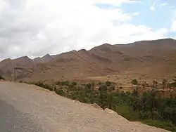 Village of Amentane | |
| 05-005 | Village of Tighanimine | Nature Park | Tighanimine |  Village of Tighanimine | ||
| 05-006 | Canyon of Ghoufi | Nature Park | T'Kout Ghassira |
35°02′57″N 6°10′02″E | ||
| 05-007 | Ruins of the ancient municipality of Tobna | Ruins/antiquity | Bitam | 35°20′59″N 5°20′58″E | Upload Photo | |
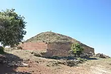
| 05-008 | Mausoleum of the Numidian kings, known as Medracen | Funerary/antiquity | Boumia | 35°42′26″N 6°26′04″E | ||
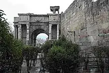
| 05-009 | Arc de triomphe of Markouna | Monument/antiquity | Tazoult | 35°29′11″N 6°17′16″E | 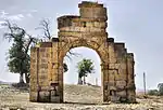 Arc de triomphe of Markouna | |
| 05-010 | Territories and monuments of Lambaesis | Antiquity | Tazoult | 35°29′25″N 6°15′17″E | 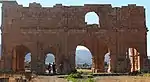 Territories and monuments of Lambaesis | |
| 05-011 | Territories and monuments of Thamugadi | Antiquity | Timgad (World Heritage Site) | 35°29′05″N 6°28′07″E | Territories and monuments of Thamugadi | |
| 05-012 | Gorges of Foum Ksentina | Nature Park | Oued Taga | 35°24′08″N 6°24′03″E |  Gorges of Foum Ksentina | |
| 05-013 | Territories and monuments of the Diana Veteranorum (Zana) of antiquity | Ancient sites and monuments | Zanet El Beida | 35°46′46″N 6°04′31″E |  Territories and monuments of the Diana Veteranorum (Zana) of antiquity | |
| 05-014 | Igelfen Granary[4] | antiquity | Tigherghar | Upload Photo | ||
| 05-015 | Village of Menâa | Nature Park | Menâa | 35°10′25″N 6°00′29″E | .jpg.webp) Village of Menâa | |
| 05-016 | Granary of Baloul | monuments of antiquity | Tigherghar | Upload Photo |
Béjaïa Province
| ID | Monument | Type | Municipality | Address | Coordinates | Image |
|---|---|---|---|---|---|---|
| 06-001 | Ruins of the fortified walls of the Fouka Gate | Ruins/Medieval | Béjaïa | 36°45′18″N 5°04′53″E | 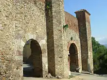 Ruins of the fortified walls of the Fouka Gate | |
| 06-002 | Fort Moussa known as Fort Barral | Fortification/Medieval | Béjaïa | 36°45′18″N 5°05′02″E | 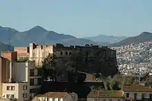 Fort Moussa known as Fort Barral | |
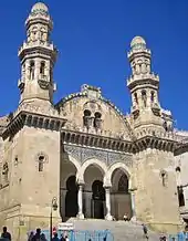
| 06-003 | Casbah de Béjaïa | Fortification/Medieval | Béjaïa | 36°45′05″N 5°05′02″E | ![Casbah de Béjaïa [fr]](../I/%D8%A8%D8%B1%D8%AC_%D8%A7%D9%84%D8%B1%D9%88%D9%85%D8%A7%D9%86.jpg.webp) Casbah de Béjaïa | |
| 06-004 | Porte Sarrasine or sea gate | Access/Medieval | Béjaïa | 36°45′12″N 5°05′15″E | 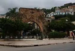 Porte Sarrasine or sea gate | |
| 06-005 | Corniche | Nature Park | Tichy | Upload Photo | ||
| 06-006 | Corniche | Nature Park | Aokas | Upload Photo | ||
| 06-007 | Corniche | Nature Park | Souk El Ténine | Upload Photo | ||
| 06-008 | Site of Tiklat | Archaeology site/Antiquity | El Kseur | 36°39′21″N 4°50′18″E | 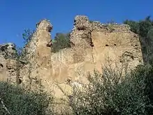 Site of Tiklat | |
| 06-009 | Roman cippus | funerary stone/Antiquity | Béjaïa | 36°45′13″N 5°05′11″E | 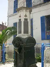 Roman cippus | |
| 06-010 | Mihrab of the Ibn Tumart mosque | Religious/Islamic | Oued Ghir | 36°42′49″N 5°01′14″E | 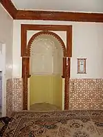 Mihrab of the Ibn Tumart mosque | |
| 06-011 | Citadel of the Zayyanid dynasty known as Lassouar | Fortification/Medieval | El Kseur | 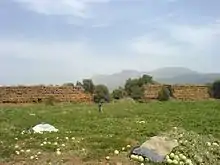 Citadel of the Zayyanid dynasty known as Lassouar | ||
| 06-012 | Roman cisterns | Antiquity | Béjaïa | 36°45′25″N 5°05′01″E | 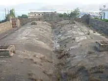 Roman cisterns | |
| 06-013 | Corniche | Nature Park | Béjaïa | 36°46′29″N 5°06′20″E | 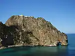 Corniche |
Biskra Province
| ID | Monument | Type | Municipality | Address | Coordinates | Image |
|---|---|---|---|---|---|---|
| 07-001 | ruins of thermal baths | ruins/antiquity | Biskra | Upload Photo | ||
| 07-002 | Gemellae | ruins/antiquity | M'Lili | Upload Photo | ||
| 07-003 | wooden door of the mosque | Architectural element | Sidi Okba | 34°45′19″N 5°54′24″E | 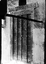 wooden door of the mosque | |
| 07-004 | Gorges and village of Djemina | Nature Park | M'Chouneche | 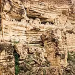 Gorges and village of Djemina | ||
| 07-005 | Village of Kebach | Nature Park | M'Chouneche | Upload Photo | ||
| 07-006 | Gorges of Khenguet Sidi-Nadji | Nature Park | Khenguet Sidi Nadji | Upload Photo | ||
| 07-007 | Islamic village Khenguet Sidi-Nadji, cave carvings around Ain-Naga |
prehistoric artwork | Aïn Naga | Upload Photo | ||
| 07-008 | milestone in Seba Mgata | Antiquity/navigation | El Kantara | Upload Photo | ||
| 07-009 | Inscription built into the gate of the caravanserail | Antiquity | El Outaya | Upload Photo | ||
| 07-010 | Ruins of the amphitheatre | Ruins/Antiquity | El Outaya | Upload Photo | ||
| 07-011 | Roman bridge | Antiquity | El Kantara | 35°14′01″N 5°42′06″E | 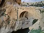 Roman bridge | |
| 07-012 | Lapidary collection in the municipal museum | Artwork/antiquity | El Kantara | 35°13′17″N 5°42′04″E | Lapidary collection in the municipal museum | |
| 07-013 | Gorges of El Kantara | Nature Park | El Kantara | 35°13′54″N 5°42′08″E | 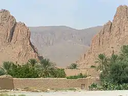 Gorges of El Kantara | |
| 07-014 | Mosque of Sidi Khaled | religious/Islam | Sidi Khaled | Upload Photo | ||
| 07-015 | Zaouia tidjania | Upload Photo | ||||
| 07-016 | Gorge of Sidi Masmoudi | Nature Park | M'Chouneche | Upload Photo |
Béchar Province
| ID | Monument | Type | Municipality | Address | Coordinates | Image |
|---|---|---|---|---|---|---|
| 08-001 | Ksar de Kenadsa | Living history | Kénadsa | Upload Photo | ||
| 08-002 | Ksar of Taghit | Living history | Taghit |  Ksar of Taghit | ||
| 08-003 | Ksar of Beni Abbes | living history | Béni Abbès |  Ksar of Beni Abbes | ||
| 08-004 | Necropolis (tumulus) | Upload Photo |
Blida Province
| ID | Monument | Type | Municipality | Address | Coordinates | Image |
|---|---|---|---|---|---|---|
| 09-001 | Chemin Abel de Chréa | nature park | Blida | 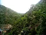 Chemin Abel de Chréa |
Bouira Province
| ID | Monument | Type | Municipality | Address | Coordinates | Image |
|---|---|---|---|---|---|---|
| 10-001 | Forest of Azrou, Taouialt and Tikjda cantons | nature park | Bechloul | Upload Photo | ||
| 10-002 | Inscription and ancient fragments deposited in Sour El-Ghozlane on the esplanade | Antiquity/epigraph | Sour El-Ghozlane | Upload Photo |
Tamanrasset Province
| ID | Monument | Type | Municipality | Address | Coordinates | Image |
|---|---|---|---|---|---|---|
| 11-001 | Abalessa and tomb (Tin-Hinan) | funerary monument/prehistoric | Tamanrasset, (Site of the Ahaggar) | 23°17′00″N 5°32′00″E |

Tébessa Province
| ID | Monument | Type | Municipality | Address | Coordinates | Image |
|---|---|---|---|---|---|---|
| 12-001 | Stations abris (shelter) of Bir Sedet | prehistoric | Chéria | Upload Photo | ||
| 12-002 | Garet Retba | prehistoric | Chéria | Upload Photo | ||
| 12-003 | Chabet Retba | prehistoric | Chéria | Upload Photo | ||
| 12-004 | Chabet Siboun | prehistoric | Chéria | Upload Photo | ||
| 12-005 | Damou Kermaia | prehistoric | Chéria | Upload Photo | ||
| 12-006 | Fadje Relilai Mengart | prehistoric | Chéria | Upload Photo | ||
| 12-007 | Foum Relilai Menguebba | prehistoric | Chéria | Upload Photo | ||
| 12-008 | Merget Sem El-Garbi | prehistoric | Chéria | Upload Photo | ||
| 12-009 | Oued Retem | prehistoric | Chéria | 34°53′48″N 7°47′15″E | Upload Photo | |
| 12-010 | Relilai Tlidjen | prehistoric | Chéria | 35°02′27″N 7°41′20″E | Upload Photo | |
| 12-011 | Ruins | Ruins/antiquity | Morsott | Upload Photo | ||
| 12-012 | Gorges of Bou Akkous | Nature Park | Morsott | Upload Photo | ||
| 12-013 | Grottos of Bou Akkous | Nature Park | Morsott | Upload Photo | ||
| 12-014 | Village of Youkous | Nature Park | Hammamet | 35°24′58″N 7°57′52″E | Upload Photo | |
| 12-015 | Arch of Caracalla | Monument/antiquity | Tebessa | 35°24′10″N 8°07′08″E | ||
| 12-016 | Amphitheatre, 4th century AD | Antiquity/venue | Tebessa | 35°24′04″N 8°07′26″E | Upload Photo | |
| 12-017 | Byzantine era wall | Fortification/antiquity | Tebessa | 35°24′09″N 8°07′08″E | 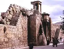 Byzantine era wall | |
| 12-018 | ruins of the basilica of St Crispinus, 4th century AD | religious/antiquity | Tebessa | 35°24′33″N 8°07′37″E | Upload Photo | |
| 12-019 | Quarter of the Zaouia | excavation site/antiquity | Tebessa | Upload Photo | ||
| 12-020 | Thèveste | Site and monuments/antiquity | Tebessa | 35°25′04″N 8°08′02″E | Upload Photo | |
| 12-021 | Roman temple of Khalia | religious/antiquity | Tebessa | 35°23′00″N 8°05′59″E | Upload Photo | |
| 12-022 | Tower of Djebel Mestiri | surveillance/antiquity | Tebessa | 35°25′04″N 7°59′30″E | Upload Photo |
Tlemcen Province
| ID | Monument | Type | Municipality | Address | Coordinates | Image |
|---|---|---|---|---|---|---|
| 13-001 | Port of Honaïne[5] | medieval | Honaïne | 35°10′35″N 1°39′18″W | Upload Photo | |
| 13-002 | Rampart of the Casbah | Fortification/medieval | Nedroma (World Heritage Site) | Upload Photo | ||
| 13-003 | Moorish baths | Thermal baths/medieval | Nedroma | Upload Photo | ||
| 13-004 | Mosque of the Gueddarines | Islamic | Nedroma |  Mosque of the Gueddarines | ||
| 13-005 | Mosque of Sidi-Mendil | Islamic | Nedroma |  Mosque of Sidi-Mendil | ||
| 13-006 | Grand Mosque | Islamic | Nedroma | Upload Photo | ||
| 13-007 | Marabout of Sidi Brahim | Funerary/Islamic | Nedroma | Upload Photo | ||
| 13-008 | Mausoleum of Sidi-Bouali | Funerary/Islamic | Nedroma | 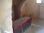 Mausoleum of Sidi-Bouali | ||
| 13-009 | Karar Lake deposit | prehistoric | Remchi | Upload Photo | ||
| 13-010 | Mosque of Beni Snous | Islamic | Beni Snous | Upload Photo | ||
| 13-011 | Village of Tafessera | Nature Park | Azaïls | Upload Photo | ||
| 13-012 | Village of Tleta | Nature Park | Azaïls | Upload Photo | ||
| 13-013 | Village of Zahra | Nature Park | Azaïls | Upload Photo | ||
| 13-014 | Mosque of Khemis | Islamic | (Remchi)? | Upload Photo | ||
| 13-015 | Mosque of Sidi Bou Ishaq Tayar | Islamic | Tlemcen | _02.jpg.webp) Mosque of Sidi Bou Ishaq Tayar | ||
| 13-016 | Grand mosque and grounds: Minaret of the Mosque | Islamic | Tlemcen | Upload Photo | ||
| 13-017 | Sidi-Belhassen Rachidi | Funerary/Islamic | Tlemcen | Upload Photo | ||
| 13-018 | Minaret of the Sidi-Hacéne mosque | Islamic | Tlemcen | Upload Photo | ||
| 13-019 | Sidi Boumediène Mosque and grounds: Medersas. | Islamic | Tlemcen | 34°53′08″N 1°19′05″W | 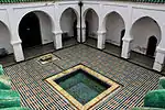 Sidi Boumediène Mosque and grounds: Medersas. | |
| 13-020 | Mosque of Sidi Bellahsen | Islamic | Tlemcen | Upload Photo | ||
| 13-021 | Mosque of Lala Erroyat | Islamic | Tlemcen | Upload Photo | ||
| 13-022 | Mosque of Sidi-Senoussi | Islamic | Tlemcen | Upload Photo | ||
| 13-023 | El Mechouar Mosque | Islamic | Tlemcen | Upload Photo | ||
| 13-024 | Mosque Bab Zir and two Marabouts of the cemetery of El Obbad Es Soufli | Islamic/Funerary | Tlemcen | Upload Photo | ||
| 13-025 | Mosque of the Oulad El-Imam | Islamic | Tlemcen | Upload Photo | ||
| 13-026 | Ancient Mosque of Sidi-El Ghali | Islamic | Tlemcen | Upload Photo | ||
| 13-027 | Marabout of Sidi Brahim | Funerary/Islamic | Tlemcen | Upload Photo | ||
| 13-028 | Marabout of Sidi-El Wahab | Funerary/Islamic | Tlemcen | Upload Photo | ||
| 13-029 | Kobba said of the Khalifat cemetery of Sidi-Yakoub | Funerary/Islamic | Tlemcen | Upload Photo | ||
| 13-030 | Kobba of Sidi El Daoudi | Funerary/Islamic | Tlemcen | Upload Photo | ||
| 13-031 | Agadir (site) | medieval | Tlemcen | Upload Photo | ||
| 13-032 | Mansourah Mosque, minaret and dependencies | religious/medieval | Mansourah | 34°52′15″N 1°20′20″W |  Mansourah Mosque, minaret and dependencies | |
| 13-033 | Mosque Sidi El Haloui and dependancies | religious/ medieval | Mansourah | Upload Photo | ||
| 13-034 | Tombs said to be of the sultana in the cemetery of Sidi Yakoub | Funerary/medieval | Mansourah | Upload Photo | ||
| 13-035 | Little palace of the sultans at El-Obbad in El Fouqui | Residence/ medieval | Mansourah | Upload Photo | ||
| 13-036 | Store and historic monument agency | Historic collections/Medieval | Mansourah | Upload Photo | ||
| 13-037 | Walls of Mansourah and ruins of the Macalla | Fortification/medieval | Mansourah | 34°52′15″N 1°20′21″W | 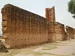 Walls of Mansourah and ruins of the Macalla | |
| 13-038 | Gate of Mansourah | Mansourah | 34°52′15″N 1°20′20″W | 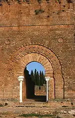 Gate of Mansourah | ||
| 13-039 | fragments from the Arab period in the city hall museum | Medieval | Mansourah | Upload Photo | ||
| 13-040 | Columns from the mosque of Mansourah | Architectural elements/medieval | Mansourah | Upload Photo | ||
| 13-041 | Tower and ruins of the gate of Sidi El Daoudi on the east face | surveillance/ruins/medieval | Mansourah | Upload Photo | ||
| 13-042 | Bab el Khemis gate | access/medieval | Tlemcen | Upload Photo | ||
| 13-043 | Ruins of the Tlemcen ramparts | ruins | Mansourah | Upload Photo | ||
| 13-044 | Bordjs and other works on the south and west faces | Fortification/medieval | Mansourah | Upload Photo | ||
| 13-045 | Gate of Bab El Kermadine on the northwest face improperly called "Bab El Toi" | access/Medieval | Tlemcen | Upload Photo | ||
| 13-046 | Minaret of Agadir | religious/medieval | Tlemcen | Upload Photo | ||
| 13-047 | Kobba of Sidi Abdallah Ben Mansour and of Sidi Ben Ali at Ain El Hout | Funerary/medieval | Tlemcen | Upload Photo | ||
| 13-048 | Ruins of Arab ramparts | ruins | Tlemcen | Upload Photo |
Tiaret Province
| ID | Monument | Type | Municipality | Address | Coordinates | Image |
|---|---|---|---|---|---|---|
| 14-001 | Djeddar | Thirteen funerary monuments of late antiquity | Medroussa-Louhou | 35°06′47″N 1°12′45″E | ||
| 14-002 | Bled Touta Lakania and grottos related to the tradition of the historian Ibn Khaldun | nature park | Frenda |  Bled Touta Lakania and grottos related to the tradition of the historian Ibn Khaldun | ||
| 14-003 | Dolmens | funerary monument/prehistoric | Tiaret | Upload Photo | ||
| 14-004 | Tahert-Tagdemt | medieval | Tagdemt | Upload Photo |
Tizi Ouzou Province
| ID | Monument | Type | Municipality | Address | Coordinates | Image |
|---|---|---|---|---|---|---|
| 15-001 | Roman ruins known as "El Habs El Ksour" | ruins/antiquity | Azzefoun | Upload Photo | ||
| 15-002 | Roman mausoleum of Teksebt | funerary/antiquity | Iflissen | Upload Photo | ||
| 15-003 | Ruined Roman temples and basilicas | ruins/religious/antiquity | Tigzirt (Iomnium) | Upload Photo |
Algiers Province
| ID | Monument | Type | Municipality | Address | Coordinates | Image |
|---|---|---|---|---|---|---|
| 16-001 | Dolmens Bologhine Ibnou Ziri | Funerary/Prehistoric | Bologhine | 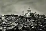 Dolmens Bologhine Ibnou Ziri | ||
| 16-002 | Roman inscription carved in a stone in the façade of a building on the corner of rue Bab Azzoun and rue Caftan | Epigraph/Antiquity | Casbah | Upload Photo | ||
| 16-003 | Vestiges of fortifications known as Bastion XI | Fortification/Medieval | Casbah | Upload Photo | ||
| 16-004 | Ketchaoua Mosque | Islamic | Algiers | 36°47′06″N 3°03′39″E | ||
| 16-005 | Ali Bitchin Mosque | Islamic | Casbah | |||
| 16-006 | Djamâa El Kebir | religious/Islamic | Casbah | 36°47′07″N 3°03′51″E | ||
| 16-007 | Mosque Abderrahmane El-Tâalbi | Islamic | Casbah | 36°47′17″N 3°03′35″E |  Mosque Abderrahmane El-Tâalbi | |
| 16-008 | Mosque Sidi Ramdane | Islamic | Casbah | 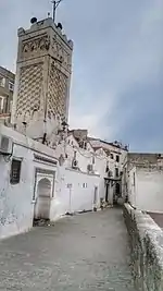 Mosque Sidi Ramdane | ||
| 16-009 | Casbah of Algiers (World Heritage Site) | living city center/Medieval | Casbah | 36°47′03″N 3°03′32″E |  Casbah of Algiers (World Heritage Site) | |
| 16-010 | Djamâa Safir | Islamic | Casbah-Oued Koriche | Upload Photo | ||
| 16-011 | Mosque Mohamed Cherif | Islamic | Casbah-Oued Koriche | Upload Photo | ||
| 16-012 | Marabout of the "Jardin Marengo", known as Tomb of the Queen | funerary/Islam | Casbah-Oued Koriche | Upload Photo | ||
| 16-013 | Hassen Pacha marabout with cupola, known as Ben Ali, on street of the same name | Funerary/Islamic | Casbah-Oued Koriche | Upload Photo | ||
| 16-014 | Dar Hassen Pacha | Abode/Modern | Casbah-Oued Koriche | Upload Photo | ||
| 16-015 | Group of Moorish houses (Bastion 23) ex. rue du 14 juin | Abodes/Modern | Casbah-Oued Koriche | Upload Photo | ||
| 16-016 | Dar Es Souf (formerly court of assises) | Abode/Modern | Casbah-Oued Koriche | Upload Photo | ||
| 16-017 | Dar Kkhaznadji (former Archbishopric) | Abode/Modern | Casbah-Oued Koriche | Upload Photo | ||
| 16-018 | Dar Mustapha Pacha (formerly the Bibliothèque Nationale) Abode/Modern Casbah (Oued Koriche Casbah) (Fortress) | Fortress/Modern | Casbah-Oued Koriche | 36°47′08″N 3°03′39″E | 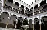 Dar Mustapha Pacha (formerly the Bibliothèque Nationale) Abode/Modern Casbah (Oued Koriche Casbah) (Fortress) | |
| 16-019 | Djamaa el Djedid | Islamic | Casbah-Oued Koriche | 36°47′06″N 3°03′47″E | ||
| 16-020 | Vestiges of the wall of the Medina of Algiers, including the front (Bab Azzoun) and northwest (Bab El Oued) | Fortification element/Medieval | Casbah-Oued Koriche | Upload Photo | ||
| 16-021 | Turkish gate of the Arsenal | Access/Medieval | Casbah-Oued Koriche | Upload Photo | ||
| 16-022 | Penon gate | Access/Medieval | Casbah-Oued Koriche | Upload Photo | ||
| 16-023 | Wine stalls fountain | waterwork/Medieval | Oued Koriche | Upload Photo | ||
| 16-024 | Fountain of the Admiralty | Artwork/Modern | Casbah-Oued Koriche | Upload Photo | ||
| 16-025 | Altar bible in the Protestant church in rue Chartes | religious/Medieval | Casbah-Oued Koriche | Upload Photo | ||
| 16-026 | Religious objects in the synagogues of impasse Boutin N°2 and rue Médée | religious/Medieval | Casbah-Oued Koriche | Upload Photo | ||
| 16-027 | Law scroll and silver religious objects of the synagogue in place Randon on the 2nd and 3rd floors of the consistory building, 1 rue Volland | religious objects/medieval | Casbah-Oued Koriche | Upload Photo | ||
| 16-028 | Parchments known as séraphines and ornaments of the synagogue in rue Scipion Manus | Religious/Medieval | Casbah-Oued Koriche | Upload Photo | ||
| 16-029 | Jardin Marengo | Nature Park | Casbah-Oued Koriche | Upload Photo | ||
| 16-030 | federal forest known as the Bois de Boulogne | Nature Park | Birmandreis | Upload Photo | ||
| 16-031 | Belvedere on the crest road | Nature Park | Birmandreis | Upload Photo | ||
| 16-032 | Woods around the Fort l'empereur | Nature Park | El Biar | Upload Photo | ||
| 16-033 | Citadel of the Fort l'empereur | Fortification/Modern | El Biar | Upload Photo | ||
| 16-034 | North section of the saint Raphaël cliff including parcels or partial parcels 12225, 1296, 1300, 1309, 1313 and 1315 in El Biar | Nature Park | El Biar | Upload Photo | ||
| 16-035 | Northwest end of the Sidi-Ferruch peninsula containing Roman ruins | Ruins/Roman | Sidi-Fredj | Upload Photo | ||
| 16-036 | "second weber" villa and the pine forest surrounding it on the spur of the saint Raphaël cliff | Abode et SN/Mod | El Biar | Upload Photo | ||
| 16-037 | Bordj Polignac | Fortification/Modern | Bouzaréah | Upload Photo | ||
| 16-038 | Setting of the Bordj Polignac | Nature Park | Bouzaréah | Upload Photo | ||
| 16-039 | Mosque and marabouts called de Sidi Madjouba | funerary/religious/Islamic | Bouzaréah | Upload Photo | ||
| 16-040 | Cemetery of sidi Madjouba | funerary/Islamic | Bouzaréah | Upload Photo | ||
| 16-041 | Tombs/megaliths on the plateau of Beni Messous | funerary/prehistoric | Beni Messous | Upload Photo | ||
| 16-042 | Villa Hussein-Dey | Abode/Modern | Hussein-Dey | Upload Photo | ||
| 16-043 | Site of the Villa Louvet | Nature Park | Hussein-Dey | Upload Photo | ||
| 16-044 | Villa des Arcades | Abode/Modern | El Madania | Upload Photo | ||
| 16-045 | site of the Villa des Arcades | Nature Park | El Madania | Upload Photo | ||
| 16-046 | Arab Fountains and marabout, or Hamma, place called les Platanes in the jardin d'Essai | Waterworks/Funeray/Modern | Sidi M'Hamed | Upload Photo | ||
| 16-047 | Villa Abdelatif | Abode/Modern | Sidi M'Hamed | Upload Photo | ||
| 16-048 | Villa Mahieddine | Abode/Modern | Sidi M'Hamed | Upload Photo | ||
| 16-049 | Public square | Nature Park | Bouzaréah | Upload Photo | ||
| 16-050 | Villa Mahieddine | Nature Park | Sidi M'Hamed | Upload Photo | ||
| 16-051 | Jardin d'essai of Hamma | Nature Park | Alger-Annassers | 36°44′53″N 3°04′34″E | 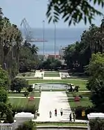 Jardin d'essai of Hamma | |
| 16-052 | Parc de la liberté | Nature Park | Sidi M'Hamed | Upload Photo | ||
| 16-053 | Prison of Barbarossa | penitenciary/Modern | Casbah-Oued Koriche | Upload Photo | ||
| 16-054 | Mosaic of the mosque of Tadfina in Tlemcen, held in the Musée National des Antiquités. | Mosaic | Alger | Upload Photo | ||
| 16-055 | Lighthouse on Cape Caxine | Signal/Maritime/Modern | Sidi M'Hamed | Upload Photo | ||
| 16-056 | Turkish Fort of Bordj El Kiffane | Fortification/Medieval | Bordj El Bahri | Upload Photo | ||
| 16-057 | Forêt de Baïnem. | Baïnem | Upload Photo | |||
| 16-058 | Forêt de Sidi Fredj. | Sidi-Fredj | Upload Photo | |||
| 16-059 | Djamaâ el Djazaïr. | religious/Islamic | Mohammadia | 36°44′06″N 3°08′36″E | Upload Photo | |
| 16-060 | Mosquée El Oumma. | Religious/Islamic | Bologhine | 36°48′24″N 3°02′30″E | 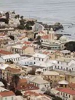 Mosquée El Oumma. |
.jpg.webp)
.jpg.webp)
Djelfa Province
| ID | Monument | Type | Municipality | Address | Coordinates | Image |
|---|---|---|---|---|---|---|
| 17-001 | Hadjra Sidi Boubeker (cave art) | Artwork/prehistoric | Aïn El Ibel | Upload Photo | ||
| 17-002 | Kheneg El-Hillal (cave art) | Artwork/prehistoric | Ain El Ibel | Upload Photo | ||
| 17-003 | Zeccar (cave art) | Artwork/prehistoric | Zeccar | Upload Photo | ||
| 17-004 | Dolmens of the Windmill of Djelfa | funerary/prehistoric | Djelfa | Upload Photo | ||
| 17-005 | Dolmens off the road from Algiers to Laghouat | funerary/prehistory | Djelfa | Upload Photo |
Jijel Province
| ID | Monument | Type | Municipality | Address | Coordinates | Image |
|---|---|---|---|---|---|---|
| 18-001 | Corniche Nature Park | El Aouana | Upload Photo | |||
| 18-002 | Corniche Nature Park | Ziama Mansouriah | 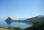 Corniche Nature Park | |||
| 18-003 | Wonderful caves | prehistoric/nature park | Ziama Mansouriah | 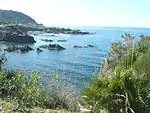 Wonderful caves |
Sétif Province
| ID | Monument | Type | Municipality | Address | Coordinates | Image |
|---|---|---|---|---|---|---|
| 19-001 | Village of Tidget Guergour | nature park | Ghenzet | Upload Photo | ||
| 19-002 | Gorges of Chabet Akra | nature park | Ghenzet |  Gorges of Chabet Akra | ||
| 19-003 | Territories and monuments of Cuicul | Site and monuments/Antiquity | Djémila (World Heritage Site) |
36°19′11″N 5°44′11″E | 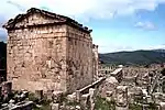 Territories and monuments of Cuicul | |
| 19-004 | Citadel of Sétif | fortification/antiquity | Sétif | Upload Photo | ||
| 19-005 | Archeology zone: quarter of the basilica, rampart, circus, quarter of the temple | site and monuments/antiquity | Sétif | Upload Photo | ||
| 19-006 | Ikdjen[6] | archaeology site/medieval | Aïn El Kebira | Upload Photo | ||
| 19-007 | Ain El Fouara Fountain | Artwork/Medieval | Sétif | 36°11′22″N 5°24′18″E |

Saïda Province
| ID | Monument | Type | Municipality | Address | Coordinates | Image |
|---|---|---|---|---|---|---|
| 20-001 | Grottos of Oued Saïda | prehistoric | Saïda | Upload Photo | ||
| 20-002 | Timzighine Site | prehistoric | Youb | Upload Photo | ||
| 20-003 | Prehistoric site of Ain Menaaé | prehistoric | Aïn El Hadjar | Upload Photo |
Skikda Province
| ID | Monument | Type | Municipality | Address | Coordinates | Image |
|---|---|---|---|---|---|---|
| 21-001 | Roman theatre and architectural fragments it contains (Skikda) | antiquity | Skikda | Upload Photo | ||
| 21-002 | Objects in the state museum | antiquity | Skikda | Upload Photo | ||
| 21-003 | Canvas representing entombment of Christ attributed to Anthony van Dyck | Artwork | Skikda | Upload Photo | ||
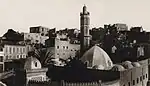
| 21-004 | great mosque | Islamic | Collo | Upload Photo |
Sidi Bel Abbes Province
| ID | Monument | Type | Municipality | Address | Coordinates | Image |
|---|---|---|---|---|---|---|
| 22-001 | Bossuet internment camps | penitentiary/modern | Dhaya | Upload Photo |
Annaba Province
| ID | Monument | Type | Municipality | Address | Coordinates | Image |
|---|---|---|---|---|---|---|
| 23-001 | Cistern of Hippone (Hippo Regius) | waterwork/antiquity | Annaba | Upload Photo | ||
| 23-002 | Ruins of Hippone | ruins/antiquity | Annaba | Upload Photo | ||
| 23-003 | Citadel, Fort of the Victims and the Remains of the Rampart of the City of Annba | fortification | Annaba | Upload Photo |
Guelma Province
| ID | Monument | Type | Municipality | Address | Coordinates | Image |
|---|---|---|---|---|---|---|
| 24-001 | Grottos of Djebel Taya (near Oued Charef Nature Park) | prehistoric | Bou Hamdane | Upload Photo | ||
| 24-002 | Roman swimming pool (Hammam Berda) | thermal baths/antiquity | Héliopolis | Upload Photo | ||
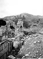
| 24-003 | Ruined theatre and thermal baths | Roman theatre of Calama, built with financing from a priestess of the imperial cult | Guelma | 36°28′02″N 7°25′48″E | 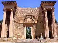 Ruined theatre and thermal baths | |
| 24-004 | Ruins of Thibilis[7] | ruins/antiquity | Bellaoua Announa | |||
| 24-005 | Hammam Debagh (Meskhoutine) | thermal baths/antiquity | Hammam Debagh | 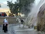 Hammam Debagh (Meskhoutine) | ||
| 24-006 | Site Khenguet El Hadjar Site | nature/prehistoric | Salaout Announa | Upload Photo | ||
| 24-007 | Dolmens of Cheniour | funerary/prehistoric | Ain El Arbi | Upload Photo | ||
| 24-008 | Site of Ain Nechma | prehistoric | Ben-Djerrah | Upload Photo | ||
| 24-009 | Citadel Bouatfane | fortification/antiquity | Ain El Arbi | Upload Photo | ||
| 24-010 | Kef Bouzioune Zatara | antiquity | Bou Hachana | Upload Photo | ||
| 24-011 | Zaouia Cheikh El Hafnaoui Bedyar | Islamic | Beni Mezline | Upload Photo | ||
| 24-012 | Sour Ethakana el Kadiùm | fortification/modern | Guelma | Upload Photo | ||
| 24-013 | Dolmens and funerary grottos (necropolis). | Upload Photo |
Constantine Province
| ID | Monument | Type | Municipality | Address | Coordinates | Image |
|---|---|---|---|---|---|---|
| 25-001 | Dolmens of Salluste near the ancient gardens of Constantine (Constantine) | funerary/prehistoric | Constantine | Upload Photo | ||
| 25-002 | Roman aqueduct | waterwork/antiquity | Constantine | 36°21′01″N 6°37′03″E | Upload Photo | |
| 25-003 | Roman bridge | roadwork/antiquity | Constantine | 36°22′08″N 6°37′05″E | Upload Photo | |
| 25-004 | Tomb of Praecillius | funerary/antiquity | Constantine | Upload Photo | ||
| 25-005 | Mosque of Souk El Ghezel (former Cathedral) | religious/medieval | Constantine | 36°22′02″N 6°36′42″E | 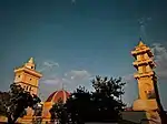 Mosque of Souk El Ghezel (former Cathedral) | |
| 25-006 | Mosque of Sidi Lakhdar | Islamic | Constantine | Upload Photo | ||
| 25-007 | Part of the old madrassa enclosing the tombs of Salah Bey and his family | funerary/modern | Constantine | Upload Photo | ||
| 25-008 | Ahmed Bey Palace | Abode/Modern | Constantine | 36°22′04″N 6°36′42″E | 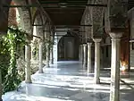 Ahmed Bey Palace | |
| 25-009 | Ancient fragments and inscription in the square | ruins and epigraph | Constantine | Upload Photo | ||
| 25-010 | Inscription of the martyrs Saint Jacques and Saint Marien | Epigraph/Antiquity | Constantine | Upload Photo | ||
| 25-011 | Mosaic of Penthesilea discovered at Ouled Agla, held at the Constantine municipal building | artwork/antiquity | Constantine | Upload Photo | ||
| 25-012 | Objects in the museum of Constantine | collection/antiquity | Constantine | Upload Photo | ||
| 25-013 | Gorges of Rhummel | nature park | Constantine |  Gorges of Rhummel | ||
| 25-014 | Dolmens and Cromlechs 35km south of Constantine Ras El Ain Bou Merzoug Ouled Rahmoun | funerary/prehistoric | Ouled Rahmoune | Upload Photo | ||
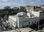
| 25-015 | Old town Constantine | living history | Constantine | 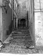 Old town Constantine | ||
| 25-016 | Dolmens and cromlechs in place known as djebel Ksaibi 32 km from Constantine | funerary/prehistoric | Ouled Rahmoune | Upload Photo | ||
| 25-017 | Greek-Punic Mausoleum named Soumaâ | Funerary/ antiquity | El Khroub | 36°16′20″N 6°43′31″E | 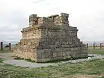 Greek-Punic Mausoleum named Soumaâ | |
| 25-018 | Dolmens and cromlechs in place known as Djebel Mazalaa 16 km from El Khroub | funerary/prehistoric | Ouled Rahmoune | Upload Photo |
Médéa Province
| ID | Monument | Type | Municipality | Address | Coordinates | Image |
|---|---|---|---|---|---|---|
| 26-001 | funerary items unearthed from the ancient necropolis | funerary/antiquity | Djouab | Upload Photo | ||
| 26-002 | Territories and monuments of Rapidum | Djouab | Upload Photo | |||
| 26-003 | Site of Benia constituting the site of the ancient city of Yachir 4 km (2.5 mi) southwest of Tletat Ed Douair | capital/medieval | Tletat Ed Douair | Upload Photo | ||
| 26-004 | Dar El Bey named Dar EL Emir Abdelkader | commemorative/modern | Médéa | Upload Photo | ||
| 26-005 | Remains of house, enclosure, door in Rapidum | antiquity/ruins | Djouab | Upload Photo |
Mostaganem Province
| ID | Monument | Type | Municipality | Address | Coordinates | Image |
|---|---|---|---|---|---|---|
| 27-001 | Grand Mosque | Islamic | Mostaganem | Upload Photo |
M'Sila Province
| ID | Monument | Type | Municipality | Address | Coordinates | Image |
|---|---|---|---|---|---|---|
| 28-001 | Kalâa of the Beni Hammad | medieval (World Heritage Site) | Mâadid | Upload Photo | ||
| 28-002 | Camps of El Djorf | prison/medieval | Ouled Derradj | Upload Photo |
Mascara Province
| ID | Monument | Type | Municipality | Address | Coordinates | Image |
|---|---|---|---|---|---|---|
| 29-001 | Ruins of Aquae Sienses[9] | Ruins/antiquity | Bou Hanifia (El Hammamet) | Upload Photo | ||
| 29-002 | Mosque at the Douar of El Guetna | religious/Islamic | Hacine | Upload Photo | ||
| 29-003 | Mosque of Ain Beida | religious/Islamic | Mascara | Upload Photo | ||
| 29-004 | Djemaâ El-Kebir Mosque | religious/Islamic | Mascara | Upload Photo | ||
| 29-005 | Ruins of the Zaouia of Sidi Mahieddine | religious/Islamic/ruins | Sidi-Kada | Upload Photo | ||
| 29-006 | Baths known as Emir Abdel Kader's" | thermal baths/modern | Sidi Kada | Upload Photo | ||
| 29-007 | Earthen ramparts and battlements | fortification/modern, ruins related to the Emir AbdelKader | Sidi Kada | Upload Photo | ||
| 29-008 | Woods of olive trees near the ruins, related to the tradition of the Emir Abdelkader | nature park | Sidi Kada | Upload Photo | ||
| 29-009 | Prehistoric deposit of Ternifine | prehistoric | Tighenif | Upload Photo | ||
| 29-010 | Site of Dardara tree | Commemorative: Tree beneath which the tribes pledged allegiance to the Emir Abdelkader on 27 November 1832 | Ghriss | _(15).JPG.webp) Site of Dardara tree | ||
| 29-011 | Headquarters of the Emir Abdelkader | military building/modern | Mascara | Upload Photo | ||
| 29-012 | Tribunal of the Emir Abdelkader | judicial building/modern | Mascara | Upload Photo |
Ouargla Province
| ID | Monument | Type | Municipality | Address | Coordinates | Image |
|---|---|---|---|---|---|---|
| 30-001 | Ruins of Sedrata[10] | capital/Islamic | Ouargla | Upload Photo | ||
| 30-002 | Valley of the Oued Djerat | prehistoric | Ouargla | Upload Photo | ||
| 30-003 | Ksar of Ouargla | living city | Ouargla | Upload Photo |
Oran Province
| ID | Monument | Type | Municipality | Address | Coordinates | Image |
|---|---|---|---|---|---|---|
| 31-001 | Ruins of Portus Magnus | Ruins/Antiquity | Bethioua | 35°48′17″N 0°15′35″W | Upload Photo | |
| 31-002 | Punic caseity known as les Andalouses | ruins/antiquity | Boutlélis | 1 | Upload Photo | |
| 31-003 | Abri Alain[11] | prehistoric | Oran | Upload Photo | ||
| 31-004 | Grottos of El Cuartel | prehistoric | Oran | Upload Photo | ||
| 31-005 | Mosque of the Bey Mohamed el-Kébir | 18th century mosque | Oran | 35°42′19″N 0°38′12″W | ![Mosque of the Bey Mohamed el-Kébir [fr]](../I/Oran_vieille_mosqu%C3%A9e_Karguentah.JPG.webp) Mosque of the Bey Mohamed el-Kébir | |
| 31-006 | Hassan Pasha Mosque | 18th century Ottoman mosque | Oran | 35°42′19″N 0°39′00″W | ||
| 31-007 | Minaret du campement | Minaret of an 18th century mosque | Oran | 35°42′16″N 0°39′16″W | 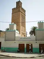 Minaret du campement | |
| 31-008 | Minaret of the Mosquée du Pacha | polygonal minaret in Ottoman style | Oran | 35°42′17″N 0°39′00″W | 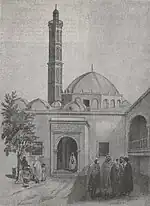 Minaret of the Mosquée du Pacha | |
| 31-009 | Caravansérail (Modern) (Oran) | gate of a caravansérail built in 1849, remontée promenade ex-de Létang. | Oran | 35°42′29″N 0°38′43″W |  Caravansérail (Modern) (Oran) | |
| 31-010 | Palace of the Bey | Ottoman palace, late 18th century | Oran | 35°42′19″N 0°38′57″W | 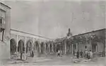 Palace of the Bey | |
| 31-011 | Spanish gate of the castle | Spanish gate of the Casbah | Oran | 35°42′07″N 0°39′16″W | 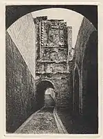 Spanish gate of the castle | |
| 31-012 | Pavilion of the Favorite | Ottoman pavilion on the grounds of the palace of the bey | Oran | 35°42′18″N 0°38′58″W | 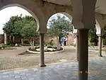 Pavilion of the Favorite | |
| 31-013 | Mohamed El Houari Mosque | Small mosque with minaret and koubba built in 1799/1800, with a cenotaph to Sidi El Houari. | Oran | 35°42′11″N 0°39′15″W | ![Mohamed El Houari Mosque [fr]](../I/Sidi_houari.jpg.webp) Mohamed El Houari Mosque | |
| 31-014 | military logistics gate | military construction/modern | Oran | 35°42′29″N 0°39′17″W | Upload Photo | |
| 31-015 | Spanish escutcheon carved on the outside of the wall surrounding the new castle | Vestiges of a Spanish escutcheon from the reign of Philip V of Spain | Oran | 35°42′25″N 0°38′46″W | Upload Photo | |
| 31-016 | Tambour de San José | Vigie fortifiée espagnole (16th century), overlooking the mouth of the Ras el Aïn ravine. | Oran | 35°42′05″N 0°39′12″W | Upload Photo | |
| 31-017 | Fountain of Place Emerat | Spanish Fountain in the quartier de la Marine, 1789. | Oran | 35°42′24″N 0°39′20″W | 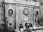 Fountain of Place Emerat | |
| 31-018 | Porte de Santon | Gate of Oran, towards Mers el-Kébir, 1754. | Oran | 35°42′20″N 0°39′23″W | Upload Photo | |
| 31-019 | Porte de Castel | Porte de Canastel, east entrance to old Oran | Oran | 35°42′17″N 0°39′09″W | Upload Photo | |
| 31-020 | Entrance gate to the new château | access/modern | Oran | 35°42′21″N 0°38′59″W | Upload Photo | |
| 31-021 | Posada Espagnole | House in the Moorish or Andalusian style, used as first a brothel then an inn (demolished?) | Oran | 35°42′25″N 0°39′21″W | Upload Photo | |
| 31-022 | Chapel of Santa Cruz | Votive chapel to the Virgin Mary, son the Aïdour (1850/1959) | Oran | 35°42′35″N 0°39′48″W | 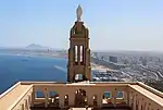 Chapel of Santa Cruz | |
| 31-023 | Inscription in the rue du vieux château | epigraph/modern | Oran | Upload Photo | ||
| 31-024 | Watchtower in corner of wall surrounding the new château | watchtower in corner of southeast bastion of the new château | Oran | 35°42′19″N 0°38′51″W | Upload Photo | |
| 31-025 | Objects of antiquity in the Musée Ahmed Zabana | collection | Oran | 35°41′45″N 0°38′43″W | Upload Photo | |
| 31-026 | Mosaic from a house in Bethioua in the Musée Ahmed Zabana | Mosaic known as "of the fighting" from the ruins of Portus Magnus (Bethioua). | Oran | 35°41′45″N 0°38′43″W |  Mosaic from a house in Bethioua in the Musée Ahmed Zabana | |
| 31-027 | Promenande Ibn Badis formerly létang Natural Park (Oran) | Tree-lined promenade at the foot of the north courtines of the "Château Neuf", 1836. | Oran | 35°42′25″N 0°38′54″W | Promenande Ibn Badis formerly létang Natural Park (Oran) | |
| 31-028 | Site of the Murdjajo | Nature Park | Oran | Upload Photo | ||
| 31-029 | Cemetery known as "Des cholériques" (of the choleric) in the Ras El Ain ravine | funerary/modern | Oran | Upload Photo | ||
| 31-030 | Hôtel de la division. | Same monument as the palace of the Bey, used as residence and seat of the état-major of the general commanding Oran division from 1831 to 1962 | Oran | Upload Photo | ||
| 31-031 | Mosaic from Bethioua EX/ ST LEU in the Musée Ahmed Zabana (Oran) | Mosaic titled "départure of Bacchus for India", from the ruins of Portus Magnus | Oran | 35°41′45″N 0°38′43″W | Upload Photo | |
| 31-032 | prehistoric collection in the Musée Ahmed Zabana (Oran) | collection/prehistoric | Oran | 35°41′45″N 0°38′43″W | Upload Photo |
El Bayadh Province
| ID | Monument | Type | Municipality | Address | Coordinates | Image |
|---|---|---|---|---|---|---|
| 32-001 | Merdoufa | cave/prehistoric | Ghassoul | 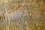 Merdoufa |
Illizi Province
| ID | Monument | Type | Municipality | Address | Coordinates | Image |
|---|---|---|---|---|---|---|
| 33-001 | Tassili N'Ajjer (World Heritage Site) | prehistoric | Djanet | 25°30′00″N 9°00′00″E | 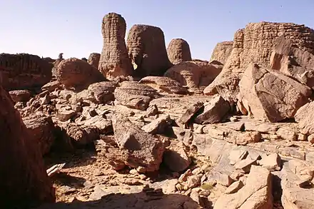 Tassili N'Ajjer (World Heritage Site) |
Bordj Bou Arréridj Province
| ID | Monument | Type | Municipality | Address | Coordinates | Image |
|---|---|---|---|---|---|---|
| 34-001 | Ruins of the ancient city of Tihamamine | ruins/Antiquity | El Hamadia | Upload Photo |
Boumerdès Province
| ID | Monument | Type | Municipality | Address | Coordinates | Image |
|---|---|---|---|---|---|---|
| 35-001 | Zemmouri El Bahri | fortification/medieval | Zemmouri | Zemmouri El Bahri | 36°48′03″N 3°33′55″E | |
| 35-002 | Ferme Gautier | Torture center | Souk El Had | Titouna | 36°42′27″N 3°35′34″E |
El Taref Province
| ID | Monument | Type | Municipality | Address | Coordinates | Image |
|---|---|---|---|---|---|---|
| 36-001 | El Kala church | religious/Modern | El Kala | 36°53′51″N 8°26′40″E | Upload Photo | |
| 36-002 | Ruins of the Bastion de France | Ruins/Modern | El Kala | 36°55′04″N 8°20′24″E | 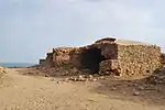 Ruins of the Bastion de France |
Tindouf Province
| ID | Monument | Type | Municipality | Address | Coordinates | Image |
|---|---|---|---|---|---|---|
| 37-001 | Casbah of Belaâmach | living urban center | Tindouf | Upload Photo |
Tissemsilt Province
| ID | Monument | Type | Municipality | Address | Coordinates | Image |
|---|---|---|---|---|---|---|
| 38-001 | National Parks of Ain N'Sour and Theniet el Had | Nature site | Théniet El Had | Upload Photo | ||
| 38-002 | Archaeological site of Ain Sfa | Stratified period | Tissemsilt | Upload Photo | ||
| 38-003 | Archaeological site of Ain Torkia | Stratified period | Khemisti | Upload Photo |
El Oued Province
| ID | Monument | Type | Municipality | Address | Coordinates | Image |
|---|---|---|---|---|---|---|
| 39-001 | Zaouia Tidjania | Islamic | Guemar | Upload Photo |
Khenchela Province
| ID | Monument | Type | Municipality | Address | Coordinates | Image |
|---|---|---|---|---|---|---|
| 40-001 | Valley of Oued Beni Barbar | nature park | Khenchela | Upload Photo | ||
| 40-002 | Gorges of the Oued El Arab river | nature park | Khenchela | Upload Photo | ||
| 40-003 | Grottos of Fringal | nature park | Khenchela | Upload Photo | ||
| 40-004 | Village of Djellal | nature park | Djellal | Upload Photo | ||
| 40-005 | Village of Tabardga | nature park | Charchar | Upload Photo | ||
| 40-006 | Village of Tizigarine | nature park | Bouhmama | Upload Photo | ||
| 40-007 | Baghai | medieval | Baghai | Upload Photo | ||
| 40-008 | Mausoleum Cédia (ksar el Djazia) | Upload Photo |
Souk Ahras Province
| ID | Monument | Type | Municipality | Address | Coordinates | Image |
|---|---|---|---|---|---|---|
| 41-001 | Ruins of Byzantine palace | ruins/Antiquity | M'Daourouch | Upload Photo | ||
| 41-002 | Roman mausoleum | funerary/antiquity | M'Daourouch | Upload Photo | ||
| 41-003 | Territories and monuments of Thubusicum Numidarum[12] | site/antiquity | Khemissa | Upload Photo | ||
| 41-004 | Remains of citadels, Byzantine enclosure of Tiffech | Antiquity | Tiffech | Upload Photo | ||
| 41-005 | Statues and fragments of antiquity from municipal garden | artworks/antiquity | Souk Ahras | Upload Photo | ||
| 41-006 | Roman mausoleum in the douar of the Ouled Soukies (Ksar El Ahmar) | funerary/antiquity | Taoura (Thagora) | Upload Photo |
Tipaza Province
| ID | Monument | Type | Municipality | Address | Coordinates | Image |
|---|---|---|---|---|---|---|
| 42-001 | Cistern under the barracks | waterwork/antiquity | Cherchell | Upload Photo | ||
| 42-002 | Remains of the thermal baths, west and east | ruins/antiquity | Cherchell | Upload Photo | ||
| 42-003 | Remains of the amphitheatre | Antiquity/venue | Cherchell | Upload Photo | ||
| 42-004 | Pulpit built in the year 981 of the Hijrah in the mosque | religious/Islamic | Cherchell | Upload Photo | ||
| 42-005 | Objects from Antiquity held in the Archaeological Museum of Cherchell | collection/antiquity | Cherchell | Upload Photo | ||
| 42-006 | Aqueduct 5km from Cherchell | waterwork/antiquity | Cherchell | Upload Photo | ||
| 42-007 | Caid Youcef, Roman ruins | ruins/antiquity | Cherchell | Upload Photo | ||
| 42-008 | Cape known as "les Trois Ilôts', or "the three islets" | ruins/antiquity | Cherchell | Upload Photo | ||
| 42-009 | Aqueduct in Sidi Amar | waterwork/antiquity | Sidi Amar | Upload Photo | ||
| 42-010 | Royal Mausoleum of Mauretania (Tomb of the Christian Woman) | funerary/antiquity | Hadjout | 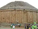 Royal Mausoleum of Mauretania (Tomb of the Christian Woman) | ||
| 42-011 | Mosque in the Roman plaza | religious/Islamic | Cherchell | Upload Photo | ||
| 42-012 | Roman ramparts and Punic cemetery | fortification, funerary/antiquity | Hadjout | Upload Photo | ||
| 42-013 | Château d'eau | waterwork/Antiquity | Hadjout | Upload Photo | ||
| 42-014 | Land between the route du Phare and the sea | nature park | Tipaza | Upload Photo | ||
| 42-015 | Public square | nature park | Tipaza | Upload Photo | ||
| 42-016 | Remains of the theatre | Antiquity/venue | Tipaza | 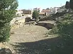 Remains of the theatre | ||
| 42-017 | Remains of a basilica and a cemetery | religious/funerary/Antiquity | Tipaza | 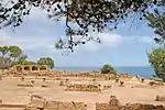 Remains of a basilica and a cemetery | ||
| 42-018 | Ruins of a courtroom | ruins/antiquity | Tipaza | Upload Photo | ||
| 42-019 | Sarcophagus and fragments from Antiquity | funerary/Antiquity | Tipaza | Upload Photo | ||
| 42-020 | Nador farm | ruins/antiquity | Tipaza | Upload Photo | ||
| 42-021 | Shoreline of Tipaza | nature park | Tipaza | Upload Photo | ||
| 42-022 | Bérard waterfall | nature park | Tipaza | Upload Photo | ||
| 42-023 | Ain Ksiba | antiquity | Cherchell | Upload Photo | ||
| 42-024 | Kaddour property known as "Boufarik' | Archeological reserve/Antiquity | Cherchell | Upload Photo | ||
| 42-025 | Mosque of the hundred columns | Upload Photo | ||||
| 42-026 | El Ghobrini Cemetery | Islamic | Cherchell | Upload Photo | ||
| 42-027 | Ruins of Roman theatre | Antiquity | Upload Photo | |||
| 42-028 | kaddour mosque known as boufarik | Tipaza | Upload Photo | |||
| 42-029 | Tipaza historic sites | Upload Photo |
Mila Province
| ID | Monument | Type | Municipality | Address | Coordinates | Image |
|---|---|---|---|---|---|---|
| 43-001 | Ruins of Milev - National/1910 | Ruins/antiquity | Mila | Upload Photo | ||
| 43-002 | Baths of Pomperianus - National/L.1900 | thermal baths | Oued Athmania | Upload Photo | ||
| 43-003 | Old Mila - National/1999 | site/antiquity | Mila | 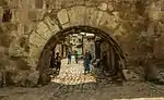 Old Mila - National/1999 |
Aïn Defla Province
| ID | Monument | Type | Municipality | Address | Coordinates | Image |
|---|---|---|---|---|---|---|
| 44-001 | Sidi Ahmed Ben Youcef mosque | religious | Miliana | 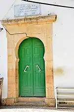 Sidi Ahmed Ben Youcef mosque |
Naâma Province
| ID | Monument | Type | Municipality | Address | Coordinates | Image |
|---|---|---|---|---|---|---|
| 45-001 | Necropolis of Djorf Torba[13] | funerary/antiquity | Aïn Séfra | Upload Photo | ||
| 45-002 | Traces of Sidi Cheikh's mare in Theniet Azzia Nature Park | nature park (footprints) | Aïn Séfra | Upload Photo |
Aïn Témouchent
| ID | Monument | Type | Municipality | Address | Coordinates | Image |
|---|---|---|---|---|---|---|
| 46-001 | Numidian Kingdom of Syphax (Siga) | Site/Capital/Ant. | Oulhaça El Gheraba | 35°15′59″N 1°27′00″W | 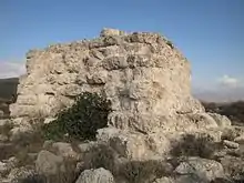 Numidian Kingdom of Syphax (Siga) |
Ghardaïa Province
| ID | Monument | Type | Municipality | Address | Coordinates | Image |
|---|---|---|---|---|---|---|
| 47-001 | Ramparts of Beni Isguen | Fortification/Medieval | Ghardaïa | Upload Photo | ||
| 47-002 | M'zab Valley | living city center | Ghardaïa | Upload Photo | ||
| 47-003 | Ksar of Metlili | living town center | Metlili | Upload Photo |
Relizane Province
| ID | Monument | Type | Municipality | Address | Coordinates | Image |
|---|---|---|---|---|---|---|
| 48-001 | Ruins of Kaoua[14] | Ruins/Antiquity | Ammi Moussa | 35°55′08″N 1°12′01″E | 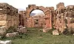 Ruins of Kaoua[15] |
See also
- List of heritage registers
- Liste de forts, fortifications, citadelles et places fortes en Afrique
References
- "Liste Générale des Biens Culturels Protégés (General List of Protected Cultural Properties)". Algerian Ministry of Culture (in French). Retrieved 2 December 2019.
- "List of Cultural Assets of Adrar" (PDF). Algerian Ministry of Culture (in French).
- "St. Reparata Labyrinth: Medieval Studies: Loyola University Chicago".
- Centre National de Recherche en Archéologie (August 17, 2017). "Grenier Igelfen de Tigharghar et de Baloul" [Igelfen Granary of Tigharghar and of Baloul].
- Arrêté du 01 février 1982 MINISTERE DE LA CULTURE JO N° 18 du 04 mai 1982, Page 634, Portant classement du site de Honaine parmi les sites historiques.
- Centre National de Recherche en Archéologie (August 19, 2017). "Site D'Ikdjen (Sétif)".
- Centre National de Recherche en Archéologie (August 20, 2017). "Ruines de la ville de Thibilis (Bellaoua Announa)" [Ruins of the city of Thibilis (Bellaoua Announa)].
- Centre National de Recherche en Archéologie (August 20, 2017). "Ruines de la ville de Thibilis (Bellaoua Announa)" [Ruins of the city of Thibilis (Bellaoua Announa)].
- "Aquae Sienses (El Hammamet) | Atlas Arhéologique Algérien". 26 August 2017.
- "Ouargla: l'antique ville de Sedrata menacée par des extensions dans ses alentours" (in French). Algérie Presse Service. July 30, 2017.
- L'Abri Alain, près d'Oran / Par Paul Pallary. 1934.
- Société de Saint-Jean (1879). Revue de l'art chrétien [Review of Christian Art]. Vol. 28. St. Augustin, Desclée, De Brouwer et Cie. p. 25 – via Google Books.
- Unesco. International Scientific Committee for the Drafting of a General History of Africa (1981). G. Mokhtar; Mohamed Gamal el-Din; Muḥammad Jamāl al-Dīn Mukhtār; Joseph Ki-Zerbo; A. Adu Boahen; J. F. Ade Ajayi; Djibril Tamsir Niane; Bethwell A. Ogot (eds.). Ancient Civilizations of Africa. p. 523. ISBN 9789231017087.
{{cite book}}:|work=ignored (help) - Sir Robert Lambert (1898). Supplement to A Bibliography of Algeria: From the Expedition of Charles V. in 1541 to 1887. Murray. p. 252 – via Google Books.
- Sir Robert Lambert (1898). Supplement to A Bibliography of Algeria: From the Expedition of Charles V. in 1541 to 1887. Murray. p. 252 – via Google Books.
This article is issued from Wikipedia. The text is licensed under Creative Commons - Attribution - Sharealike. Additional terms may apply for the media files.