List of districts in Milton Keynes
This is a list of the districts ('grid squares') of Milton Keynes, England. This list only includes settlements in its built-up-area.[1] For a complete list of areas in the borough, see civil parishes in the City of Milton Keynes.
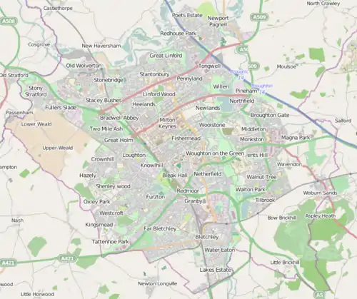
OpenStreetMap mapping of Milton Keynes, showing most of the districts
Click on marker beside "Name" or "Civil Parish" to sort into desired order.
There are no roads V0 and H0: these co-ordinates indicate that a district lies west/north of V1/H1 and to its own west/north has no grid street.
Notes
- Not in original designated area but subsequent expansion has grown to include it.[1]
References
- "UNITED KINGDOM: Countries and Major Urban Areas". citypopulation.de. 11 November 2022. Retrieved 16 July 2023.
This article is issued from Wikipedia. The text is licensed under Creative Commons - Attribution - Sharealike. Additional terms may apply for the media files.