List of historic places in Yukon
This article is a list of historic places in the territory of Yukon entered on the Canadian Register of Historic Places, whether they are federal, provincial, or municipal.
List of historic places
| Name | Address | Coordinates | Government recognition (CRHP №) | Image | |
|---|---|---|---|---|---|
| Discovery Claim (Claim 37903) National Historic Site | Claim No. 37903 Bonanza Creek YT |
63°55′00″N 139°19′01″W | Federal (6310) | 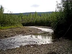 More images | |
| Dredge No. 4 National Historic Site | Lot 586, group 1052 Bonanza Creek YT |
63°56′38″N 139°20′10″W | Federal (6280) |  More images | |
| Caribou Hotel | Dawson Charlie Street Carcross YT |
60°09′55″N 134°42′22″W | Yukon (9834) | 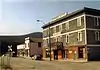 More images | |
| White Pass and Yukon Railway Station | Main Street Carcross YT |
60°09′54″N 134°42′18″W | Federal (6723) | 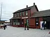 More images | |
| St. Paul's Anglican Church National Historic Site | Dawson City YT |
64°03′33″N 139°26′20″W | Federal (14122) | .JPG.webp) More images | |
| S.S. Keno National Historic Site | Dawson City YT |
64°03′45″N 139°26′10″W | Federal (9308) | 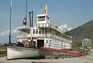 More images | |
| Lowe's Mortuary | Dawson City YT |
64°03′45″N 139°25′55″W | Federal (9692) | 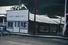 | |
| Bank of British North America | Queen Street Dawson City YT |
64°03′44″N 139°26′02″W | Federal (11263) | 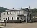 | |
| BYN Ticket Office | Dawson City YT |
64°03′49″N 139°26′02″W | Federal (9704) |  | |
| Canadian Bank of Commerce National Historic Site of Canada | Front and Queen Streets Dawson City YT |
64°03′46″N 139°26′07″W | Federal (15524) | .jpg.webp) | |
| KTM Building | Dawson City YT |
64°03′40″N 139°25′56″W | Federal (11425) |  Upload Photo | |
| NWMP Married Quarters | Dawson City YT |
64°03′25″N 139°26′17″W | Federal (9824) | Upload Photo | |
| Mme. Tremblay’s Store (16) | Dawson City YT |
64°03′46″N 139°25′44″W | Federal (9826) | 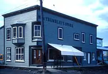 | |
| Harrington’s Store (15) | Dawson City YT |
64°03′38″N 139°26′02″W | Federal (9829) | 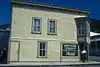 More images | |
| North West Mounted Police Stables | Dawson City YT |
64°03′26″N 139°26′17″W | Federal (9842) | Upload Photo | |
| North West Mounted Police Jail | Dawson City YT |
64°03′25″N 139°26′13″W | Federal (9854) | Upload Photo | |
| Northern Commercial Company Warehouse | Dawson City YT |
64°03′42″N 139°25′37″W | Federal (10373) | Upload Photo | |
| Root Cellar | Dawson City YT |
64°01′39″N 139°14′46″W | Federal (11208) | Upload Photo | |
| General Manager's House | Dawson City YT |
64°01′39″N 139°14′35″W | Federal (11213) | Upload Photo | |
| Tr'ochëk National Historic Site | Dawson City YT |
64°03′04″N 139°26′28″W | Federal (14661) | 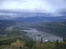 | |
| Dawson Daily News | 123 3rd Avenue Dawson City YT |
64°03′43″N 139°25′55″W | Federal (11264) | 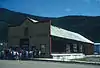 | |
| Yukon Sawmill Company Office | 1302 Front Street Dawson City YT |
64°03′57″N 139°25′48″W | Yukon (4832) | 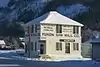 More images | |
| Ruby's Place | 233 Second Avenue Dawson City YT |
64°03′41″N 139°26′02″W | Federal (10372) | 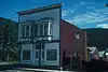 | |
| Third Avenue Hotel, Building 14 | 309-11 Third Avenue Dawson City YT |
64°03′45″N 139°25′52″W | Federal (6227) |  | |
| Commanding Officer's Residence (10) | 508 Fifth Avenue Dawson City YT |
64°03′17″N 139°26′17″W | Federal (9825) | Upload Photo | |
| Dawson City Telegraph Office | 512 Seventh Avenue Dawson City YT |
64°03′21″N 139°25′59″W | Yukon (3920) | 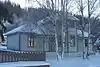 More images | |
| Old Territorial Administration Building National Historic Site | 595 Fifth Avenue Dawson City YT |
64°03′21″N 139°26′13″W | Federal (15784) | 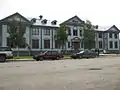 | |
| St. Andrew's Manse | 601 Fourth Avenue Dawson City YT |
64°03′45″N 139°25′52″W | Federal (10364) | Upload Photo | |
| Auto Repair Shop, Building #7 | Bear Creek Compound Dawson City YT |
64°01′37″N 139°14′35″W | Federal (6232) | Upload Photo | |
| Carpentry Shop, Building #6 | Bear Creek Compound Dawson City YT |
64°01′36″N 139°14′36″W | Federal (6235) | Upload Photo | |
| Cat Repair Shop, Building #8 | Bear Creek Compound Dawson City YT |
64°01′37″N 139°14′34″W | Federal (6242) | Upload Photo | |
| Garage and Fire Hall | Bear Creek Compound Dawson City YT |
64°01′39″N 139°14′33″W | Federal (11215) | Upload Photo | |
| Garage and Storage Building | Bear Creek Compound Dawson City YT |
64°01′39″N 139°14′32″W | Federal (11227) | Upload Photo | |
| Gas House | Bear Creek Compound Dawson City YT |
64°01′35″N 139°14′33″W | Federal (10778) | Upload Photo | |
| Mess Hall and Bunkhouse | Bear Creek Compound Dawson City YT |
64°01′41″N 139°14′38″W | Federal (11210) | Upload Photo | |
| Staff House | Bear Creek Compound Dawson City YT |
64°01′37″N 139°14′31″W | Federal (11112) | Upload Photo | |
| Tin Shop | Bear Creek Compound Dawson City YT |
64°01′36″N 139°14′35″W | Federal (9882) | Upload Photo | |
| Troberg Residence, Building #67 | Bear Creek Compound Dawson City YT |
64°01′48″N 139°14′16″W | Federal (9890) | Upload Photo | |
| V.I.P. Guest House | Bear Creek Compound Dawson City YT |
64°01′38″N 139°14′30″W | Federal (9922) | Upload Photo | |
| Warehouse No. 1, Building #27 | Bear Creek Compound Dawson City YT |
64°01′38″N 139°14′40″W | Federal (9923) | Upload Photo | |
| Warehouse No. 2 | Bear Creek Compound Dawson City YT |
64°00′N 139°14′W | Federal (10819) | Upload Photo | |
| Warehouse No. 3, Building #35 | Bear Creek Compound Dawson City YT |
64°01′38″N 139°14′45″W | Federal (9924) | Upload Photo | |
| Engineering Office (Building 19) | Bear Creek Compound Dawson City YT |
64°01′40″N 139°14′37″W | Federal (9925) | Upload Photo | |
| Engineering Office (Building 28) | Bear Creek Compound Dawson City YT |
64°01′38″N 139°14′41″W | Federal (9926) | Upload Photo | |
| Gold Room. Building #29 | Bear Creek Compound Dawson City YT |
64°01′39″N 139°14′44″W | Federal (11214) | Upload Photo | |
| Machine Shop, Building #1 & #2 | Bear Creek Compound Dawson City YT |
64°01′37″N 139°14′38″W | Federal (11226) | Upload Photo | |
| St. Andrew's Presbyterian Church | Church / Fourth Street Dawson City YT |
64°03′45″N 139°25′52″W | Federal (10366) | .jpg.webp) More images | |
| Former Territorial Court House National Historic Site | Corner of Front and Turner Streets Dawson City YT |
64°03′23″N 139°26′28″W | Federal (12743, (16081) | 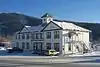 | |
| Robert Service Cabin | Eighth / Hansen Street Dawson City YT |
64°03′45″N 139°25′52″W | Federal (10368) | 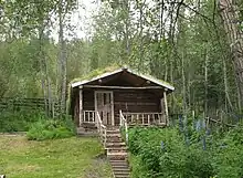 | |
| Black Residence, No. 9 | Fifth Avenue and Turner Street Dawson City YT |
64°03′15″N 139°26′17″W | Federal (6226) | Upload Photo | |
| Yukon Hotel National Historic Site | First Avenue Dawson City YT |
64°03′33″N 139°26′17″W | Federal (9163) | 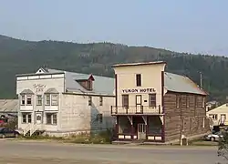 More images | |
| Commissioner's Residence | Front Street Dawson City YT |
64°03′24″N 139°26′28″W | Federal (15641) | 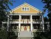 | |
| Post Office | King Street and Third Avenue Dawson City YT |
64°03′47″N 139°25′52″W | Federal (11629) | 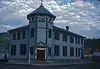 | |
| Winaut's Store | Second Avenue Dawson City YT |
64°03′23″N 139°26′10″W | Federal (6241) | Upload Photo | |
| Dawson Historical Complex National Historic Site | Third Avenue Dawson City YT |
64°03′48″N 139°25′52″W | Federal (6253) | 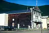 | |
| Mabel Mcintyre House | 12 Centre Street Mayo YT |
63°35′36″N 135°53′46″W | Yukon (1282) | Upload Photo | |
| Mayo Legion Hall | 310 First Ave Mayo YT |
63°35′28″N 135°53′42″W | Yukon (6585) | Upload Photo | |
| SS Klondike National Historic Site | Whitehorse YT |
60°42′48″N 135°02′53″W | Federal (9348) | 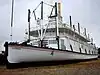 More images | |
| Smith House | 3128 Third Ave. Whitehorse LePage Park Whitehorse YT |
60°43′14″N 135°03′19″W | Whitehorse municipality (8903) | .jpg.webp) | |
| Train Crew's House 1 | 1091 First Ave Whitehorse YT |
60°43′07″N 135°02′56″W | Whitehorse municipality (15133) | 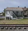 | |
| Train Crew's House 2 | 1093 First Avenue Whitehorse YT |
60°43′08″N 135°02′56″W | Whitehorse municipality (15134) | Upload Photo | |
| Old Firehall | 1105 First Avenue Whitehorse YT |
60°43′10″N 135°03′00″W | Whitehorse municipality (14867) | .jpg.webp) | |
| White Pass and Yukon Route Railway Depot | 1109 First Ave Whitehorse YT |
60°43′12″N 135°03′00″W | Whitehorse municipality (4471) | 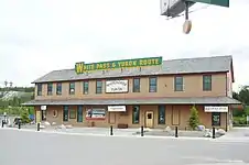 More images | |
| Building 200 | 200 Range Road Whitehorse YT |
60°44′17″N 135°05′17″W | Federal (10792) | Upload Photo | |
| Log Skyscrapers | 208 Lambert Street Whitehorse YT |
60°43′04″N 135°03′07″W | Whitehorse municipality (1903) | 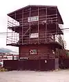 | |
| T.C. Richards Building | 302 Steele Street Whitehorse YT |
60°43′12″N 135°03′18″W | Whitehorse municipality (4574) | Upload Photo | |
| Donnenworth House | 3126 Third Avenue Whitehorse YT |
60°43′13″N 135°03′18″W | Whitehorse municipality (6592) | 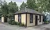 | |
| The Taylor House | 412 Main Street Whitehorse YT |
60°43′08″N 135°03′29″W | Yukon (4833) | Upload Photo | |
| Pioneer Hotel 2 | Shipyards Park Whitehorse YT |
60°43′42″N 135°03′18″W | Whitehorse municipality (8904) | 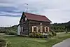 | |
| T'äw Tà'är National Historic Site of Canada | 30 miles east of Lake Laberge on the Teslin River Teslin River, Yukon YT |
61°14′37″N 134°37′00″W | Federal (19568) | Upload Photo |
See also
Wikimedia Commons has media related to Cultural heritage monuments in Yukon.
| National parks | |
|---|---|
| National historic sites |
|
| Territorial parks |
|
| Marine Protected Areas | |
| National Wildlife Areas |
|
| Other | |
| |
This article is issued from Wikipedia. The text is licensed under Creative Commons - Attribution - Sharealike. Additional terms may apply for the media files.