List of lakes of Dawson County, Montana
Reservoirs
- Bailer Reservoir, 46°55′00″N 104°44′19″W, el. 2,205 feet (672 m)[1]
- Big Drop Reservoir, 46°53′40″N 104°38′38″W, el. 2,379 feet (725 m)[2]
- Camp Reservoir, 46°53′38″N 104°38′17″W, el. 2,385 feet (727 m)[3]
- Circle Reservoir, 47°32′18″N 105°13′44″W, el. 2,503 feet (763 m)[4]
- Crisafulli Lake, 47°07′53″N 104°44′42″W, el. 2,159 feet (658 m)[5]
- Deer Creek Reservoir, 47°14′42″N 105°04′38″W, el. 2,717 feet (828 m)[6]
- Forks Reservoir, 46°53′14″N 104°39′28″W, el. 2,326 feet (709 m)[7]
- Gagena Reservoir, 46°53′28″N 104°31′18″W, el. 2,648 feet (807 m)[8]
- Hollecker Lake, 47°07′45″N 104°43′38″W, el. 2,083 feet (635 m)[9]
- Hollecker Reservoir, 47°07′48″N 104°43′38″W, el. 2,083 feet (635 m)[10]
- Jack Downs Reservoir, 47°10′30″N 105°06′38″W, el. 2,641 feet (805 m)[11]
- Johnson Reservoir, 47°18′52″N 105°05′46″W, el. 2,657 feet (810 m)[12]
- Keeland Reservoir, 47°38′42″N 105°01′31″W, el. 2,474 feet (754 m)[13]
- Lindsay Reservoir, 47°13′03″N 105°09′05″W, el. 2,694 feet (821 m)[14]
- Longs Reservoir, 47°38′28″N 105°01′05″W, el. 2,477 feet (755 m)[15]
- Malkuch Reservoir, 47°09′45″N 105°00′47″W, el. 2,513 feet (766 m)[16]
- Malkuch Reservoir, 47°09′54″N 105°18′56″W, el. 2,926 feet (892 m)[17]
- Milliron Reservoir Number 1, 47°10′22″N 104°24′57″W, el. 2,303 feet (702 m)[18]
- Milliron Reservoir Number 2, 47°09′12″N 104°23′58″W, el. 2,306 feet (703 m)[19]
- Prairie Goat Reservoir, 46°53′44″N 104°38′13″W, el. 2,382 feet (726 m)[20]
- Roy Richey Reservoir, 47°38′48″N 105°07′02″W, el. 2,457 feet (749 m)[21]
- Senner Reservoir, 47°31′18″N 104°48′56″W, el. 2,726 feet (831 m)[22]
- Twin Forks Reservoir, 46°53′33″N 104°35′16″W, el. 2,461 feet (750 m)[23]
- Twin Forks Reservoir, 46°53′42″N 104°35′14″W, el. 2,461 feet (750 m)[24]
- Upper Labell Reservoir, 46°53′02″N 104°35′21″W, el. 2,421 feet (738 m)[25]
- Upper Magpie Reservoir, 46°56′48″N 104°39′26″W, el. 2,323 feet (708 m)[26]
- Wold Reservoir, 47°38′00″N 105°00′09″W, el. 2,477 feet (755 m)[27]
- Wolff Reservoir, 47°10′36″N 105°04′32″W, el. 2,595 feet (791 m)[28]
See also
Notes
- "Bailer Reservoir". Geographic Names Information System. United States Geological Survey, United States Department of the Interior.
- "Big Drop Reservoir". Geographic Names Information System. United States Geological Survey, United States Department of the Interior.
- "Camp Reservoir". Geographic Names Information System. United States Geological Survey, United States Department of the Interior.
- "Circle Reservoir". Geographic Names Information System. United States Geological Survey, United States Department of the Interior.
- "Crisafulli Lake". Geographic Names Information System. United States Geological Survey, United States Department of the Interior.
- "Deer Creek Reservoir". Geographic Names Information System. United States Geological Survey, United States Department of the Interior.
- "Forks Reservoir". Geographic Names Information System. United States Geological Survey, United States Department of the Interior.
- "Gagena Reservoir". Geographic Names Information System. United States Geological Survey, United States Department of the Interior.
- "Hollecker Lake". Geographic Names Information System. United States Geological Survey, United States Department of the Interior.
- "Hollecker Reservoir". Geographic Names Information System. United States Geological Survey, United States Department of the Interior.
- "Jack Downs Reservoir". Geographic Names Information System. United States Geological Survey, United States Department of the Interior.
- "Johnson Reservoir". Geographic Names Information System. United States Geological Survey, United States Department of the Interior.
- "Keeland Reservoir". Geographic Names Information System. United States Geological Survey, United States Department of the Interior.
- "Lindsay Reservoir". Geographic Names Information System. United States Geological Survey, United States Department of the Interior.
- "Longs Reservoir". Geographic Names Information System. United States Geological Survey, United States Department of the Interior.
- "Malkuch Reservoir". Geographic Names Information System. United States Geological Survey, United States Department of the Interior.
- "Malkuch Reservoir". Geographic Names Information System. United States Geological Survey, United States Department of the Interior.
- "Milliron Reservoir Number 1". Geographic Names Information System. United States Geological Survey, United States Department of the Interior.
- "Milliron Reservoir Number 2". Geographic Names Information System. United States Geological Survey, United States Department of the Interior.
- "Prairie Goat Reservoir". Geographic Names Information System. United States Geological Survey, United States Department of the Interior.
- "Roy Richey Reservoir". Geographic Names Information System. United States Geological Survey, United States Department of the Interior.
- "Senner Reservoir". Geographic Names Information System. United States Geological Survey, United States Department of the Interior.
- "Twin Forks Reservoir". Geographic Names Information System. United States Geological Survey, United States Department of the Interior.
- "Twin Forks Reservoir". Geographic Names Information System. United States Geological Survey, United States Department of the Interior.
- "Upper Labell Reservoir". Geographic Names Information System. United States Geological Survey, United States Department of the Interior.
- "Upper Magpie Reservoir". Geographic Names Information System. United States Geological Survey, United States Department of the Interior.
- "Wold Reservoir". Geographic Names Information System. United States Geological Survey, United States Department of the Interior.
- "Wolff Reservoir". Geographic Names Information System. United States Geological Survey, United States Department of the Interior.
Municipalities and communities of Dawson County, Montana, United States | ||
|---|---|---|
| City | 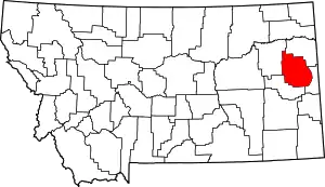 Dawson County map | |
| Town | ||
| CDPs | ||
This article is issued from Wikipedia. The text is licensed under Creative Commons - Attribution - Sharealike. Additional terms may apply for the media files.