List of urban areas in the United Kingdom
This is a list of the most populous urban areas in the United Kingdom based on the 2011 census, as defined by the Office for National Statistics (ONS).
Definition
The methodology used by ONS in 2011 is set out in 2011 Built-up Areas – Methodology and Guidance, published in June 2013. When ONS reported the results of the 2011 UK census, it used the term "built-up area" rather than the term "urban area" as used in previous censuses. ONS states, however, that the criteria used to define "built-up area" have not changed:
the definition follows a ‘bricks and mortar’ approach, with areas defined as built-up land with a minimum area of 20 hectares (200,000 m2), while settlements within 200 metres of each other are linked. Built-up area sub-divisions are also identified to provide greater detail in the data, especially in the larger conurbations.[1]
In reporting the 2001 census, the ONS gave a clearer definition of the term "built-up" as follows:
This comprises permanent structures and the land on which they are situated, including land enclosed by or closely associated with such structures; transportation corridors such as roads, railways and canals which have built up land on one or both sides, or which link built-up sites which are less than 200 metres apart; transportation features such as airports and operational airfields, railway yards, motorway service areas and car parks; mine buildings, excluding mineral workings and quarries; and any area completely surrounded by builtup sites. Areas such as playing fields and golf courses are excluded unless completely surrounded by builtup sites...[2]
Most populous
The list below shows the most populated urban areas in the United Kingdom as defined by the Office for National Statistics (ONS), but as readily referenced at Citypopulation.de. The list includes all urban areas with a population in excess of 100,000 at the 2011 census.[3]
Over 500,000
| # | Picture | Area | Cities | Devolved | Population (2011) | Area (km2)[note 1] | Density (2011) |
|---|---|---|---|---|---|---|---|
| 1 | 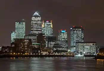 |
Greater London | London-Westminster | Greater London | 9,787,426 | 1,737.9 | 5,630/km2 |
| 2 |  |
Greater Manchester | Manchester-Salford | Greater Manchester | 2,553,379 | 630.3 | 4,051/km2 |
| 3 |  |
West Midlands | Birmingham-Wolverhampton | West Midlands | 2,440,986 | 598.9 | 4,076/km2 |
| 4 |  |
West Yorkshire | Leeds-Bradford-Wakefield | West Yorkshire | 1,777,934 | 487.8 | 3,645/km2 |
| 5 |  |
Greater Glasgow | Glasgow | Scotland | 957,620 | 368.5 | 3,390/km2 |
| 6 | 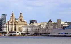 |
Liverpool | Liverpool | Liverpool City Region | 864,122 | 199.6 | 4,329/km2 |
| 7 |  |
South Hampshire | Southampton-Portsmouth | No | 855,569 | 192.0 | 4,455/km2 |
| 8 | .jpg.webp) |
Tyneside | Newcastle-upon-Tyne | North East | 774,891 | 180.5 | 4,292/km2 |
| 9 |  |
Nottingham | Nottingham | No | 729,977 | 176.4 | 4,139/km2 |
| 10 | .jpg.webp) |
Sheffield | Sheffield | South Yorkshire | 685,368 | 167.5 | 4,092/km2 |
| 11 | 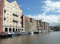 |
Bristol | Bristol | West of England | 617,280 | 144.4 | 4,274/km2 |
| 12 | _-_geograph.org.uk_-_2183606.jpg.webp) |
Greater Belfast | Belfast | Northern Ireland | 595,879 | 960 | 620/km2 |
| 13 | 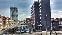 |
Leicester | Leicester | No | 508,916 | 109.4 | 4,653/km2 |
Over 100,000
| # | Urban area | Devolved | Population (2011) | Area (km2)[note 2] | Density (2011) |
|---|---|---|---|---|---|
| 14 | Edinburgh | Scotland | 482,270 | 125 | 4,172/km2 |
| 15 | Brighton and Hove | No | 474,485 | 89.4 | 5,304/km2 |
| 16 | South East Dorset | No | 466,266 | 131.0 | 3,559/km2 |
| 17 | Cardiff | Wales | 447,287 | 102.3 | 4,370/km2 |
| 18 | Teesside | Tees Valley | 376,633 | 108.2 | 3,482/km2 |
| 19 | The Potteries | No | 372,775 | 103.9 | 3,588/km2 |
| 20 | Coventry | West Midlands | 359,262 | 81.3 | 4,420/km2 |
| 21 | Wearside | North East | 335,415 | 83.5 | 4,018/km2 |
| 22 | Birkenhead | Liverpool City Region | 325,264 | 88.2 | 3,687/km2 |
| 23 | Reading | No | 318,014 | 83.7 | 3,800/km2 |
| 24 | Kingston upon Hull | No | 314,018 | 82.6 | 3,802/km2 |
| 25 | Central Lancashire | No | 313,322 | 82.4 | 3,802/km2 |
| 26 | Newport | Wales | 306,844 | 84.2 | 3,643/km2 |
| 27 | Swansea | Wales | 300,352 | 87.6 | 3,431/km2 |
| 28 | Southend-on-Sea | No | 295,310 | 71.8 | 4,111/km2 |
| 29 | Derby | No | 270,468 | 64.1 | 4,219/km2 |
| 30 | Plymouth | No | 260,203 | 59.7 | 4,356/km2 |
| 31 | Luton | No | 258,018 | 50.7 | 5,088/km2 |
| 32 | Farnborough-Aldershot | No | 252,397 | 78.5 | 3,217/km2 |
| 33 | Medway Towns | No | 243,931 | 52.2 | 4,677/km2 |
| 34 | Blackpool | No | 239,409 | 61.3 | 3,908/km2 |
| 35 | Milton Keynes | No | 229,941[4] | 62.5 | 3,678/km2 |
| 36 | Barnsley-Dearne Valley | South Yorkshire | 223,281 | 59.7 | 3,739/km2 |
| 37 | Northampton | No | 215,963 | 57.9 | 3,731/km2 |
| 38 | Norwich | No | 213,166 | 61.9 | 3,444/km2 |
| 39 | Aberdeen | Scotland | 208,190 | 69.5 | 3,050/km2 |
| 40 | Swindon | No | 185,609 | 47.1 | 3,945/km2 |
| 41 | Crawley | No | 180,508 | 58.1 | 3,107/km2 |
| 42 | Ipswich | No | 178,835 | 49.1 | 3,639/km2 |
| 43 | Wigan | Greater Manchester | 175,405 | 43.8 | 4,009/km2 |
| 44 | Mansfield | No | 171,958 | 48.4 | 3,556/km2 |
| 45 | Oxford | No | 171,380 | 37.4 | 4,585/km2 |
| 46 | Warrington | No | 165,456 | 44.9 | 3,686/km2 |
| 47 | Slough | No | 163,777 | 34.1 | 4,797/km2 |
| 48 | Peterborough | Cambridgeshire and Peterborough | 163,379 | 44.2 | 3,693/km2 |
| 49 | Cambridge | Cambridgeshire and Peterborough | 158,434 | 42.1 | 3,760/km2 |
| 50 | Doncaster | South Yorkshire | 158,141 | 43.5 | 3,634/km2 |
| 51 | Dundee | Scotland | 157,550 | 49.9 | 3,180/km2 |
| 52 | York | No | 153,717 | 34.0 | 4,518/km2 |
| 53 | Gloucester | No | 150,053 | 40.4 | 3,718/km2 |
| 54 | Burnley | No | 149,422 | 35.7 | 4,183/km2 |
| 55 | Telford | No | 147,980 | 47.7 | 3,103/km2 |
| 56 | Blackburn | No | 146,521 | 35.6 | 4,115/km2 |
| 57 | Basildon | No | 144,859 | 37.1 | 3,902/km2 |
| 58 | Grimsby | No | 134,160 | 35.3 | 3,804/km2 |
| 59 | Hastings | No | 133,422 | 33.2 | 4,019/km2 |
| 60 | High Wycombe | No | 133,204 | 39.2 | 3,398/km2 |
| 61 | Thanet | No | 125,370 | 27.9 | 4,495/km2 |
| 62 | Accrington-Rossendale | No | 125,059 | 30.0 | 4,168/km2 |
| 63 | Motherwell | Scotland | 124,540 | 45.1 | 2,765/km2 |
| 64 | Burton-upon-Trent | No | 122,199 | 35.0 | 3,487/km2 |
| 65 | Colchester | No | 121,859 | 32.7 | 3,732/km2 |
| 66 | Eastbourne | No | 118,219 | 25.1 | 4,705/km2 |
| 67 | Exeter | No | 117,763 | 28.5 | 4,133/km2 |
| 68 | Cheltenham | No | 116,447 | 28.9 | 4,034/km2 |
| 69 | Torquay | No | 115,410 | 31.5 | 3,667/km2 |
| 70 | Lincoln | No | 114,879 | 32.7 | 3,518/km2 |
| 71 | Chesterfield | No | 113,057 | 34.6 | 3,263/km2 |
| 72 | Chelmsford | No | 111,511 | 26.2 | 4,259/km2 |
| 73 | Basingstoke | No | 107,642 | 29.4 | 3,662/km2 |
| 74 | Maidstone | No | 107,627 | 25.4 | 4,229/km2 |
| 75 | Bedford | No | 106,940 | 24.8 | 4,309/km2 |
| 76 | Worcester | No | 101,659 | 24.7 | 4,121/km2 |
Map
_location_map.svg.png.webp)
Notes
References
- "2011 Built-up Areas – Methodology and Guidance" (PDF). 2013 v1. Office for National Statistics. June 2013. p. 3. Archived from the original (PDF) on 21 September 2013.
- "Census 2001: Key Statistics for urban areas in the North" (PDF). 2004. p. 1. Archived from the original (PDF) on 21 July 2014.
- "United Kingdom: Urban Areas". Citypopulation.de. Retrieved 31 December 2014.
- UK Census (2011). "Local Area Report – Milton Keynes BUA Built-up area (E34005056)". Nomis. Office for National Statistics. Retrieved 29 March 2019.