List of listed buildings in Dunoon
This is a list of listed buildings in the parish of Dunoon, on the Cowal Peninsula, in Argyll and Bute, Scotland.
List
| Name | Location | Date Listed | Grid Ref. [note 1] | Geo-coordinates | Notes | LB Number [note 2] | Image |
|---|---|---|---|---|---|---|---|
| 34 Argyll Road, Edgemont | 55°57′20″N 4°55′18″W | Category B | 44182 |  Upload Photo | |||
| Kirk Street, Boundary Wall Of Castle Gardens | 55°56′44″N 4°55′28″W | Category B | 26433 | Upload Photo | |||
| Gate-Lodge To Castle House With Gate-Piers And Screen Walls, Pier Esplanade | 55°56′46″N 4°55′24″W | Category B | 26435 | Upload Photo | |||
| George Hotel, George Street | 55°57′08″N 4°55′27″W | Category C(S) | 26443 | 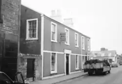
| |||
| Auchamore Farmhouse And Steading With Boundary Wall, Auchamore Road | 55°56′51″N 4°56′12″W | Category B | 26446 | Upload Photo | |||
| Kilbride Bridge, Over Balgie Burn | 55°56′49″N 4°56′20″W | Category C(S) | 26447 | 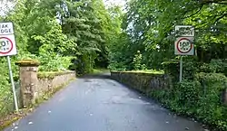
| |||
| Hunters Quay, Marine Parade, Hunters Quay Hotel | 55°58′11″N 4°54′32″W | Category C(S) | 50810 | 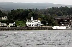
| |||
| Corner House, 2 Castle Street And 44 Kirk Street And Adjoining Wall To North | 55°56′48″N 4°55′32″W | Category B | 26431 | Upload Photo | |||
| Argyll Hotel, Argyll Street | 55°56′54″N 4°55′28″W | Category B | 26438 | 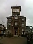
| |||
| Corner Tenement Moir Place And Church Street | 55°57′02″N 4°55′32″W | Category C(S) | 26441 | Upload Photo | |||
| Clyde Cottage, Alexandra Parade | 55°57′03″N 4°55′29″W | Category B | 26442 | Upload Photo | |||
| Hunter's Quay, Cammes Reinach | 55°58′14″N 4°54′31″W | Category B | 26444 | 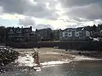
| |||
| Milton House (District Council Offices) | 55°56′54″N 4°55′37″W | Category B | 26451 | Upload Photo | |||
| Hunter's Quay, Royal Marine Hotel (Former Royal Northern And Later Royal Clyde Yacht Club) Including Lodge, Boundary Walls And Gatepiers | 55°58′12″N 4°54′38″W | Category B | 46551 | 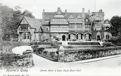
| |||
| 4, 6, 8 Castle Street | 55°56′48″N 4°55′32″W | Category B | 26432 | Upload Photo | |||
| St. John's Church Of Scotland. Hanover Street And Argyll Street | 55°57′02″N 4°55′45″W | Category A | 26440 | .jpg.webp)
| |||
| Dunoon Pier & Entrance Lodge | 55°56′48″N 4°55′18″W | Category B | 26450 | 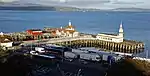
| |||
| Statue Of Highland Mary | 55°56′44″N 4°55′24″W | Category B | 26437 | .jpg.webp)
| |||
| Holy Trinity Church, Kilbride Hill (Episcopal) | 55°56′46″N 4°56′22″W | Category B | 26448 | 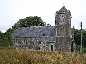
| |||
| Dunoon High Kirk (Old Parish Church), Kirk Street, Church Of Scotland | 55°56′50″N 4°55′32″W | Category B | 26429 | .jpg.webp)
| |||
| 'Ballochyle House' Kirk Street | 55°56′51″N 4°55′33″W | Category B | 26430 | Upload Photo | |||
| Castle House, Castle Gardens | 55°56′46″N 4°55′28″W | Category B | 26434 | 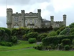
| |||
| Kirn, The Queen's Hotel | 55°57′38″N 4°54′40″W | Category C(S) | 44187 | 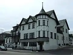
| |||
| Dunoon Castle | 55°56′45″N 4°55′26″W | Category B | 26436 | 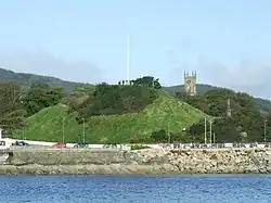
| |||
| Argyll Street, Burgh Hall Building | 55°57′02″N 4°55′41″W | Category B | 26439 | 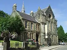
| |||
| 'Beach House' Corner Of Jane Street And Clyde Street | 55°56′44″N 4°55′44″W | Category B | 26445 | Upload Photo | |||
| Kirn Church Of Scotland, Kirn Brae | 55°57′46″N 4°54′38″W | Category B | 26449 | 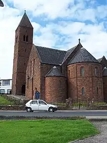
| |||
| Hillfoot Street, Dunoon Primary School And Janitor's House | 55°56′51″N 4°55′37″W | Category B | 50809 | .jpg.webp) |
Key
The scheme for classifying buildings in Scotland is:
- Category A: "buildings of national or international importance, either architectural or historic; or fine, little-altered examples of some particular period, style or building type."[1]
- Category B: "buildings of regional or more than local importance; or major examples of some particular period, style or building type, which may have been altered."[1]
- Category C: "buildings of local importance; lesser examples of any period, style, or building type, as originally constructed or moderately altered; and simple traditional buildings which group well with other listed buildings."[1]
In March 2016 there were 47,288 listed buildings in Scotland. Of these, 8% were Category A, and 50% were Category B, with the remaining 42% being Category C.[2]
Notes
- Sometimes known as OSGB36, the grid reference (where provided) is based on the British national grid reference system used by the Ordnance Survey.
• "Guide to National Grid". Ordnance Survey. Retrieved 12 December 2007.
• "Get-a-map". Ordnance Survey. Retrieved 17 December 2007. - Historic Environment Scotland assign a unique alphanumeric identifier to each designated site in Scotland, for listed buildings this always begins with "LB", for example "LB12345".
References
- All entries, addresses and coordinates are based on data from Historic Scotland. This data falls under the Open Government Licence
- "What is Listing?". Historic Environment Scotland. Retrieved 29 May 2018.
- Scotland's Historic Environment Audit 2016 (PDF). Historic Environment Scotland and the Built Environment Forum Scotland. pp. 15–16. Retrieved 29 May 2018.
This article is issued from Wikipedia. The text is licensed under Creative Commons - Attribution - Sharealike. Additional terms may apply for the media files.